Hills of Britain and Ireland
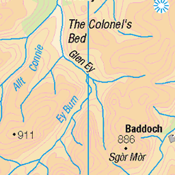
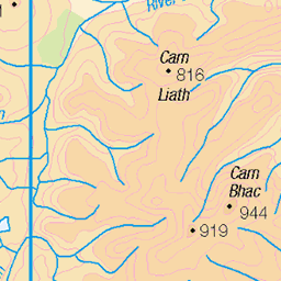
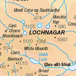
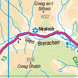
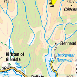
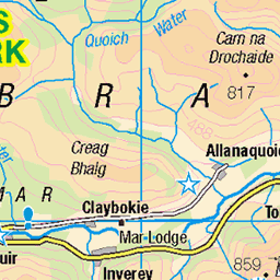
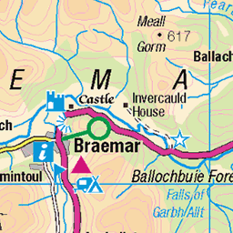
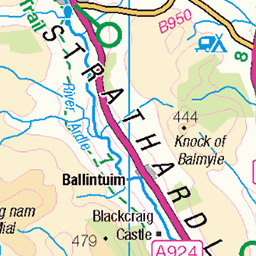
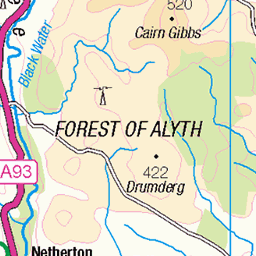
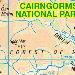
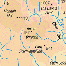
OS Map of Creag Leacach
Height: 988m / 3242ft • Prominence: 71m / 233ft • Summit : cairn on rock rib • Trip reports (hill-bagging)


Heading towards Creag Leacach
The hill in the distance for sunset.
06-Sep-23 • We travel the Spaceways • flickr
53177049774


View from our tea spot
Looking down into Glen Brighty. It was good to sit, have a brew and wait for sunset.
06-Sep-23 • We travel the Spaceways • flickr
53176260482

View from Creag Leacach to Glen Maol
We waited for sunset then walked between the two tops. It was dark and misty by the time we reached Glen Maol.
06-Sep-23 • We travel the Spaceways • flickr
53177049244

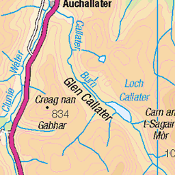
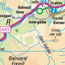
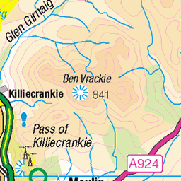
OS Map
This is OS mapping. In some areas, OpenStreetMap shows more footpaths
Spatial NI has online OSNI mapping. Click "Basemap Gallery" (4 squares icon at the top).
Now would be a good time for a cup of tea.

GPX Editor
Record map clicks
Reload map
Photos
Please tag your photos and upload them to the British and Irish Mountains group on Flickr
The other photos have been geo-tagged as on or around the summit. For less busy mountains, it can be a little hit and miss.
Heading towards Creag Leacach
The hill in the distance for sunset.
06-Sep-23 • We travel the Spaceways • flickr
53177049774
View from our tea spot
Looking down into Glen Brighty. It was good to sit, have a brew and wait for sunset.
06-Sep-23 • We travel the Spaceways • flickr
53176260482
View from Creag Leacach to Glen Maol
We waited for sunset then walked between the two tops. It was dark and misty by the time we reached Glen Maol.
06-Sep-23 • We travel the Spaceways • flickr
53177049244

Last rays of sunshine on Creag Leacach
The day was nearly done.
06-Sep-23 • We travel the Spaceways • flickr
53177340258


Walking over to Glas Moal
After sunset visit to Glas Maol. Started with cake at the Glenshee cafe as we were a bit early. Then headed up the track to visit Creag Leacach first for tea and a lovely sunset. Next a twilight plod over to Glas Maol. Bit tricky on top in the mist and dark. Said hello to the trig then made the slow walk back to the start. We stopped half way down to have a brew and look at the stars. Red Deer, a Hen harrier and lots of ptarmigan on the hill this evening.
06-Sep-23 • We travel the Spaceways • flickr
53177284350

Cairn and Mountain
A marker cairn on the way down, with the dramatic Creag Leacach from which we've just come in the background. From here you can see the peaks and troughs we had to climb to reach the summit. Glas Maol (meaning the grey green hill) is my 18th Munro and stands at a height of 1068 meters (3504 feet). Creag Leacach (meaning 'the slabby crag') is my 19th and stands at 987 meters (3238 feet).
09-Jul-22 • steve_whitmarsh • flickr
aberdeenshire scotland scottishhighlands highlands hills mountain munro glen grass green cairn rock rocks creagleacach topic rockpaper 52308709717
Videos
In today's video I will be doing the Glas Maol Circuit from the Glenshee Ski Center! This is a long hike in Scotlands Easterly ...
Music from #Uppbeat (free for Creators!): https://uppbeat.io/t/haquin/forest-of-the-ancients License code: 3S1CVZLANJRRK1X0.
Follow us on a day hike up Creag Leacach in the Southern Cairngorms, close to the Glenshee Ski Centre, with a bit of a wet ...
Notes
- Data: Database of British and Irish Hills v18.2
- Maps: We use OS mapping for England, Scotland, Wales, and the Isle of Man. Sadly, Channel Islands, Northern (OSNI) and Southern Ireland (OSI) mapping isn't available online, so we use Openstreetmap.