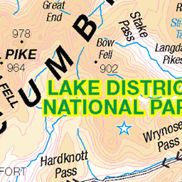
Hills of Britain and Ireland
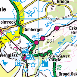
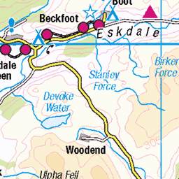
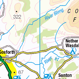
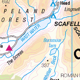
OS Map of Burn Moor


The Coniston Fells, From the Furness Fells
Taken on Buckbarrow Crag.
29-Jan-25 • Paul Austin Murphy • flickr
54299051835


On Burn Moor, With the Coniston Fells Over the Valley
29-Jan-25 • Paul Austin Murphy • flickr
54295327227

Kirk Fell, Great Gable and Scafell
Photo taken below Whitfell.
29-Jan-25 • Paul Austin Murphy • flickr
54297023739

Video: The Tiny Holehouse Tarn and the Western Fells
29-Jan-25 • Paul Austin Murphy • flickr
lakedistrict 54296605160
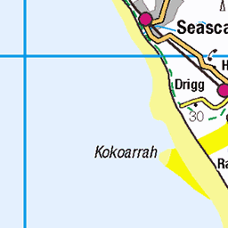
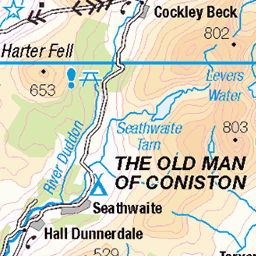
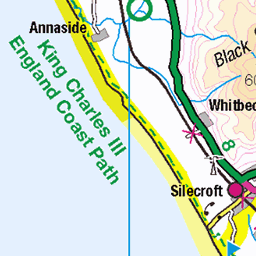
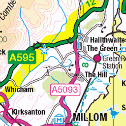
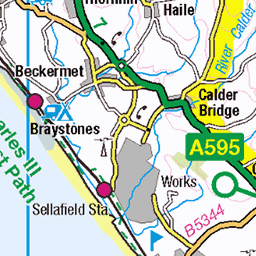
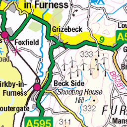
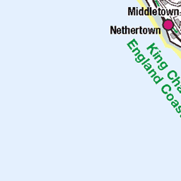
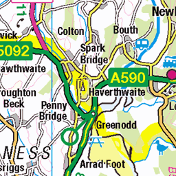
OS Map
This is OS mapping. In some areas, OpenStreetMap shows more footpaths
Spatial NI has online OSNI mapping. Click "Basemap Gallery" (4 squares icon at the top).
Now would be a good time for a cup of tea.


GPX Editor
Record map clicks
Reload map
Photos
Please tag your photos and upload them to the British and Irish Mountains group on Flickr
The other photos have been geo-tagged as on or around the summit. For less busy mountains, it can be a little hit and miss.
The Coniston Fells, From the Furness Fells
Taken on Buckbarrow Crag.
29-Jan-25 • Paul Austin Murphy • flickr
54299051835
On Burn Moor, With the Coniston Fells Over the Valley
29-Jan-25 • Paul Austin Murphy • flickr
54295327227
Kirk Fell, Great Gable and Scafell
Photo taken below Whitfell.
29-Jan-25 • Paul Austin Murphy • flickr
54297023739
Video: The Tiny Holehouse Tarn and the Western Fells
29-Jan-25 • Paul Austin Murphy • flickr
lakedistrict 54296605160

Kinmont Buck Barrow (Cumbria)
The nearest village is Waberthwaite. The nearest town is Millom.
07-Jan-24 • Paul Austin Murphy • flickr
53532865509


View From the Furness Fells
That's Kirk Fell with the three scars running vertically down it. Somewhere in the middle of the big hills.
07-Jan-24 • Paul Austin Murphy • flickr
53551800207

Sundown on the Cumbrian West Coast
Waberthwaite area. the little River Esk estuary can be seen on the right.
07-Jan-24 • Paul Austin Murphy • flickr
53532986760
Videos
Christine embarks on a two hour walk from Eskdale to Burnmoor Tarn, to have a warm 19 °C swim. Many thanks to David who ...
A Saturday adventure with the Sawrey Bikers saw us go over to Eskdale for MTB ride to Burnmoor Tarn. Film footage was ...
Fellwalking in Cumbria. This video follows a route from Wasdale Head to Burnmoor Tarn and then up Sca Fell and then to Foxes ...
An off grid house with solar panels near Burnmoor Tarn in The Lake District and an old stone abandoned structure we accidently ...
A shortish route (13.75 miles) that takes you from the parking in Miterdale Forest to Wasdale and then back over Eskdale Fell to ...
Notes
- Data: Database of British and Irish Hills v18.2
- Maps: We use OS mapping for England, Scotland, Wales, and the Isle of Man. Sadly, Channel Islands, Northern (OSNI) and Southern Ireland (OSI) mapping isn't available online, so we use Openstreetmap.