Hills of Britain and Ireland
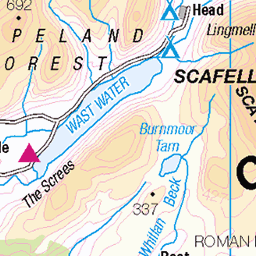
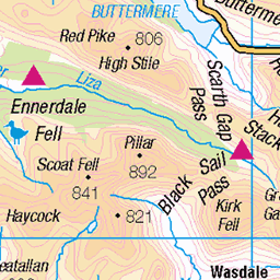
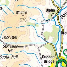
OS Map of Harter Fell (Eskdale)

Hardknott Roman Fort, February 2025
hardknottpass hillpass eskdale duddonvalley lakedistrict cumbria england hardknottfell 2025 southlakes 54318313447

Hardknott Pass towards Eskdale Valley, February 2025
hardknottpass hillpass eskdale duddonvalley lakedistrict cumbria england hardknottfell 2025 southlakes 54319442403

Hardknott Pass, February 2025
hardknottpass hillpass eskdale duddonvalley lakedistrict cumbria england hardknottfell 2025 southlakes sheep 54318320227

Hardknott Pass, February 2025
hardknottpass hillpass eskdale duddonvalley lakedistrict cumbria england hardknottfell 2025 southlakes 54319214071

Hardknott Pass, February 2025
hardknottpass hillpass eskdale duddonvalley lakedistrict cumbria england hardknottfell 2025 southlakes 54318412217

Hardknott Pass towards Eskdale Valley, February 2025
hardknottpass hillpass eskdale duddonvalley lakedistrict cumbria england hardknottfell 2025 southlakes 54319535068
OS Map
This is OS mapping. In some areas, OpenStreetMap shows more footpaths
Spatial NI has online OSNI mapping. Click "Basemap Gallery" (4 squares icon at the top).
Now would be a good time for a cup of tea.


GPX Editor
Record map clicks
Reload map
Photos
Please tag your photos and upload them to the British and Irish Mountains group on Flickr
The other photos have been geo-tagged as on or around the summit. For less busy mountains, it can be a little hit and miss.

Hardknott Roman Fort, February 2025
hardknottpass hillpass eskdale duddonvalley lakedistrict cumbria england hardknottfell 2025 southlakes 54318313447

Hardknott Pass towards Eskdale Valley, February 2025
hardknottpass hillpass eskdale duddonvalley lakedistrict cumbria england hardknottfell 2025 southlakes 54319442403

Hardknott Pass, February 2025
hardknottpass hillpass eskdale duddonvalley lakedistrict cumbria england hardknottfell 2025 southlakes sheep 54318320227

Hardknott Pass, February 2025
hardknottpass hillpass eskdale duddonvalley lakedistrict cumbria england hardknottfell 2025 southlakes 54319214071

Hardknott Pass, February 2025
hardknottpass hillpass eskdale duddonvalley lakedistrict cumbria england hardknottfell 2025 southlakes 54318412217

Hardknott Pass towards Eskdale Valley, February 2025
hardknottpass hillpass eskdale duddonvalley lakedistrict cumbria england hardknottfell 2025 southlakes 54319535068


KTM 790 Adventure
Birks Bridge, Dunnerdale
20-Jun-24 • Jim Rides This • flickr
ktm790adventure cumbria motorcycles 53805241913

KTM 790 Adventure
Birks Bridge, Dunnerdale
20-Jun-24 • Jim Rides This • flickr
ktm790adventure cumbria motorcycles 53805241748

Aerial View Over Hardknott Roman Fort & Thermae Towards Summit of Hardnott Pass, Eskdale, Lake District National Park, Cumbria
This is an early morning aerial view looking over a sunlit Hardknott Roman Fort towards the summit of Hardknott Pass. The road can be seen running to the right of the Roman Fort, winding its way to the summit. Also shown in the top left hand corner is the peaks of the Langdale Pikes. Crinkle Crags and Great Knott can be seen in the middle distance. Hardknott Pass is a hill pass between Eskdale and the Duddon Valley in the Lake District National Park, Cumbria. The tarmac-surfaced road, which is the most direct route from the central Lake District to West Cumbria, shares the title of steepest road in England with Rosedale Chimney Bank in North Yorkshire. It has a maximum gradient of 1 in 3 (about 33%). On the western side is Harter Fell and the remains of Hardknott Roman Fort (200 metres (660 ft) above sea level) which is just out of image to the left. The Hardknott Pass stands at a maximum elevation of 393 m (1,289 ft). The road descends steeply at a gradient of 30% (1 in 3) into the Duddon Valley. At the eastern end of the pass is Cockley Beck farm, built in the 1860s and owned by the National Trust. The route from Hardknott leads eastward towards the Wrynose Pass and Ambleside. The pass is described as one of the most challenging roads in Britain. A series of hairpin bends make visibility difficult in various places, and the road surface is in poor condition and slippery when wet. The pass is often closed in winter due to ice that makes the route impassable for vehicles. Dramatically sited on a spur above the Hardknott Pass, Hardknott Fort presides over the Esk Valley, offering spectacular views of Scafell Pike and as far as the Isle of Man. It was built early in the reign of Emperor Hadrian (117–38), and helped the Roman army control the region, guarding an important road that connected the Cumbrian coast with the heart of the Lake District. Well-marked remains include the headquarters building, commandant’s house and bath house. The site of the parade ground survives beside the fort, and the road which Hardknott guarded can be traced for some distance as an earthwork. For centuries, its beautiful location and well-preserved remains have inspired wonder at the history of Roman Britain. Yet pottery discovered at the fort shows that it was in use for barely 20 years, and was probably abandoned by the end of Hadrian’s reign. This image is a nine shot panorama taken using the DJI Mavic 2 Pro drone.
07-Aug-18 • st3v3cook3 • flickr
copyright aerialview lakedistrictnationalpark hardknottpass romanfort mountainrange sunlight rugged scdronemedia drone djimavic2pro dji mavic mavic2pro langdalepike hardknottromanfort pano panorama aerial crinklecrags hardknott greatknott mountain dawn morninglight eskdale lakedistrict nationalpark shadows borderend wilderness nationaltrust cumbria 54054619004

Videos
A slow 360 panorama from the summit of Harter Fell, in the Eskdale region of the English Lake District. Music from ...
Mid-February 2024, Neil heads out from beside the River Duddon, through Hardknott Forest (and a red squirrel encounter) and up ...
Another beautiful day another beautiful Mountain. A trip down my favourite Valley Eskdale and a wander over my favourite Little ...
GPX Download Of Route... https://drive.google.com/file/d/1m00KdtnkAsoL0r8w7KFSHoxq49YhxjCw/view?usp=drivesdk HARTER ...
Notes
- Data: Database of British and Irish Hills v18.2
- Maps: We use OS mapping for England, Scotland, Wales, and the Isle of Man. Sadly, Channel Islands, Northern (OSNI) and Southern Ireland (OSI) mapping isn't available online, so we use Openstreetmap.