Hills of Britain and Ireland
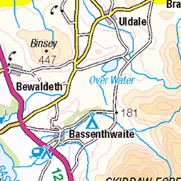
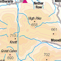
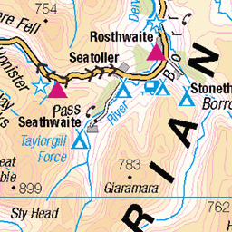
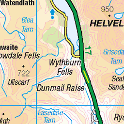
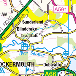
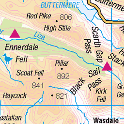
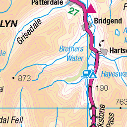
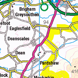
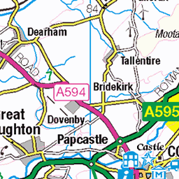
OS Map of High Rigg (Naddle Fell)
Height: 356m / 1167ft • Prominence: 187m / 614ft • Summit : rock 5m W of cairn • Trip reports (hill-bagging)


Mighty Blencathra
lakedistrict blencathra trewettarn blackandwhite bw blackwhite mono monochrome panorama landscape cumbria fujixt5 54376004231
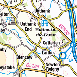
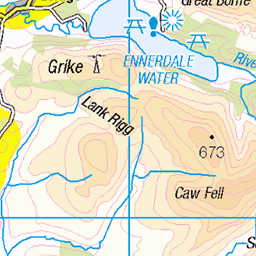
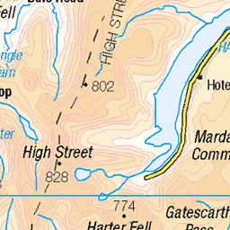
OS Map
This is OS mapping. In some areas, OpenStreetMap shows more footpaths
Spatial NI has online OSNI mapping. Click "Basemap Gallery" (4 squares icon at the top).
Now would be a good time for a cup of tea.


GPX Editor
Record map clicks
Reload map
Photos
Please tag your photos and upload them to the British and Irish Mountains group on Flickr
The other photos have been geo-tagged as on or around the summit. For less busy mountains, it can be a little hit and miss.
Mighty Blencathra
lakedistrict blencathra trewettarn blackandwhite bw blackwhite mono monochrome panorama landscape cumbria fujixt5 54376004231

Tewet tarn mono
A shot from December 2024 looking down to Tewet Tarn on a cold morning
12-Dec-24 • Alf Branch • flickr
tewettarn tarn cumbria clouds cumbrialakedistrict calmwater mono monochrome monoexteriorscape landscape lakes lakedistrict lakesdistrict lake fells cumbrianfells lakedistrictfells northernfells blencathra bw blackandwhite whiteandblack lakeland alfbranch olympus omd omsystem omsystemom1 mzuiko825mmf4pro 54366910319


B5322 Fornside, St John-in-the-Vale Combria Lakes
Cumbria Lakes
12-Mar-24 • 19Lynky44 • flickr
keswick england unitedkingdom 54315100925

High Rigg looking towards Helvellyn
Castle Rock below in the Vale of St. John's. A day of frequent showers rain, sleet, snow and hail.
03-Mar-17 • greengrocer48 • flickr
cumbria england lakedistrict helvellynrange helvellyn highrigg stjohnsinthevale 54428247583
Videos
End of March 2024, on a bright spring morning, Neil tackles the sixth-smallest Wainwright, High Rigg, beside St John's in the Vale, ...
A walk up to the Wainwright summit of High Rigg and return route through the valley of St John's in the Vale. High Rigg at 357m in ...
hiking #lakedistrict #fellwalking #wainwrights #cumbria.
Notes
- Data: Database of British and Irish Hills v18.2
- Maps: We use OS mapping for England, Scotland, Wales, and the Isle of Man. Sadly, Channel Islands, Northern (OSNI) and Southern Ireland (OSI) mapping isn't available online, so we use Openstreetmap.