Hills of Britain and Ireland
OS Map of Grike
Height: 488m / 1601ft • Prominence: 37m / 121ft • Summit : large windshelter • Trip reports (hill-bagging)
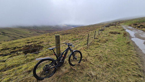
Heckbarley Mountain biking
16-Feb-24 • brian.phillips57 • flickr
cleator england unitedkingdom 53698411114

Heckbarley Mountain biking
16-Feb-24 • brian.phillips57 • flickr
cleator england unitedkingdom 53698510830

Heckbarley
17-Jan-24 • brian.phillips57 • flickr
cleator england unitedkingdom snow heckbarley emtb mountainbiking westcumbria 53642495444

Heckbarley
17-Jan-24 • brian.phillips57 • flickr
england unitedkingdom cleator snow mountainbiking westcumbria emtb heckbarley 53642373598

Heckbarley
17-Jan-24 • brian.phillips57 • flickr
england unitedkingdom cleator snow mountainbiking westcumbria emtb heckbarley 53641277347

Winter afternoon, Ennerdale Water
The lake is in shadow from the hills behind. Opposite the hills are in full sun. Left to right - Great Borne, Bowness Knott (neaer, just breaks skyline),, Starling Dodd (dome), Red Pike, High Stile. Angler's Crag (Crag Fell) steep shadow far right.
09-Jan-24 • a.hill-psalm145 • flickr
ennerdale water great borne bowness knott starling dodd red pike high stile hills winter sunshine lake district cumbria 53455824977
OS Map
This is OS mapping. In some areas, OpenStreetMap shows more footpaths
Spatial NI has online OSNI mapping. Click "Basemap Gallery" (4 squares icon at the top).
Now would be a good time for a cup of tea.
GPX Editor
Record map clicks
Reload map
Photos
Please tag your photos and upload them to the British and Irish Mountains group on Flickr
The other photos have been geo-tagged as on or around the summit. For less busy mountains, it can be a little hit and miss.
Heckbarley Mountain biking
16-Feb-24 • brian.phillips57 • flickr
cleator england unitedkingdom 53698411114
Heckbarley Mountain biking
16-Feb-24 • brian.phillips57 • flickr
cleator england unitedkingdom 53698510830
Heckbarley
17-Jan-24 • brian.phillips57 • flickr
cleator england unitedkingdom snow heckbarley emtb mountainbiking westcumbria 53642495444
Heckbarley
17-Jan-24 • brian.phillips57 • flickr
england unitedkingdom cleator snow mountainbiking westcumbria emtb heckbarley 53642373598
Heckbarley
17-Jan-24 • brian.phillips57 • flickr
england unitedkingdom cleator snow mountainbiking westcumbria emtb heckbarley 53641277347
Winter afternoon, Ennerdale Water
The lake is in shadow from the hills behind. Opposite the hills are in full sun. Left to right - Great Borne, Bowness Knott (neaer, just breaks skyline),, Starling Dodd (dome), Red Pike, High Stile. Angler's Crag (Crag Fell) steep shadow far right.
09-Jan-24 • a.hill-psalm145 • flickr
ennerdale water great borne bowness knott starling dodd red pike high stile hills winter sunshine lake district cumbria 53455824977

Heavy frost by the path
09-Jan-24 • a.hill-psalm145 • flickr
footpath woodland trees frost ice winter path track ennerdale cumbria 53460839989

Autumn recollection
16-Nov-23 • a.hill-psalm145 • flickr
ennerdale woodland autumn foliage lake district cumbria 53419549663

Ennerdale, lane to the lake
Autumn colours
16-Nov-23 • a.hill-psalm145 • flickr
lane trees autumn foliage leaves valley ennerdale cumbria lake district 53361201841

Late autumn, full river
River Ehen a little way below Ennerdale Water.
16-Nov-23 • a.hill-psalm145 • flickr
river trees leaves autumn water ehen ennerdale lake district cumbria 53354314581

2482 Grike
Name:Grike Hill number:2482 Height:488m / 1601ft Area:34B: Lake District - Central & Western Fells Class:W,B Grid ref:NY 08502 14080 Summit feature:windshelter Drop:37m Col:451m NY092140 OS map sheet(s):(1:50k) 89 (1:25k) 4S 303
01-Dec-12 • Dugswell2 • flickr
p30 8241602421

Videos
A great day out over the Lake District climbing the three most Westerly Wainwrights, Grike, Crag Fell & Lank Rigg, all brand new ...
This is a solo Lake District hike taking in the 3 Wainwrights Grike, Crag Fell and Lank Rigg in the Lake District If you enjoyed ...
A hike to the summits of Grike, Crag Fell, and Lank Rigg in the far western fells of the Lake District. With spectacular views of ...
Day 4 of our Lake District Adventure, so after yesterday's washout, we seized the opportunity to tick off another couple of ...
An 8.6 mile walk from near Blakeley Raise Stone Circle, the route first heads up Grike before continuing on to Crag Fell with views ...
Notes
- Data: Database of British and Irish Hills v18.2
- Maps: We use OS mapping for England, Scotland, Wales, and the Isle of Man. Sadly, Channel Islands, Northern (OSNI) and Southern Ireland (OSI) mapping isn't available online, so we use Openstreetmap.