Hills of Britain and Ireland
OS Map of Crag Fell

Ennerdale Water
misty
30-Oct-24 • koothenholly • flickr
ennerdalewater cumbria lakedistrict hff 54310466086

Gravelicious group ride to BlackSail YHA
20-Apr-24 • brian.phillips57 • flickr
blacksail ennerdale gravelicious gravelride 53702288038

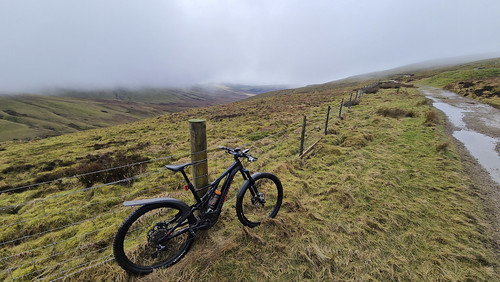
Heckbarley Mountain biking
16-Feb-24 • brian.phillips57 • flickr
cleator england unitedkingdom 53698279668

Heckbarley Mountain biking
16-Feb-24 • brian.phillips57 • flickr
cleator england unitedkingdom 53697177622
Heckbarley Mountain biking
16-Feb-24 • brian.phillips57 • flickr
cleator england unitedkingdom 53698411114

Heckbarley Mountain biking
16-Feb-24 • brian.phillips57 • flickr
cleator england unitedkingdom 53698510830
OS Map
This is OS mapping. In some areas, OpenStreetMap shows more footpaths
Spatial NI has online OSNI mapping. Click "Basemap Gallery" (4 squares icon at the top).
Now would be a good time for a cup of tea.
GPX Editor
Record map clicks
Reload map
Photos
Please tag your photos and upload them to the British and Irish Mountains group on Flickr
The other photos have been geo-tagged as on or around the summit. For less busy mountains, it can be a little hit and miss.
Ennerdale Water
misty
30-Oct-24 • koothenholly • flickr
ennerdalewater cumbria lakedistrict hff 54310466086
Gravelicious group ride to BlackSail YHA
20-Apr-24 • brian.phillips57 • flickr
blacksail ennerdale gravelicious gravelride 53702288038
Heckbarley Mountain biking
16-Feb-24 • brian.phillips57 • flickr
cleator england unitedkingdom 53698279668
Heckbarley Mountain biking
16-Feb-24 • brian.phillips57 • flickr
cleator england unitedkingdom 53697177622
Heckbarley Mountain biking
16-Feb-24 • brian.phillips57 • flickr
cleator england unitedkingdom 53698411114
Heckbarley Mountain biking
16-Feb-24 • brian.phillips57 • flickr
cleator england unitedkingdom 53698510830

Gravel ride to Black Sail Hut
Gravelicious ride out to Black Sail YHA Hut
03-Feb-24 • brian.phillips57 • flickr
cleator england unitedkingdom ennerdale 53646944221

River Ehen in late autumn
River just below Ennerdale Water.
16-Nov-23 • a.hill-psalm145 • flickr
river water trees ehen ennerdale lake district cumbria 53480516355


Ennerdale on a VERY calm morning
Ennerdale is the most westerly of the lakes in the Lake District. It is a natural lake but the sourthern end had a weir constructed to regulate the water level when water from the lake was adstracted by the water company United Utilities. Abstraction has now stopped in favour of water from wells. Here, the view is due south from Ennerdale Bridge showing the larger hill on the left (Great Borne) and the lower hill on the left (covered in trees) is Bowness Knott.
18-Sep-13 • BenElliottUK • flickr
beautifulbeautybownessknottbritainclarityclearcloudscumbriadestinationennerdalegreatbournelakelakedistrictpanoramapanoramicpicturesqueskytouristukwater 54241863690


2476 Crag Fell
Name:Crag Fell Hill number:2476 Height:523m / 1716ft Area:34B: Lake District - Central & Western Fells Class:Hu,5,W,B Grid ref:NY 09725 14385 Summit feature:cairn Drop:114m Col:409m NY101136 OS map sheet(s):(1:50k) 89 (1:25k) 4S 303
01-Dec-12 • Dugswell2 • flickr
lakes wainwright hump birkett p30 8242661700
Videos
This is a solo Lake District hike taking in the 3 Wainwrights Grike, Crag Fell and Lank Rigg in the Lake District If you enjoyed ...
Explore the stunning Western Fells of the Lake District in this epic hike, covering three Wainwrights—Grike, Crag Fell, and Lank ...
Join me on an epic overnight adventure in the stunning Lake District! In this video, I tackle the Western Fells, starting and finishing ...
I set off at 0645 for anglers crag hopeing for some good light. Got the drone up but it wasn't brilliant so decided to head up to the ...
Crag Fell via Anglers Crag and the Pinnacle. A day of sweltering heat that would ultimately bring the hike to an early finish!
Notes
- Data: Database of British and Irish Hills v18.2
- Maps: We use OS mapping for England, Scotland, Wales, and the Isle of Man. Sadly, Channel Islands, Northern (OSNI) and Southern Ireland (OSI) mapping isn't available online, so we use Openstreetmap.