Hills of Britain and Ireland
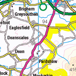
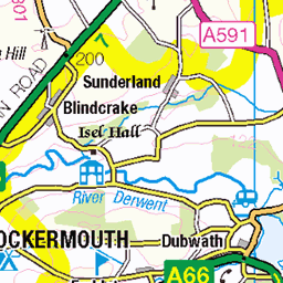
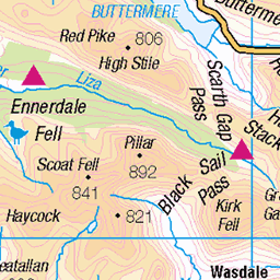
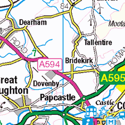
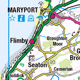
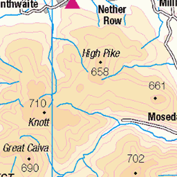
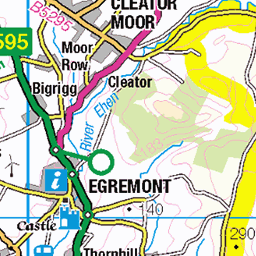
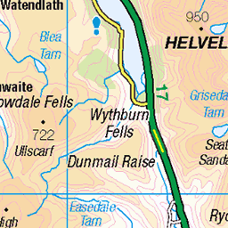
OS Map of Whiteside (Whiteside West Top)
Height: 707m / 2320ft • Prominence: 17m / 56ft • Summit : a few stones • Trip reports (hill-bagging)


Liza Beck - Gasgale Gill, Cumbria
08-Sep-23 • Jim Muller • flickr
cockermouth england unitedkingdom 53189370397

Hopegill Head from Whiteside, Cumbria
Looking along the airy ridge from Whiteside East Top to Hopegill Head. Ladyside Pike is seen to the left of Hopegill Head and Sand Hill to the right. Grisedale Pike is more distant, just to the left of Hopegill Head, with Skiddaw and Blencathra in the left distance and Catstye Cam and Helvellyn to the right.
25-Apr-23 • pete.taylor42 • flickr
52858589917

Edita looks out across Lorton Vale from Grasmoor End
Grasmoor and Gasgale via Grasmoor End
07-Apr-23 • markhorrell • flickr
cumbria lakedistrict britain walking hillwalking 52814507627

Looking out across Lorton Vale from Grasmoor End
Grasmoor and Gasgale via Grasmoor End
07-Apr-23 • markhorrell • flickr
cumbria lakedistrict britain walking hillwalking 52815522303

Edita scrambles up Grasmoor End
Grasmoor and Gasgale via Grasmoor End
07-Apr-23 • markhorrell • flickr
cumbria lakedistrict britain walking hillwalking 52814507327
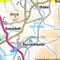
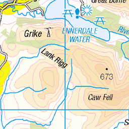
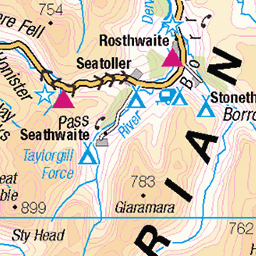
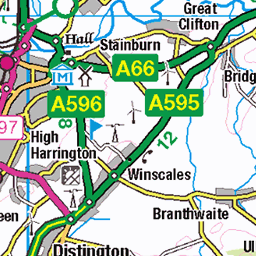
OS Map
This is OS mapping. In some areas, OpenStreetMap shows more footpaths
Spatial NI has online OSNI mapping. Click "Basemap Gallery" (4 squares icon at the top).
Now would be a good time for a cup of tea.


GPX Editor
Record map clicks
Reload map
Photos
Please tag your photos and upload them to the British and Irish Mountains group on Flickr
The other photos have been geo-tagged as on or around the summit. For less busy mountains, it can be a little hit and miss.
Liza Beck - Gasgale Gill, Cumbria
08-Sep-23 • Jim Muller • flickr
cockermouth england unitedkingdom 53189370397
Hopegill Head from Whiteside, Cumbria
Looking along the airy ridge from Whiteside East Top to Hopegill Head. Ladyside Pike is seen to the left of Hopegill Head and Sand Hill to the right. Grisedale Pike is more distant, just to the left of Hopegill Head, with Skiddaw and Blencathra in the left distance and Catstye Cam and Helvellyn to the right.
25-Apr-23 • pete.taylor42 • flickr
52858589917
Edita looks out across Lorton Vale from Grasmoor End
Grasmoor and Gasgale via Grasmoor End
07-Apr-23 • markhorrell • flickr
cumbria lakedistrict britain walking hillwalking 52814507627
Looking out across Lorton Vale from Grasmoor End
Grasmoor and Gasgale via Grasmoor End
07-Apr-23 • markhorrell • flickr
cumbria lakedistrict britain walking hillwalking 52815522303
Edita scrambles up Grasmoor End
Grasmoor and Gasgale via Grasmoor End
07-Apr-23 • markhorrell • flickr
cumbria lakedistrict britain walking hillwalking 52814507327

Zigzagging up ledges
Grasmoor and Gasgale via Grasmoor End
07-Apr-23 • markhorrell • flickr
cumbria lakedistrict britain walking hillwalking 52814507207

Scrambling up Grasmoor End
Grasmoor and Gasgale via Grasmoor End
07-Apr-23 • markhorrell • flickr
cumbria lakedistrict britain walking hillwalking 52815263929

High above Crummock Water
Grasmoor and Gasgale via Grasmoor End
07-Apr-23 • markhorrell • flickr
cumbria lakedistrict britain walking hillwalking 52815521848

Edita contours up Grasmoor End
Grasmoor and Gasgale via Grasmoor End
07-Apr-23 • markhorrell • flickr
cumbria lakedistrict britain walking hillwalking 52814506842
Videos
A slow 360 panorama from the summit of Whiteside in the Northwestern Fells region of the English Lake District. All main ...
A beautiful hike on the first day of Autumn (Fall) up to Grisdale Pike via Hopegill Head and Whiteside, on a glorious sunny day.
A solo hike in the Lake District, England taking in the 5 Wainwrights Whiteless Pike, Wandope, Grasmoor, Hopegill Head and ...
A 10 mile walk from the car park near Lanthwaite Green Farm. The route climbs the north western face of Grasmoor and then ...
Notes
- Data: Database of British and Irish Hills v18.2
- Maps: We use OS mapping for England, Scotland, Wales, and the Isle of Man. Sadly, Channel Islands, Northern (OSNI) and Southern Ireland (OSI) mapping isn't available online, so we use Openstreetmap.