Hills of Britain and Ireland
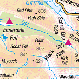
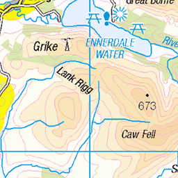
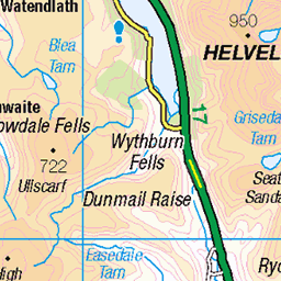
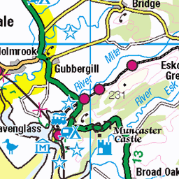
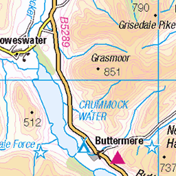
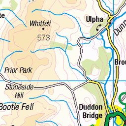
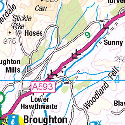
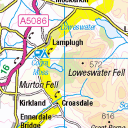
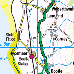
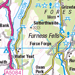
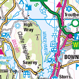
OS Map of Slight Side
Height: 762m / 2500ft • Prominence: 14m / 46ft • Summit : small cairn on rocky tor • Trip reports (hill-bagging)

Over Eskdale from Slight Side to the Irish Sea.
17-Jun-24 • colin9007 • flickr
lake district cumbria eskdale uk cumberland westmorland england 53798249503

Scafell and Scafell Pike from Slight Side.
17-Jun-24 • colin9007 • flickr
lake district cumbria eskdale scafell uk cumberland westmorland england 53797989056

Burnmoor Tarn and a glimpse of Wast Water from Slight Side.
17-Jun-24 • colin9007 • flickr
lake district cumbria eskdale uk cumberland westmorland england 53798288388

Crinkle Crags above Upper Eskdale.
17-Jun-24 • colin9007 • flickr
lake district cumbria eskdale uk cumberland westmorland england 53797115597

Eskdale panorama on the way up Scafell.
17-Jun-24 • colin9007 • flickr
lake district cumbria eskdale uk cumberland westmorland england 53798462654

Upper Eskdale from Scafell.
17-Jun-24 • colin9007 • flickr
lake district cumbria eskdale scafell uk cumberland westmorland england 53798374863
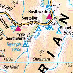
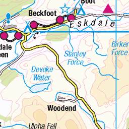
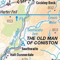
OS Map
This is OS mapping. In some areas, OpenStreetMap shows more footpaths
Spatial NI has online OSNI mapping. Click "Basemap Gallery" (4 squares icon at the top).
Now would be a good time for a cup of tea.


GPX Editor
Record map clicks
Reload map
Photos
Please tag your photos and upload them to the British and Irish Mountains group on Flickr
The other photos have been geo-tagged as on or around the summit. For less busy mountains, it can be a little hit and miss.
Over Eskdale from Slight Side to the Irish Sea.
17-Jun-24 • colin9007 • flickr
lake district cumbria eskdale uk cumberland westmorland england 53798249503
Scafell and Scafell Pike from Slight Side.
17-Jun-24 • colin9007 • flickr
lake district cumbria eskdale scafell uk cumberland westmorland england 53797989056
Burnmoor Tarn and a glimpse of Wast Water from Slight Side.
17-Jun-24 • colin9007 • flickr
lake district cumbria eskdale uk cumberland westmorland england 53798288388
Crinkle Crags above Upper Eskdale.
17-Jun-24 • colin9007 • flickr
lake district cumbria eskdale uk cumberland westmorland england 53797115597
Eskdale panorama on the way up Scafell.
17-Jun-24 • colin9007 • flickr
lake district cumbria eskdale uk cumberland westmorland england 53798462654
Upper Eskdale from Scafell.
17-Jun-24 • colin9007 • flickr
lake district cumbria eskdale scafell uk cumberland westmorland england 53798374863

Scafell Pike and Esk Pike from Long Green, Scafell.
17-Jun-24 • colin9007 • flickr
lake district cumbria eskdale scafell uk cumberland westmorland england 53798376453


Burnmoor Tarn and Wast Water.
17-Jun-24 • colin9007 • flickr
lake district cumbria eskdale uk cumberland westmorland england 53798151351

Memorial to Polish airmen Zygmund Hohne and Stanislav Karubin whose Hurricane fighters came down on Slight Side, Cumbria, in 1941.
17-Jun-24 • colin9007 • flickr
lake district cumbria eskdale war memorial polish airmen hawker hurricane uk cumberland westmorland england 53796937247
Videos
Circular Wainwright walk from Boot - Lake District.
Exploring the beautiful Eskdale Valley. Following the river Esk across Lingcove Bridge, an old packhorse bridge, up to the ...
A walk up to Scafell, England's second highest mountain at 3162ft (964m) The walk starts from the parking area opposite Wha ...
Notes
- Data: Database of British and Irish Hills v18.2
- Maps: We use OS mapping for England, Scotland, Wales, and the Isle of Man. Sadly, Channel Islands, Northern (OSNI) and Southern Ireland (OSI) mapping isn't available online, so we use Openstreetmap.