Hills of Britain and Ireland
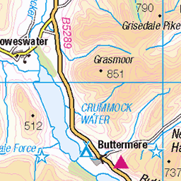
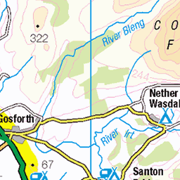
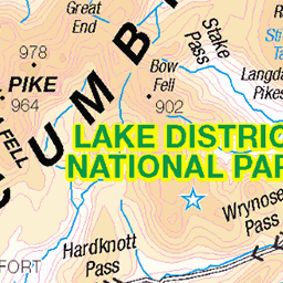
OS Map of High Stile (Grey Crag - High Stile)
Height: 807m / 2646ft • Prominence: 362m / 1188ft • Summit : small cairn on outcrop • Trip reports (hill-bagging)

Buttermere Reflections
Another view of the edge Buttermere with it's mirror like reflections of the Lakeland fells.
mountains reflections buttermere lakedistrict cumbria uk omdigitalsolutions om1markii 12100 f4 54142259385

Making Waves
- or at least ripples! This dog waited patiently for it's owner to call it, making only minor ripples in the lake - unlike some of the rather enthusiastic ones, chasing sticks, that rather spoiled the mirror effect! They did look like they were enjoying themselves though!
dog mountains reflections buttermere lakedistrict cumbria uk omdigitalsolutions om1markii 12100 f4 54144082994

Fleetwith Pike
Fleetwith Pike (centre) from the path round Buttermere, with the Honister Pass to the left of it. The circuit of the lake is a relatively easy walk of about 4 miles.
path mountains fleetwithpike buttermere lakedistrict cumbria uk omdigitalsolutions om1markii 12100 f4 54146374868

Lake District
31-Oct-23 • Matthew Margot • flickr
england unitedkingdom lakedistrict cockermouth 54216598994


Buttermere
21-Oct-21 • Matthew Margot • flickr
unitedkingdom england europe lakedistrict mm cockermouth fav10 54295617156
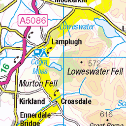
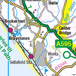
OS Map
This is OS mapping. In some areas, OpenStreetMap shows more footpaths
Spatial NI has online OSNI mapping. Click "Basemap Gallery" (4 squares icon at the top).
Now would be a good time for a cup of tea.


GPX Editor
Record map clicks
Reload map
Photos
Please tag your photos and upload them to the British and Irish Mountains group on Flickr
The other photos have been geo-tagged as on or around the summit. For less busy mountains, it can be a little hit and miss.
Buttermere Reflections
Another view of the edge Buttermere with it's mirror like reflections of the Lakeland fells.
mountains reflections buttermere lakedistrict cumbria uk omdigitalsolutions om1markii 12100 f4 54142259385
Making Waves
- or at least ripples! This dog waited patiently for it's owner to call it, making only minor ripples in the lake - unlike some of the rather enthusiastic ones, chasing sticks, that rather spoiled the mirror effect! They did look like they were enjoying themselves though!
dog mountains reflections buttermere lakedistrict cumbria uk omdigitalsolutions om1markii 12100 f4 54144082994
Fleetwith Pike
Fleetwith Pike (centre) from the path round Buttermere, with the Honister Pass to the left of it. The circuit of the lake is a relatively easy walk of about 4 miles.
path mountains fleetwithpike buttermere lakedistrict cumbria uk omdigitalsolutions om1markii 12100 f4 54146374868
Lake District
31-Oct-23 • Matthew Margot • flickr
england unitedkingdom lakedistrict cockermouth 54216598994
Buttermere
21-Oct-21 • Matthew Margot • flickr
unitedkingdom england europe lakedistrict mm cockermouth fav10 54295617156

Landscape photography
Taken on my iPhone, mixture of 12 pro and 15 pro
22-Jul-21 • myname.isash • flickr
54358846427

Lake District
26-Apr-21 • Matthew Margot • flickr
england europe places lakedistrict cockermouth 54216301253

Lake District
26-Apr-21 • Matthew Margot • flickr
england europe places lakedistrict cockermouth 54216077651

Lake District
26-Apr-21 • Matthew Margot • flickr
england europe places lakedistrict cockermouth 54216307524
Videos
In early June 2023, Neil returns to Buttermere, on a stunningly bright, dry, day, to do the Buttermere Fells (also known as the ...
See where WAINWRIGHT'S ASHES are scattered in THE LAKE DISTRICT. See more Lake District walks in the WESTERN ...
What a route this is... we set off from Gatesgarth Farm under the scowl of thick cloud that cloaked the high tops. Not knowing what ...
Started at the car park at the bottom of fleetwith pike which was £4 for all day. After a hard slog up to the top of fleetwith pike I then ...
Some pull up Red Pike, killer in the sunshine, unbelievable gusts on the summit. Knee killer down High Crag. We were late setting ...
Notes
- Data: Database of British and Irish Hills v18.2
- Maps: We use OS mapping for England, Scotland, Wales, and the Isle of Man. Sadly, Channel Islands, Northern (OSNI) and Southern Ireland (OSI) mapping isn't available online, so we use Openstreetmap.