Hills of Britain and Ireland
OS Map of Esk Pike
Height: 885m / 2904ft • Prominence: 112m / 367ft • Summit : rib of rock with small cairn • Trip reports (hill-bagging)


Allen Crags, May 2024
18-May-24 • Great Uncle David • flickr
lakedistrict cumbria england allencrags mountains 53775789773

The Scafell Massif
This video is 30 seconds long.
18-May-24 • Paul Austin Murphy • flickr
53731319944


OS Map
This is OS mapping. In some areas, OpenStreetMap shows more footpaths
Spatial NI has online OSNI mapping. Click "Basemap Gallery" (4 squares icon at the top).
Now would be a good time for a cup of tea.
GPX Editor
Record map clicks
Reload map
Photos
Please tag your photos and upload them to the British and Irish Mountains group on Flickr
The other photos have been geo-tagged as on or around the summit. For less busy mountains, it can be a little hit and miss.
Allen Crags, May 2024
18-May-24 • Great Uncle David • flickr
lakedistrict cumbria england allencrags mountains 53775789773
The Scafell Massif
This video is 30 seconds long.
18-May-24 • Paul Austin Murphy • flickr
53731319944


Pike of Stickle... Pike of Blisco... Bowfell... Great End... Great Gable
This video is 28 seconds long. The video was shot on Allen Crags.
18-May-24 • Paul Austin Murphy • flickr
53733901945
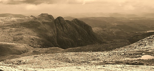
View of the Langdale Pikes (From Esk Pike)
19-Apr-24 • Paul Austin Murphy • flickr
illgillhead 53668694411
Videos
Blessed with good weather, I headed out on this beautiful 10 mile circular from Old Dungeon Ghyll along the Cumbria Way to ...
This is an excellent walk in the beautiful Langdale Valley. This hike starts with an easy 2.5km valley walk before the ascent up to ...
Climbing Rosset Pike from The Old Dungeon Ghyll for the very first time. A superb sunny day for a walk through the Langdale ...
After parking down at Seathwaite Farm, I walk up towards Stockley Bridge before taking a shape left turn after the bridge, to walk ...
A series of brief time lapse videos I created while on a camp on Esk Pike overnight.
Notes
- Data: Database of British and Irish Hills v18.2
- Maps: We use OS mapping for England, Scotland, Wales, and the Isle of Man. Sadly, Channel Islands, Northern (OSNI) and Southern Ireland (OSI) mapping isn't available online, so we use Openstreetmap.