Hills of Britain and Ireland
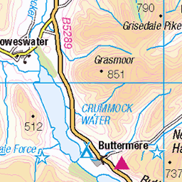
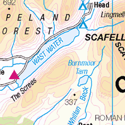
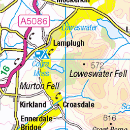
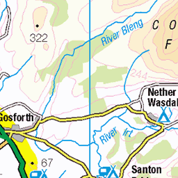
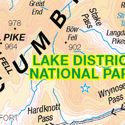
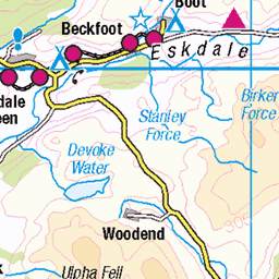
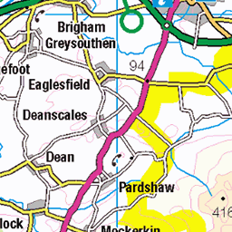
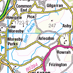
OS Map of Pillar
Height: 892m / 2928ft • Prominence: 349m / 1145ft • Summit : trig point • Trip reports (hill-bagging)

2368 Haycock d
25-Mar-25 • Dugswell2 • flickr
ennerdale cumberland england haycock p94 tump simm hewitt nuttall wainwright birkett synge fellranger subhump buxtonlewis bridge 54411152701

2368 Haycock e
25-Mar-25 • Dugswell2 • flickr
ennerdale cumberland england haycock p94 tump simm hewitt nuttall wainwright birkett synge fellranger subhump buxtonlewis bridge 54411527655

20250131_140841412_iOS
Memorial bridge damaged by Storm Eowyn January 2025
31-Jan-25 • Wild Ennerdale • flickr
river liza bridge 54303987441

Waterfall below Pillar Rock, Aug. 2024
18-Aug-24 • Great Uncle David • flickr
cumbria lakedistrict england waterfalls 53975940693

Pillar Rock, Aug. 2024
18-Aug-24 • Great Uncle David • flickr
cumbria lakedistrict england pillarrock 53976131240

Robinson's Cairn, Aug. 2024
18-Aug-24 • Great Uncle David • flickr
cumbria lakedistrict england robinsonscairn 53974812187
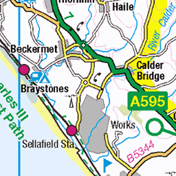
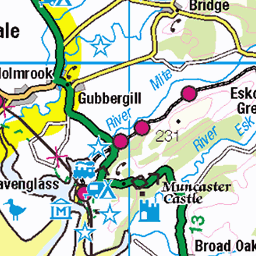
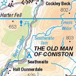
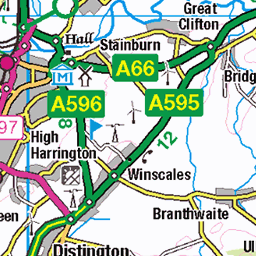
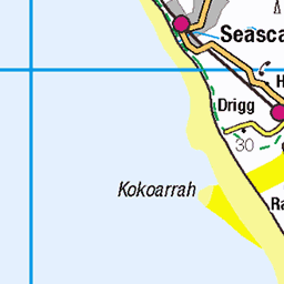
OS Map
This is OS mapping. In some areas, OpenStreetMap shows more footpaths
Spatial NI has online OSNI mapping. Click "Basemap Gallery" (4 squares icon at the top).
Now would be a good time for a cup of tea.


GPX Editor
Record map clicks
Reload map
Photos
Please tag your photos and upload them to the British and Irish Mountains group on Flickr
The other photos have been geo-tagged as on or around the summit. For less busy mountains, it can be a little hit and miss.
2368 Haycock d
25-Mar-25 • Dugswell2 • flickr
ennerdale cumberland england haycock p94 tump simm hewitt nuttall wainwright birkett synge fellranger subhump buxtonlewis bridge 54411152701
2368 Haycock e
25-Mar-25 • Dugswell2 • flickr
ennerdale cumberland england haycock p94 tump simm hewitt nuttall wainwright birkett synge fellranger subhump buxtonlewis bridge 54411527655
20250131_140841412_iOS
Memorial bridge damaged by Storm Eowyn January 2025
31-Jan-25 • Wild Ennerdale • flickr
river liza bridge 54303987441
Waterfall below Pillar Rock, Aug. 2024
18-Aug-24 • Great Uncle David • flickr
cumbria lakedistrict england waterfalls 53975940693
Pillar Rock, Aug. 2024
18-Aug-24 • Great Uncle David • flickr
cumbria lakedistrict england pillarrock 53976131240
Robinson's Cairn, Aug. 2024
18-Aug-24 • Great Uncle David • flickr
cumbria lakedistrict england robinsonscairn 53974812187

Scoat Fell, Aug. 2024
18-Aug-24 • Great Uncle David • flickr
cumbria lakedistrict england scoatfell mountains 53975703846


Black Clouds Around Sellafield
Photo taken between Scoat Fell and Red Pike.
06-Jul-24 • Paul Austin Murphy • flickr
53843220025


Videos
On a blisteringly hot day In May 2018, On Y Va Films headed to Wasdale Head in the English Lake District to do the iconic ...
A 13.25 mile monster of a hike from the Bowness Knott car park in Ennerdale up to Pillar. I was hiking with @eddiecaisley5746 ...
The view from Wasdale Head up to Pillar in the English Lake District. Whilst people are stuck indoors, we hope that you enjoy our ...
Hiking in Ennerdale.
GPX Download Of Route... https://drive.google.com/file/d/11uIl0ulKK71Kqu-UYGYPbs9pDqkB5QQg/view?usp=drivesdk Pillar in ...
Notes
- Data: Database of British and Irish Hills v18.2
- Maps: We use OS mapping for England, Scotland, Wales, and the Isle of Man. Sadly, Channel Islands, Northern (OSNI) and Southern Ireland (OSI) mapping isn't available online, so we use Openstreetmap.