Hills of Britain and Ireland
OS Map of Scafell
Height: 964m / 3162ft • Prominence: 132m / 433ft • Summit : cairn on rock N of windshelter • Trip reports (hill-bagging)

View of Wasdale from Hollow Stones on the route up Scafell Pike
The side of Lingmell is on the right in sunshine with Yewbarrow just to left of it.
09-Sep-24 • Richard Needham • flickr
wast water scafellpike lakedistrict 54018725036

Ravens circling the summit of Scafell Pike, 9th September 2024
Ravens can be found in many different parts of the UK. Here these huge birds are spectacularly cruising above Scafell Pike owning the sky.
09-Sep-24 • Richard Needham • flickr
birds corvids blackandwhite 53999381177


R0006095
28-Jun-24 • jrobfoto.com • flickr
grist griii ricoh lakedistrict holmrook england unitedkingdom 53838574172
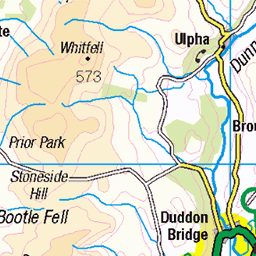
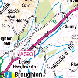
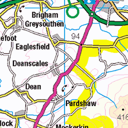
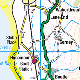
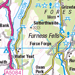
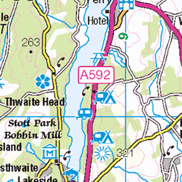
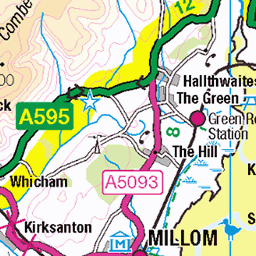
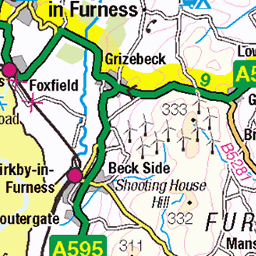
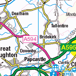
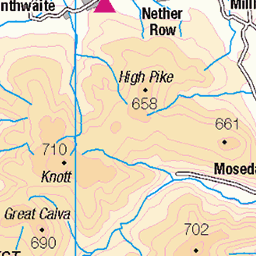
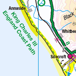
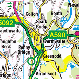
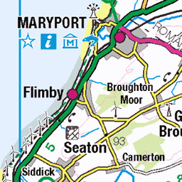
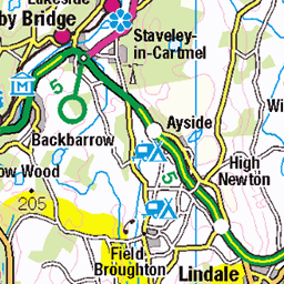
OS Map
This is OS mapping. In some areas, OpenStreetMap shows more footpaths
Spatial NI has online OSNI mapping. Click "Basemap Gallery" (4 squares icon at the top).
Now would be a good time for a cup of tea.


GPX Editor
Record map clicks
Reload map
Photos
Please tag your photos and upload them to the British and Irish Mountains group on Flickr
The other photos have been geo-tagged as on or around the summit. For less busy mountains, it can be a little hit and miss.
View of Wasdale from Hollow Stones on the route up Scafell Pike
The side of Lingmell is on the right in sunshine with Yewbarrow just to left of it.
09-Sep-24 • Richard Needham • flickr
wast water scafellpike lakedistrict 54018725036
Ravens circling the summit of Scafell Pike, 9th September 2024
Ravens can be found in many different parts of the UK. Here these huge birds are spectacularly cruising above Scafell Pike owning the sky.
09-Sep-24 • Richard Needham • flickr
birds corvids blackandwhite 53999381177
R0006095
28-Jun-24 • jrobfoto.com • flickr
grist griii ricoh lakedistrict holmrook england unitedkingdom 53838574172

R0006097
28-Jun-24 • jrobfoto.com • flickr
grist griii ricoh lakedistrict holmrook england unitedkingdom 53839468556

R0006102
28-Jun-24 • jrobfoto.com • flickr
grist griii ricoh lakedistrict holmrook england unitedkingdom 53839910550

R0006118
28-Jun-24 • jrobfoto.com • flickr
scafellpike grist griii ricoh lakedistrict holmrook england unitedkingdom 53834122783

R0006131
28-Jun-24 • jrobfoto.com • flickr
grist griii ricoh lakedistrict holmrook england unitedkingdom 53839731193
Videos
A walk up to Scafell, England's second highest mountain at 3162ft (964m) The walk starts from the parking area opposite Wha ...
What is the quickest way to the top of Scafell Pike, England's highest mountain? Is it from Seathwaite via the Corridor Route or ...
Hello everyone! Welcome back to my YouTube channel. Scafell via Lords Rake Solo Scramble - Corridor Route - Scafell Pike ...
Plagued by equipment issues right from the beginning I wasn't going to let ANYTHING stop me going up one of the best rake ...
In this video we take the 'quickest' path to the summit of Scafell Pike, which is the highest peak in England! We will show you the ...
Notes
- Data: Database of British and Irish Hills v18.2
- Maps: We use OS mapping for England, Scotland, Wales, and the Isle of Man. Sadly, Channel Islands, Northern (OSNI) and Southern Ireland (OSI) mapping isn't available online, so we use Openstreetmap.