Hills of Britain and Ireland
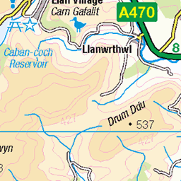
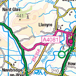
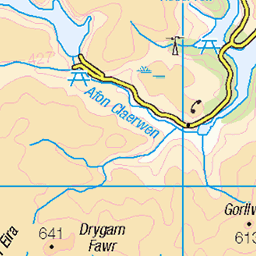
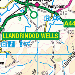
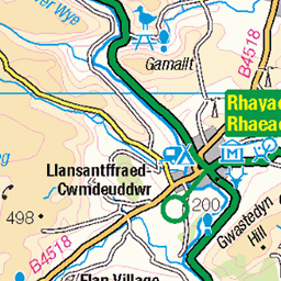
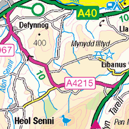
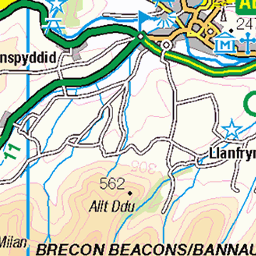
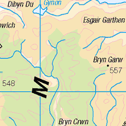
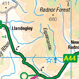
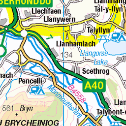
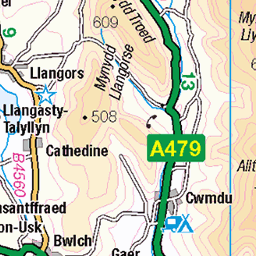
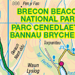
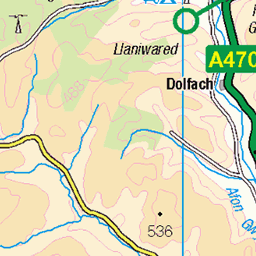
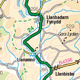
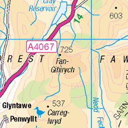
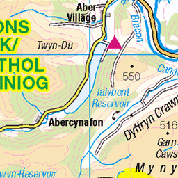
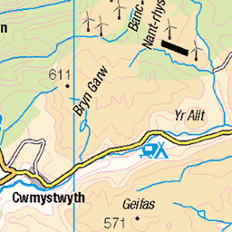
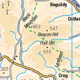
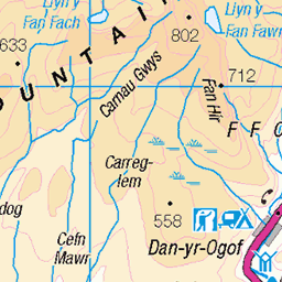
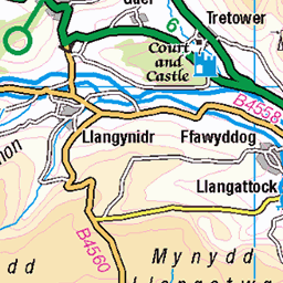
OS Map of Mynydd Epynt (Mynydd Eppynt)
Height: 476m / 1560ft • Prominence: 197m / 646ft • Summit : ground by short concrete marker • Trip reports (hill-bagging)


B4519
towards Garth
13-May-18 • Coastal Co • flickr
b4519 epynt garth powys landscape scenery wales uk unlimitedphotos 2018 mountains 40280275460

Into The Far Blue Yonder
On the B4519
02-May-17 • Coastal Co • flickr
b4519 redkiteview powys wales uk 2017 road unlimitedphotos scene sky clouds 34300865111

B4519 near Garth
This was taken during my one day motorbike camping trip from Bristol to Elan Valley. The Elan Valley is such an amazing place, literally a photo opportunity at every turn.
23-May-15 • peterallenn • flickr
18089612521
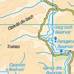
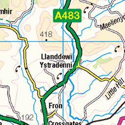
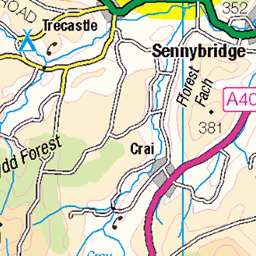
OS Map
This is OS mapping. In some areas, OpenStreetMap shows more footpaths
Spatial NI has online OSNI mapping. Click "Basemap Gallery" (4 squares icon at the top).
Now would be a good time for a cup of tea.

GPX Editor
Record map clicks
Reload map
Photos
Please tag your photos and upload them to the British and Irish Mountains group on Flickr
The other photos have been geo-tagged as on or around the summit. For less busy mountains, it can be a little hit and miss.
B4519
towards Garth
13-May-18 • Coastal Co • flickr
b4519 epynt garth powys landscape scenery wales uk unlimitedphotos 2018 mountains 40280275460
Into The Far Blue Yonder
On the B4519
02-May-17 • Coastal Co • flickr
b4519 redkiteview powys wales uk 2017 road unlimitedphotos scene sky clouds 34300865111
B4519 near Garth
This was taken during my one day motorbike camping trip from Bristol to Elan Valley. The Elan Valley is such an amazing place, literally a photo opportunity at every turn.
23-May-15 • peterallenn • flickr
18089612521

B4519 near Garth
This was taken during my one day motorbike camping trip from Bristol to Elan Valley. The Elan Valley is such an amazing place, literally a photo opportunity at every turn.
23-May-15 • peterallenn • flickr
17902419719

Gwlad a gipiwyd - Epynt
Ur vro bet skrapet - Epynt ▪▫▪▫▪▫▪▫▪▫▪▫ A stolen landscape - Epynt ▪▫▪▫▪▫▪▫▪▫▪▫ A "Welsh speaking community (200 people) was displaced in an action which although publicised in Wales was not generally highlighted elsewhere because of wartime censorship. The community was that around Epynt in mid Wales and the year was 1940. The area (a vast swathe of land) was commandeered for the war effort and the community although reluctant to go may have thought when the war was over they would be able to return. It was not to be, however. The land was retained as a military training ground and in one of those unforeseen ironies after Germany the war time adversary of Britain eventually was accepted into NATO at the height of the Cold war their troops also ended up exercising on the land from which Welsh speakers were displaced. The eviction from Epynt possibly had a greater influence on the Welsh Language than the events at Tryweryn because the creation of the military range had the effect of moving the border of Welsh speaking Wales many miles further west." www.transceltic.com/blog/epynt-death-of-community" rel="nofollow www.transceltic.com/blog/epynt-death-of-community
12-Apr-15 • Rhisiart Hincks • flickr
bare llwm bleak moel arme army byddin military milwrol landscape tirlun maezioù paisaje tírdhreach paisaia cruthtìre epynt eppynt brycheiniog breconshire powys ue eu ewrop europe eòrpa europa aneoraip a’chuimrigh kembra wales cymru kembre gales galles anbhreatainbheag 威爾斯 威尔士 wallis uels kimrio valbretland 웨일즈 велс เวลส์ ويلز uells ουαλία velsa velsas уельс уэльс уелс walia ウェールズ 威爾士 gallas 43309234185


Drovers Arms, Mynydd Epynt
Drovers Arms, situated in the military zone North of Brecon. Comandeered by the MOD.
26-Jun-14 • Gwyndaf ap Gwilym • flickr
mountains wales army pub nikon mod sheep arms military disused british welsh drovers senta mynydd d600 epynt 14524839045
Videos
Banc Y Cwm (MOD Sennybridge Ranges), Mynydd Epynt, Powys, U.K..
Had to cut the 30 mile route short due to a main part requiring access over the 'out of bounds' areas. Looking back I should have ...
Notes
- Data: Database of British and Irish Hills v18.2
- Maps: We use OS mapping for England, Scotland, Wales, and the Isle of Man. Sadly, Channel Islands, Northern (OSNI) and Southern Ireland (OSI) mapping isn't available online, so we use Openstreetmap.