Hills of Britain and Ireland
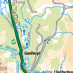
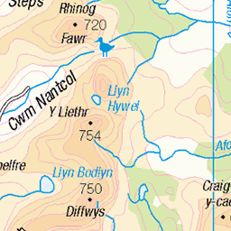
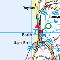
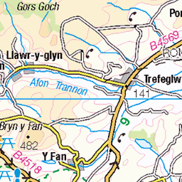
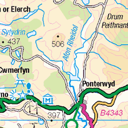
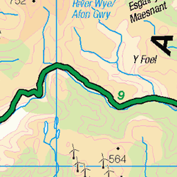
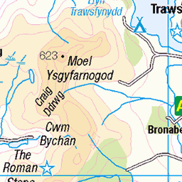
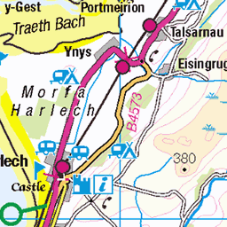
OS Map of Craig Goch (Mynydd Cwmcelli)
Height: 468m / 1536ft • Prominence: 156m / 512ft • Summit : ground less than 1m from trig point • Trip reports (hill-bagging)

Aberangell - Aberllefenni
Gwynedd
16-Jan-22 • Rhisiart Hincks • flickr
woodland coedwig light goleuni wales mountains mynyddoedd aberllefenni cymru lane lôn 51831571186

Gwlad y Bryniau
Aberangell - Aberllefenni, Meirionnydd, Gwynedd
16-Jan-22 • Rhisiart Hincks • flickr
ewrop europe eòrpa europa aneoraip a’chuimrigh kembra wales cymru kembre gales galles anbhreatainbheag 威爾斯 威尔士 51915527989

Dyfi Woodland
13-Jul-15 • Andy Stafford • flickr
trees pine woods dovey machynlleth dyfi aberangell hendreddu 19822109685


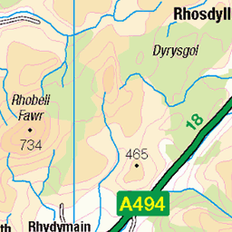
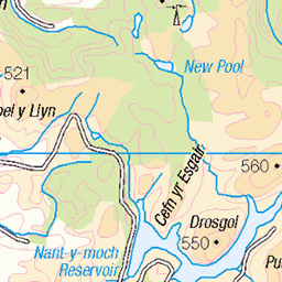
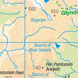
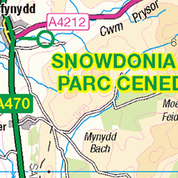
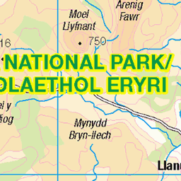
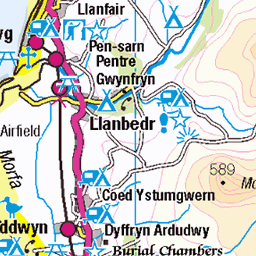
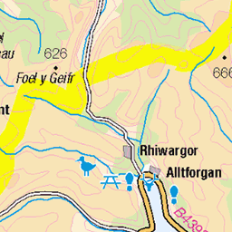
OS Map
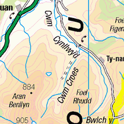
This is OS mapping. In some areas, OpenStreetMap shows more footpaths
Spatial NI has online OSNI mapping. Click "Basemap Gallery" (4 squares icon at the top).
Now would be a good time for a cup of tea.
GPX Editor
Record map clicks
Reload map
Photos
Please tag your photos and upload them to the British and Irish Mountains group on Flickr
The other photos have been geo-tagged as on or around the summit. For less busy mountains, it can be a little hit and miss.
Aberangell - Aberllefenni
Gwynedd
16-Jan-22 • Rhisiart Hincks • flickr
woodland coedwig light goleuni wales mountains mynyddoedd aberllefenni cymru lane lôn 51831571186
Gwlad y Bryniau
Aberangell - Aberllefenni, Meirionnydd, Gwynedd
16-Jan-22 • Rhisiart Hincks • flickr
ewrop europe eòrpa europa aneoraip a’chuimrigh kembra wales cymru kembre gales galles anbhreatainbheag 威爾斯 威尔士 51915527989
Dyfi Woodland
13-Jul-15 • Andy Stafford • flickr
trees pine woods dovey machynlleth dyfi aberangell hendreddu 19822109685


Videos
Sweeping views from the Craig Goch Trig Point across the Mynydd Cwmcelli area.
In Winter 2020, I ascended 200 meters of Craig Cau, located west of Llyn Cau on Cadair Idris in Snowdonia, Wales. The climb ...
Craig Cau West of Llyn Cau, Cadair Idris, Wales, Winter 2020.
I free soloed Craig Cau, a striking cliff face on the southern side of Cadair Idris in Snowdonia National Park, Wales. It rises above ...
A mini solo adventure up Cadair Idris, July 2020. Dol Idris - Minffordd Path - Craig Cau - Penygadair Summit - Mynydd Moel ...
Notes
- Data: Database of British and Irish Hills v18.2
- Maps: We use OS mapping for England, Scotland, Wales, and the Isle of Man. Sadly, Channel Islands, Northern (OSNI) and Southern Ireland (OSI) mapping isn't available online, so we use Openstreetmap.