Hills of Britain and Ireland
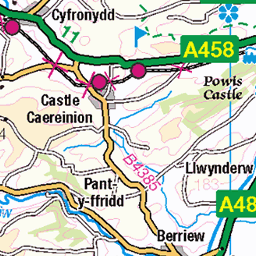
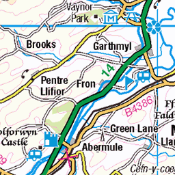
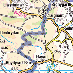
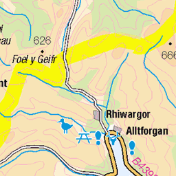
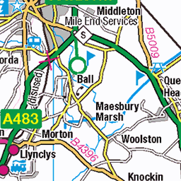
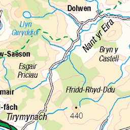
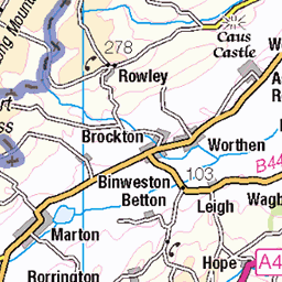
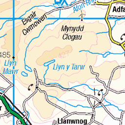
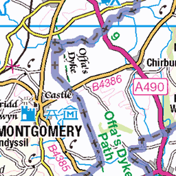
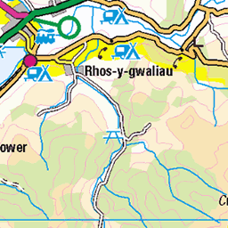
OS Map of Allt y Main
Height: 356m / 1169ft • Prominence: 175m / 574ft • Summit : trig point • Trip reports (hill-bagging)

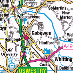
A495, ger Meifod
Maldwyn
27-May-24 • Rhisiart Hincks • flickr
ewrop europe eòrpa europa aneoraip a’chuimrigh kembra wales cymru kembre gales galles anbhreatainbheag 威爾斯 威尔士 wallis uels kimrio valbretland 웨일즈 53899772128

Salford Van Hire MX66 ESF on the A495
09-Mar-19 • Joshhowells27 • flickr
lorry truck daf lf daflf mx66esf box salfordvanhire 46853820375
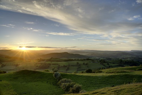
Glas Cwm Sunset
Glas Cwm, Meifod, Powys, Mid Wales UK
11-Jun-14 • Jackiepentrecoed • flickr
sunset wales midwales meifod 20025712661

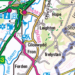
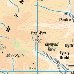
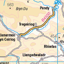
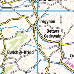
OS Map
This is OS mapping. In some areas, OpenStreetMap shows more footpaths
Spatial NI has online OSNI mapping. Click "Basemap Gallery" (4 squares icon at the top).
Now would be a good time for a cup of tea.

GPX Editor
Record map clicks
Reload map
Photos
Please tag your photos and upload them to the British and Irish Mountains group on Flickr
The other photos have been geo-tagged as on or around the summit. For less busy mountains, it can be a little hit and miss.
A495, ger Meifod
Maldwyn
27-May-24 • Rhisiart Hincks • flickr
ewrop europe eòrpa europa aneoraip a’chuimrigh kembra wales cymru kembre gales galles anbhreatainbheag 威爾斯 威尔士 wallis uels kimrio valbretland 웨일즈 53899772128
Salford Van Hire MX66 ESF on the A495
09-Mar-19 • Joshhowells27 • flickr
lorry truck daf lf daflf mx66esf box salfordvanhire 46853820375
Glas Cwm Sunset
Glas Cwm, Meifod, Powys, Mid Wales UK
11-Jun-14 • Jackiepentrecoed • flickr
sunset wales midwales meifod 20025712661
Videos
Take a virtual walking tour around Meifod loop South, Powys, Wales and you will discover the stunning views. Route: ...
We have visited our friends smallholding in Wales and taken a look around their home allotment garden. They also have a ...
Weekend riding adventure in North Wales visiting all the Welsh riding highlights and discovering a few new ones.
There hasn't been much downhill racing in 2020, so Neil thought - why not just make one? To do so, he headed to Revolution ...
Filmed using the the DJI Air 2S in 4K 30fps. Ventured outside of the home county to capture a little sample of some of the stunning ...
Notes
- Data: Database of British and Irish Hills v18.2
- Maps: We use OS mapping for England, Scotland, Wales, and the Isle of Man. Sadly, Channel Islands, Northern (OSNI) and Southern Ireland (OSI) mapping isn't available online, so we use Openstreetmap.