Hills of Britain and Ireland
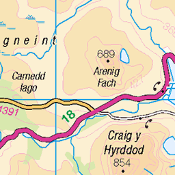
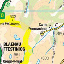
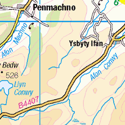
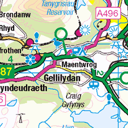
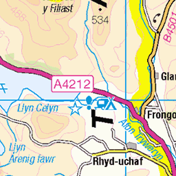
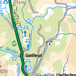
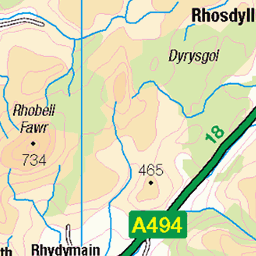
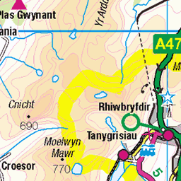
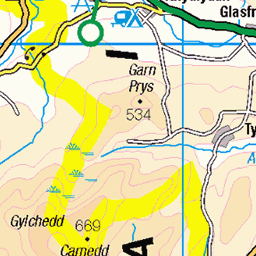
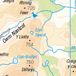
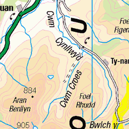
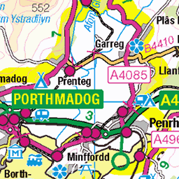
OS Map of Moel Llyfnant
Height: 751m / 2464ft • Prominence: 210m / 689ft • Summit : cairn on rocky outcrop • Trip reports (hill-bagging)

Rocky rib on the slopes of Moel Llyfnant, Arenig.
Mountain Craft // www.mountaincraft.co.uk" rel="noreferrer nofollow www.mountaincraft.co.uk - Guided mountain adventures in Snowdonia - Eryri - North Wales. This rocky rib is calling out for a scramble style ascent, it lies on the south east slopes of Moel Llyfnant, a great mountain next to Arenig Fawr. It is accessible from the Bala to Trawsfynydd road or from the minor mountain road from Llanuwchllyn.
01-Jun-19 • Mountain Craft • flickr
grass activity grassy feature unique handcrafted eryrinationalpark mountaincraftcouk wales mountainwalking adventures hillwalking northwales ridge gwynedd arenig mountaincraft snowdonia scrambling snowdonianationalpark bala moelllyfnant rib parccenedlaetholeryri scree mountaineering slope craft hiking eryri majorlocations experiences location mountainarea cliff mountain hikingchallengesuk kidsrockclimbing mountainadventures northwalesactivities snowdon snowdonguidedwalks snowdoniaactivities snowdoniatrails thingstodoinbetwsycoed yrwyddfa 54189298198

Moel Llyfnant
04-Mar-19 • OutdoorMonkey • flickr
moor moorland remote wild wilderness peak mountain mountainside moody atmospheric cloud snowdonia rural nature natural scenic scenery countryside outside outdoor wales welsh cymru arenigfawr arenig 32369350367


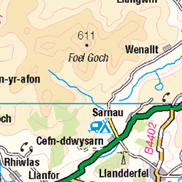
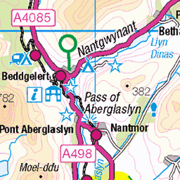
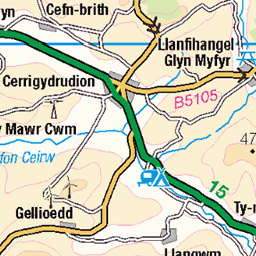
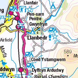
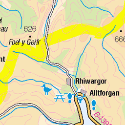
OS Map
This is OS mapping. In some areas, OpenStreetMap shows more footpaths
Spatial NI has online OSNI mapping. Click "Basemap Gallery" (4 squares icon at the top).
Now would be a good time for a cup of tea.

GPX Editor
Record map clicks
Reload map
Photos
Please tag your photos and upload them to the British and Irish Mountains group on Flickr
The other photos have been geo-tagged as on or around the summit. For less busy mountains, it can be a little hit and miss.
Rocky rib on the slopes of Moel Llyfnant, Arenig.
Mountain Craft // www.mountaincraft.co.uk" rel="noreferrer nofollow www.mountaincraft.co.uk - Guided mountain adventures in Snowdonia - Eryri - North Wales. This rocky rib is calling out for a scramble style ascent, it lies on the south east slopes of Moel Llyfnant, a great mountain next to Arenig Fawr. It is accessible from the Bala to Trawsfynydd road or from the minor mountain road from Llanuwchllyn.
01-Jun-19 • Mountain Craft • flickr
grass activity grassy feature unique handcrafted eryrinationalpark mountaincraftcouk wales mountainwalking adventures hillwalking northwales ridge gwynedd arenig mountaincraft snowdonia scrambling snowdonianationalpark bala moelllyfnant rib parccenedlaetholeryri scree mountaineering slope craft hiking eryri majorlocations experiences location mountainarea cliff mountain hikingchallengesuk kidsrockclimbing mountainadventures northwalesactivities snowdon snowdonguidedwalks snowdoniaactivities snowdoniatrails thingstodoinbetwsycoed yrwyddfa 54189298198
Moel Llyfnant
04-Mar-19 • OutdoorMonkey • flickr
moor moorland remote wild wilderness peak mountain mountainside moody atmospheric cloud snowdonia rural nature natural scenic scenery countryside outside outdoor wales welsh cymru arenigfawr arenig 32369350367


Videos
A 10k mountain walk in the Arenigs.
The route I followed: ...
A circular of Arenig Fawr with heavy snow at the summit, a nice bothy stop for a fire and all day breakfast.
Hiking Arenig Fawr in the Snowdon Range then finishing the walk with a wild camp next to the lake and bothy on the other side.
A rough,pathless ascent of a small gem of a mountain.
Notes
- Data: Database of British and Irish Hills v18.2
- Maps: We use OS mapping for England, Scotland, Wales, and the Isle of Man. Sadly, Channel Islands, Northern (OSNI) and Southern Ireland (OSI) mapping isn't available online, so we use Openstreetmap.