Hills of Britain and Ireland
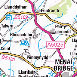
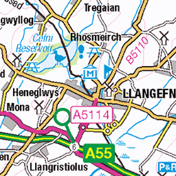
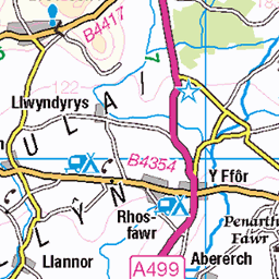
OS Map of Foel Goch
Height: 605m / 1983ft • Prominence: 92m / 302ft • Summit : small cairn • Trip reports (hill-bagging)

IRSE visit to the Ffestiniog and Welsh Highland Railways in May 2024
Views from the train window on the way to Beddgelert station for our next stop.
11-May-24 • craigdonald44 • flickr
irse ffestiniog welsh highland railways institute railway signal engineers 53720695843

IRSE visit to the Ffestiniog and Welsh Highland Railways in May 2024
Views from the train window on the way to Beddgelert station for our next stop.
11-May-24 • craigdonald44 • flickr
irse ffestiniog welsh highland railways institute railway signal engineers 53720823844

IRSE visit to the Ffestiniog and Welsh Highland Railways in May 2024
Views from the train window on the way to Beddgelert station for our next stop.
11-May-24 • craigdonald44 • flickr
irse ffestiniog welsh highland railways institute railway signal engineers 53719581937

IRSE visit to the Ffestiniog and Welsh Highland Railways in May 2024
Views from the train window on the way to Beddgelert station for our next stop.
11-May-24 • craigdonald44 • flickr
irse ffestiniog welsh highland railways institute railway signal engineers 53720919060

IRSE visit to the Ffestiniog and Welsh Highland Railways in May 2024
Views from the train window on the way to Beddgelert station for our next stop.
11-May-24 • craigdonald44 • flickr
irse ffestiniog welsh highland railways institute railway signal engineers 53720823649

IRSE visit to the Ffestiniog and Welsh Highland Railways in May 2024
Views from the train window on the way to Beddgelert station for our next stop.
11-May-24 • craigdonald44 • flickr
irse ffestiniog welsh highland railways institute railway signal engineers 53720695608
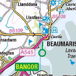
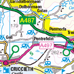
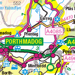
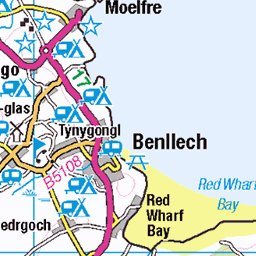
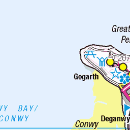
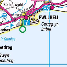
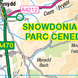
OS Map
This is OS mapping. In some areas, OpenStreetMap shows more footpaths
Spatial NI has online OSNI mapping. Click "Basemap Gallery" (4 squares icon at the top).
Now would be a good time for a cup of tea.

GPX Editor
Record map clicks
Reload map
Photos
Please tag your photos and upload them to the British and Irish Mountains group on Flickr
The other photos have been geo-tagged as on or around the summit. For less busy mountains, it can be a little hit and miss.
IRSE visit to the Ffestiniog and Welsh Highland Railways in May 2024
Views from the train window on the way to Beddgelert station for our next stop.
11-May-24 • craigdonald44 • flickr
irse ffestiniog welsh highland railways institute railway signal engineers 53720695843
IRSE visit to the Ffestiniog and Welsh Highland Railways in May 2024
Views from the train window on the way to Beddgelert station for our next stop.
11-May-24 • craigdonald44 • flickr
irse ffestiniog welsh highland railways institute railway signal engineers 53720823844
IRSE visit to the Ffestiniog and Welsh Highland Railways in May 2024
Views from the train window on the way to Beddgelert station for our next stop.
11-May-24 • craigdonald44 • flickr
irse ffestiniog welsh highland railways institute railway signal engineers 53719581937
IRSE visit to the Ffestiniog and Welsh Highland Railways in May 2024
Views from the train window on the way to Beddgelert station for our next stop.
11-May-24 • craigdonald44 • flickr
irse ffestiniog welsh highland railways institute railway signal engineers 53720919060
IRSE visit to the Ffestiniog and Welsh Highland Railways in May 2024
Views from the train window on the way to Beddgelert station for our next stop.
11-May-24 • craigdonald44 • flickr
irse ffestiniog welsh highland railways institute railway signal engineers 53720823649
IRSE visit to the Ffestiniog and Welsh Highland Railways in May 2024
Views from the train window on the way to Beddgelert station for our next stop.
11-May-24 • craigdonald44 • flickr
irse ffestiniog welsh highland railways institute railway signal engineers 53720695608

49956
Welsh Highland Railway as it travels through Plas-y-Nant in the Snowdonia area of Gwynedd, North Wales. It is the UK's longest heritage railway and runs for 25 miles from Caernarfon where trains start from beneath the castle walls for the journey to Porthmadog. The trains, hauled by the world's most powerful narrow gauge steam locomotives, climb from sea level to over 650ft on the foothills of Snowdon, before zig-zagging dramatically down the steep hillside to reach Beddgelert, nestling in the heart of the National Park, then through the magnificent Aberglaslyn Pass and on to Porthmadog. The original railway closed in 1936 and has now been completely rebuilt by volunteers at a cost of £28 million. With the 25-mile line now complete, together with a new £1.25 million two-platform layout at Harbour Station at Porthmadog (complete with a substantial semaphore signalling installation), it is now possible to connect with the world-famous Ffestiniog Railway and experience 40 unbroken miles of spectacular narrow-gauge steam. The trip though the Aberglaslyn Pass voted the most beautiful place in the UK by members of the National Trust is nothing short of magical and the views of Snowdonia from the wide flatlands of the Traeth Mawr reclaimed from the sea with the building of William Madocks' mile-long Cob embankment 200 years-ago are simply stunning. The railway also has stations at Beddgelert a magical centre of Welsh culture and Pont Croesor, right alongside the RSPB's Glaslyn Osprey Centre, before running through the streets of Porthmadog to connect up with the Ffestiniog Railway, the oldest independent railway company in the world, founded by Act of Parliament in 1832. Information Source: www.greatlittletrainsofwales.co.uk/en/railways/welsh-highland" rel="noreferrer nofollow www.greatlittletrainsofwales.co.uk/en/railways/welsh-high... www.visitwales.com/attraction/train/welsh-highland-railway-518186" rel="noreferrer nofollow www.visitwales.com/attraction/train/welsh-highland-railwa...
wales welsh cymru northwales uk unitedkingdom gb greatbritain britain british snowdonia gwynedd waunfawr snowdonianationalpark village trainstation railwaystation train railway narrowgauge station narrowgaugerailway welshhighlandrailway northwalesnarrowgaugerailways moeltryfanundertaking londonandnorthwesternrailway whheritagegroup anturwaunfawr portmadoccroesorandbeddgelerttramrailway portmadocbeddgelertandsouthsnowdonrailway 53619594237

Foel Gron, Llanberis.
Mountain Craft // www.mountaincraft.co.uk" rel="noreferrer nofollow www.mountaincraft.co.uk - Guided mountain adventures in Snowdonia - Eryri - North Wales. The north facing cliffs of Foel Gron close to Moel Eilio and Llanberis. The rakes and gullies look worth exploring... in the winter!
24-Jun-18 • Mountain Craft • flickr
grass rock moeleilio grassy feature unique handcrafted eryrinationalpark eryri wales mountainwalking adventures hillwalking remote northwales ridge gwynedd heather mountaincraft snowdonia scrambling mountainarea vibe llanberis rib yrwyddfa cliff wild gorse activity snowdon arete rake mountaineering parccenedlaetholeryri exploratory crag mountaincraftcouk craft hiking snowdonianationalpark majorlocations experiences location foelgron gully mountain hikingchallengesuk kidsrockclimbing mountainadventures northwalesactivities snowdonguidedwalks snowdoniaactivities snowdoniatrails thingstodoinbetwsycoed 54189309339

Foel Gron, Llanberis.
Mountain Craft // www.mountaincraft.co.uk" rel="noreferrer nofollow www.mountaincraft.co.uk - Guided mountain adventures in Snowdonia - Eryri - North Wales. The north facing cliffs of Foel Gron close to Moel Eilio and Llanberis. The rakes and gullies look worth exploring... in the winter! I climbed across this grassy rake but a tricky step made me turn back.
24-Jun-18 • Mountain Craft • flickr
grass rock moeleilio grassy feature unique handcrafted eryrinationalpark eryri wales mountainwalking adventures hillwalking remote northwales ridge gwynedd heather mountaincraft snowdonia scrambling mountainarea vibe llanberis rib yrwyddfa cliff wild gorse activity snowdon arete rake mountaineering parccenedlaetholeryri exploratory crag mountaincraftcouk craft hiking snowdonianationalpark majorlocations experiences location foelgron gully mountain hikingchallengesuk kidsrockclimbing mountainadventures northwalesactivities snowdonguidedwalks snowdoniaactivities snowdoniatrails thingstodoinbetwsycoed 54188138162

Foel Gron, Llanberis.
Mountain Craft // www.mountaincraft.co.uk" rel="noreferrer nofollow www.mountaincraft.co.uk - Guided mountain adventures in Snowdonia - Eryri - North Wales. The north facing cliffs of Foel Gron close to Moel Eilio and Llanberis. The rakes and gullies look worth exploring... in the winter! This gully looks like a worthwhile ascent for a good winters day
24-Jun-18 • Mountain Craft • flickr
grass rock moeleilio grassy feature unique handcrafted eryrinationalpark eryri wales mountainwalking adventures hillwalking remote northwales ridge gwynedd heather mountaincraft snowdonia scrambling mountainarea vibe llanberis rib yrwyddfa cliff wild gorse activity snowdon arete rake mountaineering parccenedlaetholeryri exploratory crag mountaincraftcouk craft hiking snowdonianationalpark majorlocations experiences location foelgron gully mountain hikingchallengesuk kidsrockclimbing mountainadventures northwalesactivities snowdonguidedwalks snowdoniaactivities snowdoniatrails thingstodoinbetwsycoed 54188138547
Videos
Very high winds and rain. Low visibility for Moel Eilio to Foel Gorn.
Part 2 of my blisteringly hot Sunday morning in August, where I made my first attempt at climbing these monster mountains in ...
A great day up in the mountains on the fourth and final day of my Snowdonia trip at the end of August 2020. Climbed up Y Garn ...
On August 28th 2020, I attempted my "10 summits challenge" by walking from Capel Curig to Nant Peris, taking in the ten ...
7hrs 30mins, starting at Bryn Du, up Moel Eilio, Foel Goch, Foel Gron, Cynghorion, Snowdon via Ranger path, Clawdd Coch and ...
Notes
- Data: Database of British and Irish Hills v18.2
- Maps: We use OS mapping for England, Scotland, Wales, and the Isle of Man. Sadly, Channel Islands, Northern (OSNI) and Southern Ireland (OSI) mapping isn't available online, so we use Openstreetmap.