Hills of Britain and Ireland
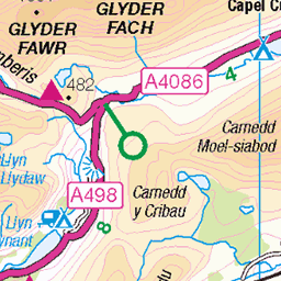
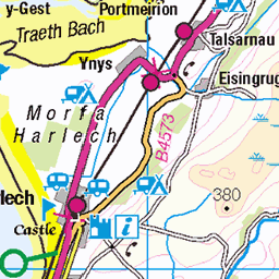
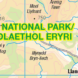
OS Map of Moel Druman
Height: 676m / 2218ft • Prominence: 58m / 190ft • Summit : rocky outcrop N of fence • Trip reports (hill-bagging)

Lots of snow at Rhosydd Quarry
Good hike to get up to Rhosydd Quarry, sketchy on the way down, but well worth it. In places the snow was knee deep here
10-Jan-25 • Jeff Guile • flickr
54264646811


Allt-y-Ceffylau {Hill of the Horse}: this looms high above the north east side of Cwmorthin
I think this is the snow being blown by the high winds
07-Jan-25 • Jeff Guile • flickr
54252766471


Capel y Gorlan (Capel Cwmorthin / Cwmorthin Chapel)
olympus uk photography art m43 river microfourthirds wales kase sky polariser trees tree snowdonia eryri nationalpark cymru grass lightroom photoshop colour mountain mountains green brown autumn cloud om1mkii slate quarry history unesco unescoworldheritage chapel religion industry rock landscape landscapes yellow orange blue purple leadingline footpath 54348839160

Capel y Gorlan (Capel Cwmorthin / Cwmorthin Chapel)
OM1 Mkii, PL 9mm f1.7
olympus uk photography art m43 river microfourthirds wales kase sky polariser trees tree snowdonia eryri nationalpark cymru grass lightroom photoshop colour mountain mountains green brown autumn cloud om1mkii slate quarry history unesco unescoworldheritage chapel religion industry rock landscape landscapes 54226463670
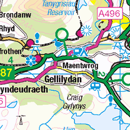
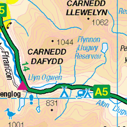
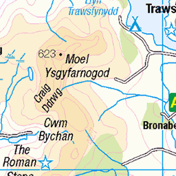
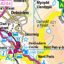
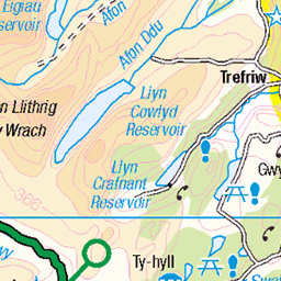
OS Map
This is OS mapping. In some areas, OpenStreetMap shows more footpaths
Spatial NI has online OSNI mapping. Click "Basemap Gallery" (4 squares icon at the top).
Now would be a good time for a cup of tea.


GPX Editor
Record map clicks
Reload map
Photos
Please tag your photos and upload them to the British and Irish Mountains group on Flickr
The other photos have been geo-tagged as on or around the summit. For less busy mountains, it can be a little hit and miss.
Lots of snow at Rhosydd Quarry
Good hike to get up to Rhosydd Quarry, sketchy on the way down, but well worth it. In places the snow was knee deep here
10-Jan-25 • Jeff Guile • flickr
54264646811
Allt-y-Ceffylau {Hill of the Horse}: this looms high above the north east side of Cwmorthin
I think this is the snow being blown by the high winds
07-Jan-25 • Jeff Guile • flickr
54252766471
Capel y Gorlan (Capel Cwmorthin / Cwmorthin Chapel)
olympus uk photography art m43 river microfourthirds wales kase sky polariser trees tree snowdonia eryri nationalpark cymru grass lightroom photoshop colour mountain mountains green brown autumn cloud om1mkii slate quarry history unesco unescoworldheritage chapel religion industry rock landscape landscapes yellow orange blue purple leadingline footpath 54348839160
Capel y Gorlan (Capel Cwmorthin / Cwmorthin Chapel)
OM1 Mkii, PL 9mm f1.7
olympus uk photography art m43 river microfourthirds wales kase sky polariser trees tree snowdonia eryri nationalpark cymru grass lightroom photoshop colour mountain mountains green brown autumn cloud om1mkii slate quarry history unesco unescoworldheritage chapel religion industry rock landscape landscapes 54226463670

Quarrymen’s Chapel
Capel y Gorlan, Cwmorthin slate quarry, near Blaenau Ffestiniog, North Wales.
wales abandoned landscape historic autumn northwales quarry sky drone ruin chapel slate mountain 54222486183


Videos
craignythygigfran to #moeldruman and #llyncongog #tanyfrisiau #cwmorthin.
A two day solo hiking and wild camping trip to the Moelwynion mountains, in Eryri (Snowdonia) National Park in Wales. I explored ...
Mixture of video, timelapse and hyperlapse clips from Bank Holiday Sunday on Allt Fawr and surrounding mountains in ...
The North Eastern Railway 1001 class is one of the more - in my opinion - unique engines in the National Railway Museum's ...
Notes
- Data: Database of British and Irish Hills v18.2
- Maps: We use OS mapping for England, Scotland, Wales, and the Isle of Man. Sadly, Channel Islands, Northern (OSNI) and Southern Ireland (OSI) mapping isn't available online, so we use Openstreetmap.