Hills of Britain and Ireland
OS Map of Scrae Field

Halcrows FJ56YWG
Volvo B12B Plaxton Paragon seen here in Quarff on Monday 11 April 2022
11-Apr-22 • Peter Spasov's Transport Website • flickr
52069041838
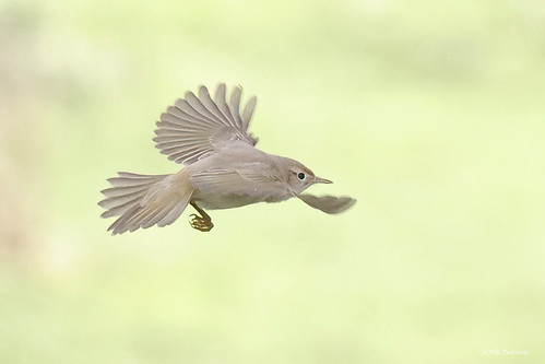
Western Bonelli's Warbler Phylloscopus bonelli
Easter Quarff, Shetland 3rd October 2021
03-Oct-21 • nik.borrow • flickr
bird warbler shetland 51578343120


Quarff
With the Telford designed Church of Scotland.
21-May-20 • Life@60DegreesNorth • flickr
shetland quarff church 49945299148


OS Map
This is OS mapping. In some areas, OpenStreetMap shows more footpaths
Spatial NI has online OSNI mapping. Click "Basemap Gallery" (4 squares icon at the top).
Now would be a good time for a cup of tea.
GPX Editor
Record map clicks
Reload map
Photos
Please tag your photos and upload them to the British and Irish Mountains group on Flickr
The other photos have been geo-tagged as on or around the summit. For less busy mountains, it can be a little hit and miss.
Halcrows FJ56YWG
Volvo B12B Plaxton Paragon seen here in Quarff on Monday 11 April 2022
11-Apr-22 • Peter Spasov's Transport Website • flickr
52069041838
Western Bonelli's Warbler Phylloscopus bonelli
Easter Quarff, Shetland 3rd October 2021
03-Oct-21 • nik.borrow • flickr
bird warbler shetland 51578343120
Quarff
With the Telford designed Church of Scotland.
21-May-20 • Life@60DegreesNorth • flickr
shetland quarff church 49945299148


1539 Scrae Field
A quick bag with Tricky Speirs. Name:Scrae Field Hill number:1539 Height:216m / 709ft Area:22: Shetland Islands Class:Ma Grid ref:HU 41789 36136 Summit feature:trig point Drop:178m Col:38m HU425352
31-May-13 • Dugswell2 • flickr
field marilyn trig shetlandislands scrae p178 9118325058

1539 Scrae Field 1
Name:Scrae Field Hill number:1539 Height:216m / 709ft Area:22: Shetland Islands Class:Ma Grid ref:HU 41789 36136 Summit feature:trig point Drop:178m Col:38m HU425352
31-May-13 • Dugswell2 • flickr
marilyn trig shetlandislands p178 scraefield 9118332512
Videos
None found
Notes
- Data: Database of British and Irish Hills v18.2
- Maps: We use OS mapping for England, Scotland, Wales, and the Isle of Man. Sadly, Channel Islands, Northern (OSNI) and Southern Ireland (OSI) mapping isn't available online, so we use Openstreetmap.