Hills of Britain and Ireland
OS Map of Da Noup (The Noup)
Height: 248m / 814ft • Prominence: 179m / 587ft • Summit : no feature: grass • Trip reports (hill-bagging)

Da Noup - Foula
Foula (Old Norse Fuglaey, "bird island", compare Norwegian Fugløy, "fowl island", Gaelic Fughlaigh) in the Shetland Islands of Scotland, is one of Great Britain's most remote permanently inhabited islands. Owned since the turn of the 20th century by the Holbourn family, the island was the location for the film The Edge of the World. RMS Oceanic was wrecked on the nearby Shaalds of Foula. Geography: Foula is a bleak yet spectacular island in the Atlantic Ocean, 20 miles west of Walls in Shetland. The island is about 2.5 miles (4.0 km) by 3.5 miles (5.6 km), with a low-lying coastal strip along the east side. With an area of 4.9 square miles (12.7 km2), it is the seventh largest and most westerly of the Shetland Islands. It rises from low broken cliffs in the east to precipitous 150 to 365m cliffs on the west. The island has five peaks, rising to 418m (1371 feet) at the Sneug and 376m (1220 feet) at the Kame. At the north end is Gaada Stack, a natural arch. Foula lies on the same latitude as Saint Petersburg. Foula has a population of 38 people, living in Hametown and Ham. Islanders previously made a living from fishing - first for Whitefish, then lobster. Today, most islanders are crofters with income from sheep farming and ornithological tourism. A hidden reef, the 'Hoevdi Grund' or the Shaalds o' Foula, lies just over 3 kilometres (1.9 mi) east of Foula between the island and the Shetland mainland. Tides here can reach 12 knots (22 km/h) and as the reef comes to within a few feet of the surface, it poses a significant threat to shipping. Transport: Ferries sail from Ham to Walls and Scalloway on the Shetland Mainland, and flights head from Foula's airstrip to Tingwall Airport. There is little shelter for boats on the island. The only beach is at the head of Ham Voe on the east coast. Local boats, including the mail boat, are hauled out of the water. Wildlife: The island's 370-metre-high (1200 ft) cliffs are home to numerous birds, including Arctic terns, red-throated divers and great skuas. Prehistory: Foula was first inhabited as far back as 5000 years ago.[10] Between 2006-2008, the Bath & Camerton Archeological Society took several trips to Foula to study prehistoric standing stones. A particular sub-circular stone circle of interest was discovered in 2006 at Da Heights on the north of Foula. A further investigation launched in 2007 revealed that the sub-circular stone construction was man-made, elliptical in shape with the axis pointing towards the mid-winter solstice, built before 1000 BCE. 15th to 19th centuries: In 1490, the Ciske family's estates were divided and Vaila and Foula became the property of Alv Knutsson. However, the Ciskes were Norwegian, and as Scotland had annexed Shetland a few decades before, there were confusing and conflicting claims of ownership. Foula remained on the Julian calendar when the rest of the Kingdom of Great Britain adopted the Gregorian calendar in 1752. Foula adhered to the Julian calendar by keeping 1800 as a leap year, but it did not observe a leap year in 1900. As a result, Foula is now one day ahead of the Julian calendar and 12 days behind the Gregorian, observing Christmas Day on 6 January Gregorian and New Year on 13 January Gregorian. In 1720, a smallpox epidemic struck the two hundred people living on Foula. Because the islanders were so isolated from the rest of the world, they had no immunity to smallpox, unlike most North European peoples at that time, and nine out of ten of the island's population died in the epidemic. The writer and journalist John Sands lived on Foula and Papa Stour for a while during the late 19th century. He fought hard against the prevailing truck system and drew political cartoons lampooning its deficiencies. In one, he drew Foula as a beautiful young woman being strangled by a boa-constrictor labelled 'landlordism' watched by other reptiles called 'missionary', 'laird' and 'truck'. The island was one of the last places where the Norn language was spoken (although it is claimed that Walter Sutherland of Skaw on Unst was the last speaker), and the local dialect is strongly influenced by Old Norse. 20th century: Professor Ian S. Holbourn, the last Laird of Foula, describes the disaster of 8 September 1914, when the White Star Line RMS Oceanic hit the Shaalds o' Foula, becoming a wreck within two weeks. Holbourn's remarkable luck with steamship travel held through the following May, when he embarked upon the RMS Lusitania. The professor's grandson, Robert Holbourn, a Naval architect, acted as the island's "Peet Marshal" for many years. Peat is valuable and scarce resource for heat and fuel in Shetland. Its cutting requires skill, taking several years to master. The most able islanders become known as the 'Cutters' and, in the spirit of a long-standing Foula tradition, all able-bodied men are now and then 'bid to the banks' of women who 'didn't have a cutter in the house.' Simon Martin, who stayed on the Isle of Foula for five years during his prolonged claim upon the wrecked Oceanic, describes the island as follows: "Foula, or Ultima Thule, as it was known as far back as the Roman times, rises impurely out of the water, and from the Shetland Isles mainland its five peaks, the Noup, Hamnafield, the Sneug, Kame and Soberlie stand out starkly and characteristically. The cliffs on the west side vie with those of St Kilda as the highest sheer cliffs in Britain, 1,200-foot (370 m) of solid rock towering from the sea. "Foula, or Fughley as it was once also known, means literally 'Bird Island', with an estimated half million birds of various breeds sharing the rock with the inhabitants. The island's surface largely consisting of a peat bog on rock." A lighthouse at the southern tip of the island was built in 1986. Originally powered by acetylene gas, it has been converted to solar and wind power. (source Wikipedia) Canon 70D Canon EF-S 17-55mm f2.8 IS USM at 17 mm ISO 200 f/6,3 1/320 sec Aperture priority +1/3 EV
22-Jun-15 • Kees Waterlander • flickr
uk scotland sandstone shetland foula oldred danoup 19214611843

Shaggy testosterone
Foula is home to a most traditional strain of the Shetland Sheep. Canon 70D Canon EF100-400 mm f/4.5-5.6L IS USM at 400 mm ISO 800, 1/640 sec., f/7,1 Aperture priority 2/3 EV
22-Jun-15 • Kees Waterlander • flickr
verenigdkoninkrijk shetland greatbritain grootbrittannië uk scotland unitedkingdom gb 38606178956

Curlew / Wulp
Numenius arquata Canon 70D Canon EF100-400 mm f/4.5-5.6L IS USM at 400 mm ISO 800, 1/1600 sec., f/7,1 Aperture priority 1/3 EV
22-Jun-15 • Kees Waterlander • flickr
scotland unitedkingdom gb shetland curlew foula wulp numeniusarquata 19642146090

Curlew / Wulp
Numenius arquata Canon 70D Canon EF100-400 mm f/4.5-5.6L IS USM at 400 mm ISO 800, 1/1000 sec., f/7,1 Aperture priority 1/3 EV
22-Jun-15 • Kees Waterlander • flickr
birds scotland unitedkingdom vogels gb shetland schotland curlew foula wulp numeniusarquata 21286045748

Sneck o da Smaalie, Foula
Sneck o da Smaalie, Foula DSC_6639
31-Aug-14 • Ross Mackenzie • flickr
2014 d700 shetlandaugust2014 islandsaugust2014 foulaaugust2014 14960159857
![1536 The Noup [Da Noup]](https://live.staticflickr.com/2845/9100544508_f7e171bfa2.jpg)
1536 The Noup [Da Noup]
28-May-13 • Dugswell2 • flickr
marilyn foula shetlandislands p179 9100544508
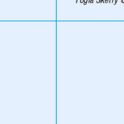
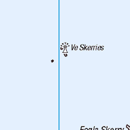
OS Map
This is OS mapping. In some areas, OpenStreetMap shows more footpaths
Spatial NI has online OSNI mapping. Click "Basemap Gallery" (4 squares icon at the top).
Now would be a good time for a cup of tea.


GPX Editor
Record map clicks
Reload map
Photos
Please tag your photos and upload them to the British and Irish Mountains group on Flickr
The other photos have been geo-tagged as on or around the summit. For less busy mountains, it can be a little hit and miss.
Da Noup - Foula
Foula (Old Norse Fuglaey, "bird island", compare Norwegian Fugløy, "fowl island", Gaelic Fughlaigh) in the Shetland Islands of Scotland, is one of Great Britain's most remote permanently inhabited islands. Owned since the turn of the 20th century by the Holbourn family, the island was the location for the film The Edge of the World. RMS Oceanic was wrecked on the nearby Shaalds of Foula. Geography: Foula is a bleak yet spectacular island in the Atlantic Ocean, 20 miles west of Walls in Shetland. The island is about 2.5 miles (4.0 km) by 3.5 miles (5.6 km), with a low-lying coastal strip along the east side. With an area of 4.9 square miles (12.7 km2), it is the seventh largest and most westerly of the Shetland Islands. It rises from low broken cliffs in the east to precipitous 150 to 365m cliffs on the west. The island has five peaks, rising to 418m (1371 feet) at the Sneug and 376m (1220 feet) at the Kame. At the north end is Gaada Stack, a natural arch. Foula lies on the same latitude as Saint Petersburg. Foula has a population of 38 people, living in Hametown and Ham. Islanders previously made a living from fishing - first for Whitefish, then lobster. Today, most islanders are crofters with income from sheep farming and ornithological tourism. A hidden reef, the 'Hoevdi Grund' or the Shaalds o' Foula, lies just over 3 kilometres (1.9 mi) east of Foula between the island and the Shetland mainland. Tides here can reach 12 knots (22 km/h) and as the reef comes to within a few feet of the surface, it poses a significant threat to shipping. Transport: Ferries sail from Ham to Walls and Scalloway on the Shetland Mainland, and flights head from Foula's airstrip to Tingwall Airport. There is little shelter for boats on the island. The only beach is at the head of Ham Voe on the east coast. Local boats, including the mail boat, are hauled out of the water. Wildlife: The island's 370-metre-high (1200 ft) cliffs are home to numerous birds, including Arctic terns, red-throated divers and great skuas. Prehistory: Foula was first inhabited as far back as 5000 years ago.[10] Between 2006-2008, the Bath & Camerton Archeological Society took several trips to Foula to study prehistoric standing stones. A particular sub-circular stone circle of interest was discovered in 2006 at Da Heights on the north of Foula. A further investigation launched in 2007 revealed that the sub-circular stone construction was man-made, elliptical in shape with the axis pointing towards the mid-winter solstice, built before 1000 BCE. 15th to 19th centuries: In 1490, the Ciske family's estates were divided and Vaila and Foula became the property of Alv Knutsson. However, the Ciskes were Norwegian, and as Scotland had annexed Shetland a few decades before, there were confusing and conflicting claims of ownership. Foula remained on the Julian calendar when the rest of the Kingdom of Great Britain adopted the Gregorian calendar in 1752. Foula adhered to the Julian calendar by keeping 1800 as a leap year, but it did not observe a leap year in 1900. As a result, Foula is now one day ahead of the Julian calendar and 12 days behind the Gregorian, observing Christmas Day on 6 January Gregorian and New Year on 13 January Gregorian. In 1720, a smallpox epidemic struck the two hundred people living on Foula. Because the islanders were so isolated from the rest of the world, they had no immunity to smallpox, unlike most North European peoples at that time, and nine out of ten of the island's population died in the epidemic. The writer and journalist John Sands lived on Foula and Papa Stour for a while during the late 19th century. He fought hard against the prevailing truck system and drew political cartoons lampooning its deficiencies. In one, he drew Foula as a beautiful young woman being strangled by a boa-constrictor labelled 'landlordism' watched by other reptiles called 'missionary', 'laird' and 'truck'. The island was one of the last places where the Norn language was spoken (although it is claimed that Walter Sutherland of Skaw on Unst was the last speaker), and the local dialect is strongly influenced by Old Norse. 20th century: Professor Ian S. Holbourn, the last Laird of Foula, describes the disaster of 8 September 1914, when the White Star Line RMS Oceanic hit the Shaalds o' Foula, becoming a wreck within two weeks. Holbourn's remarkable luck with steamship travel held through the following May, when he embarked upon the RMS Lusitania. The professor's grandson, Robert Holbourn, a Naval architect, acted as the island's "Peet Marshal" for many years. Peat is valuable and scarce resource for heat and fuel in Shetland. Its cutting requires skill, taking several years to master. The most able islanders become known as the 'Cutters' and, in the spirit of a long-standing Foula tradition, all able-bodied men are now and then 'bid to the banks' of women who 'didn't have a cutter in the house.' Simon Martin, who stayed on the Isle of Foula for five years during his prolonged claim upon the wrecked Oceanic, describes the island as follows: "Foula, or Ultima Thule, as it was known as far back as the Roman times, rises impurely out of the water, and from the Shetland Isles mainland its five peaks, the Noup, Hamnafield, the Sneug, Kame and Soberlie stand out starkly and characteristically. The cliffs on the west side vie with those of St Kilda as the highest sheer cliffs in Britain, 1,200-foot (370 m) of solid rock towering from the sea. "Foula, or Fughley as it was once also known, means literally 'Bird Island', with an estimated half million birds of various breeds sharing the rock with the inhabitants. The island's surface largely consisting of a peat bog on rock." A lighthouse at the southern tip of the island was built in 1986. Originally powered by acetylene gas, it has been converted to solar and wind power. (source Wikipedia) Canon 70D Canon EF-S 17-55mm f2.8 IS USM at 17 mm ISO 200 f/6,3 1/320 sec Aperture priority +1/3 EV
22-Jun-15 • Kees Waterlander • flickr
uk scotland sandstone shetland foula oldred danoup 19214611843
Shaggy testosterone
Foula is home to a most traditional strain of the Shetland Sheep. Canon 70D Canon EF100-400 mm f/4.5-5.6L IS USM at 400 mm ISO 800, 1/640 sec., f/7,1 Aperture priority 2/3 EV
22-Jun-15 • Kees Waterlander • flickr
verenigdkoninkrijk shetland greatbritain grootbrittannië uk scotland unitedkingdom gb 38606178956
Curlew / Wulp
Numenius arquata Canon 70D Canon EF100-400 mm f/4.5-5.6L IS USM at 400 mm ISO 800, 1/1600 sec., f/7,1 Aperture priority 1/3 EV
22-Jun-15 • Kees Waterlander • flickr
scotland unitedkingdom gb shetland curlew foula wulp numeniusarquata 19642146090
Curlew / Wulp
Numenius arquata Canon 70D Canon EF100-400 mm f/4.5-5.6L IS USM at 400 mm ISO 800, 1/1000 sec., f/7,1 Aperture priority 1/3 EV
22-Jun-15 • Kees Waterlander • flickr
birds scotland unitedkingdom vogels gb shetland schotland curlew foula wulp numeniusarquata 21286045748
Sneck o da Smaalie, Foula
Sneck o da Smaalie, Foula DSC_6639
31-Aug-14 • Ross Mackenzie • flickr
2014 d700 shetlandaugust2014 islandsaugust2014 foulaaugust2014 14960159857
1536 The Noup [Da Noup]
28-May-13 • Dugswell2 • flickr
marilyn foula shetlandislands p179 9100544508
![1536 The Noup [Da Noup] 1](https://live.staticflickr.com/5482/9100551362_74fd7764c7.jpg)
1536 The Noup [Da Noup] 1
First hill of the day with Tricky Speirs after a flight from Tingwall. View towards a cloud covered The Sneug [Da Sneug). Name:The Noup [Da Noup] Hill number:1536 Height:248m / 814ft Area:22: Shetland Islands Class:Ma Grid ref: HT 95445 37514 Summit feature:no feature: grass Drop:179m Col:69m HT951380
28-May-13 • Dugswell2 • flickr
marilyn foula shetlandislands p179 thenoupdanoup 9100551362
![1536 The Noup [Da Noup] 2](https://live.staticflickr.com/7384/9098313601_41862355a0.jpg)
1536 The Noup [Da Noup] 2
First hill of the day with Tricky Speirs after a flight from Tingwall. View towards a cloud covered The Sneug [Da Sneug).
28-May-13 • Dugswell2 • flickr
marilyn foula shetlandislands thenoupdanoup 9098313601

Foula from the Air
Olympus OM4, Ektachrome EB100, original slide photographed on a light pad with a 12mm extension tube, tethered capture and digital development in Lightroom. Foula is an outlying island of the Shetlands, in the Atlantic Ocean 30km or so west of the main group; it measures roughly 4km by 6km, and has magnificent seabird cliffs culminating in the Kame of Foula (376m). en.wikipedia.org/wiki/Foula" rel="noreferrer nofollow en.wikipedia.org/wiki/Foula
18-Jul-94 • Ed Fulton • flickr
atlanticocean brittennormanbn2islander eb100 ektachrome foasdz film foula gbedz inflight lightpaddigitised loganair olympusom4 scotland shetland uk unitedkingdom eb 51888429141

Puffin watching
Olympus OM2, Fuji Reala 100, negative scan, digital development in Lightroom. Atlantic Puffins Fratercula arctica are wonderful birds, watching them is pure relaxation (unless you are trying to take photographs of them . . . ). Never disturb, sit down quietly and enjoy. Foula is an outlying island of the Shetlands, in the Atlantic Ocean 30km or so west of the main group; it measures roughly 4km by 6km, and has magnificent seabird cliffs culminating in the Kame of Foula (376m). en.wikipedia.org/wiki/Foula" rel="noreferrer nofollow en.wikipedia.org/wiki/Foula en.wikipedia.org/wiki/Atlantic_puffin" rel="noreferrer nofollow en.wikipedia.org/wiki/Atlantic_puffin
17-Jul-94 • Ed Fulton • flickr
atlanticocean atlanticpuffin film foula fraterculaarctica fujireala100 jeni olympus olympusom2 scotland shetland uk unitedkingdom 51878465831

Foula
Olympus OM4, Ektachrome EB100, original slide photographed on a light pad with a 12mm extension tube, tethered capture and digital development in Lightroom. Foula is an outlying island of the Shetlands, in the Atlantic Ocean 30km or so west of the main group; it measures roughly 4km by 6km, and has magnificent seabird cliffs culminating in the Kame of Foula (376m). en.wikipedia.org/wiki/Foula" rel="noreferrer nofollow en.wikipedia.org/wiki/Foula
17-Jul-94 • Ed Fulton • flickr
atlanticocean eb100 ektachrome film foula lightpaddigitised olympusom4 scotland shetland uk unitedkingdom eb 51880775201

Foula
Olympus OM4, Olympus OM G.Zuiko Auto-W 21mm f/3.5, Ektachrome EB100, original slide photographed on a light pad with a 12mm extension tube, tethered capture and digital development in Lightroom. Foula is an outlying island of the Shetlands, in the Atlantic Ocean 30km or so west of the main group; it measures roughly 4km by 6km, and has magnificent seabird cliffs culminating in the Kame of Foula (376m). en.wikipedia.org/wiki/Foula" rel="noreferrer nofollow en.wikipedia.org/wiki/Foula
17-Jul-94 • Ed Fulton • flickr
atlanticocean eb100 ektachrome film foula lightpaddigitised olympusomgzuikoautow21mmf35 olympusom4 scotland shetland uk unitedkingdom eb 51881429345

Bonxie attack!
Olympus OM2, Fuji Reala 100, negative scan, digital development in Lightroom. A view of the main settlement of Foula from the hill above; a Great Skua Stercorarius skua (locally known as a Bonxie) is lining up to attack me, although we were well away from the nesting area some distance below. Foula is an outlying island of the Shetlands, in the Atlantic Ocean 30km or so west of the main group; it measures roughly 4km by 6km, and has magnificent seabird cliffs culminating in the Kame of Foula (376m). en.wikipedia.org/wiki/Foula" rel="noreferrer nofollow en.wikipedia.org/wiki/Foula en.wikipedia.org/wiki/Great_skua" rel="noreferrer nofollow en.wikipedia.org/wiki/Great_skua
16-Jul-94 • Ed Fulton • flickr
atlanticocean bonxie film foula fujireala100 greatskua olympus olympusom2 scotland shetland stercorariusskua uk unitedkingdom 51879109845
Videos
None found
Notes
- Data: Database of British and Irish Hills v18.2
- Maps: We use OS mapping for England, Scotland, Wales, and the Isle of Man. Sadly, Channel Islands, Northern (OSNI) and Southern Ireland (OSI) mapping isn't available online, so we use Openstreetmap.