Hills of Britain and Ireland
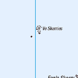
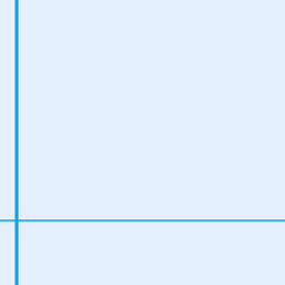
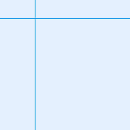
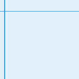
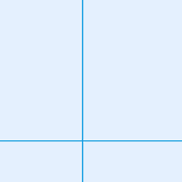
OS Map of Da Sneug (The Sneug)
Height: 418m / 1371ft • Prominence: 418m / 1371ft • Summit : no feature: ground by stone lined depression • Trip reports (hill-bagging)

Fulmar / Noordse stormvogel
Fulmarus glacialis Canon 70D Canon EF100-400 mm f/4.5-5.6L IS USM at 400 mm ISO 800, 1/800 sec., f/6,3 Aperture priority 0 EV
21-Jun-15 • Kees Waterlander • flickr
scotland unitedkingdom gb fulmar shetland foula fulmarusglacialis noordsestormvogel 19648806278
![1528 The Sneug [Da Sneug]](https://live.staticflickr.com/7437/9100698764_094e21a02d.jpg)
1528 The Sneug [Da Sneug]
Flight with Tricky Speirs to bag the TuMPs and grid squares on a lovely day for May. Summit is 10m NE of trig point and 30cm higher. Name:The Sneug [Da Sneug] Hill number:1528 Height:418m / 1371ft Area:22: Shetland Islands Class:Ma Grid ref:HT 94784 39501 Summit feature:no feature: ground by stone lined depression Drop:418m Col:Sea
28-May-13 • Dugswell2 • flickr
marilyn foula shetlandislands p418 thesneugdasneug 9100698764

Puffin watching
Olympus OM2, Fuji Reala 100, negative scan, digital development in Lightroom. Atlantic Puffins Fratercula arctica are wonderful birds, watching them is pure relaxation (unless you are trying to take photographs of them . . . ). Never disturb, sit down quietly and enjoy. Foula is an outlying island of the Shetlands, in the Atlantic Ocean 30km or so west of the main group; it measures roughly 4km by 6km, and has magnificent seabird cliffs culminating in the Kame of Foula (376m). en.wikipedia.org/wiki/Foula" rel="noreferrer nofollow en.wikipedia.org/wiki/Foula en.wikipedia.org/wiki/Atlantic_puffin" rel="noreferrer nofollow en.wikipedia.org/wiki/Atlantic_puffin
17-Jul-94 • Ed Fulton • flickr
atlanticocean atlanticpuffin film foula fraterculaarctica fujireala100 jeni olympus olympusom2 scotland shetland uk unitedkingdom 51878465831

The Kame of Foula from the Ocean
Olympus OM4, Ektachrome EB100, original slide photographed on a light pad with a 12mm extension tube, tethered capture and digital development in Lightroom. Foula is an outlying island of the Shetlands, in the Atlantic Ocean 30km or so west of the main group; it measures roughly 4km by 6km, and has magnificent seabird cliffs culminating in the Kame of Foula (376m). en.wikipedia.org/wiki/Foula" rel="noreferrer nofollow en.wikipedia.org/wiki/Foula
17-Jul-94 • Ed Fulton • flickr
atlanticocean eb100 ektachrome film foula lightpaddigitised olympusom4 scotland shetland uk unitedkingdom eb 51881842762

The Kame of Foula from the Ocean
Olympus OM4, Ektachrome EB100, original slide photographed on a light pad with a 12mm extension tube, tethered capture and digital development in Lightroom. Foula is an outlying island of the Shetlands, in the Atlantic Ocean 30km or so west of the main group; it measures roughly 4km by 6km, and has magnificent seabird cliffs culminating in the Kame of Foula (376m). en.wikipedia.org/wiki/Foula" rel="noreferrer nofollow en.wikipedia.org/wiki/Foula
17-Jul-94 • Ed Fulton • flickr
atlanticocean boattrip eb100 ektachrome film foula lightpaddigitised olympusom4 scotland shetland uk unitedkingdom eb 51885437420

The Kame of Foula - looking up
Olympus OM4, Ektachrome EB100, original slide photographed on a light pad with a 12mm extension tube, tethered capture and digital development in Lightroom. Foula is an outlying island of the Shetlands, in the Atlantic Ocean 30km or so west of the main group; it measures roughly 4km by 6km, and has magnificent seabird cliffs culminating in the Kame of Foula (376m). en.wikipedia.org/wiki/Foula" rel="noreferrer nofollow en.wikipedia.org/wiki/Foula
17-Jul-94 • Ed Fulton • flickr
eb100 ektachrome film foula lightpaddigitised olympusom4 scotland shetland uk boattrip unitedkingdom eb 51887263310
OS Map
This is OS mapping. In some areas, OpenStreetMap shows more footpaths
Spatial NI has online OSNI mapping. Click "Basemap Gallery" (4 squares icon at the top).
Now would be a good time for a cup of tea.


GPX Editor
Record map clicks
Reload map
Photos
Please tag your photos and upload them to the British and Irish Mountains group on Flickr
The other photos have been geo-tagged as on or around the summit. For less busy mountains, it can be a little hit and miss.
Fulmar / Noordse stormvogel
Fulmarus glacialis Canon 70D Canon EF100-400 mm f/4.5-5.6L IS USM at 400 mm ISO 800, 1/800 sec., f/6,3 Aperture priority 0 EV
21-Jun-15 • Kees Waterlander • flickr
scotland unitedkingdom gb fulmar shetland foula fulmarusglacialis noordsestormvogel 19648806278
1528 The Sneug [Da Sneug]
Flight with Tricky Speirs to bag the TuMPs and grid squares on a lovely day for May. Summit is 10m NE of trig point and 30cm higher. Name:The Sneug [Da Sneug] Hill number:1528 Height:418m / 1371ft Area:22: Shetland Islands Class:Ma Grid ref:HT 94784 39501 Summit feature:no feature: ground by stone lined depression Drop:418m Col:Sea
28-May-13 • Dugswell2 • flickr
marilyn foula shetlandislands p418 thesneugdasneug 9100698764
Puffin watching
Olympus OM2, Fuji Reala 100, negative scan, digital development in Lightroom. Atlantic Puffins Fratercula arctica are wonderful birds, watching them is pure relaxation (unless you are trying to take photographs of them . . . ). Never disturb, sit down quietly and enjoy. Foula is an outlying island of the Shetlands, in the Atlantic Ocean 30km or so west of the main group; it measures roughly 4km by 6km, and has magnificent seabird cliffs culminating in the Kame of Foula (376m). en.wikipedia.org/wiki/Foula" rel="noreferrer nofollow en.wikipedia.org/wiki/Foula en.wikipedia.org/wiki/Atlantic_puffin" rel="noreferrer nofollow en.wikipedia.org/wiki/Atlantic_puffin
17-Jul-94 • Ed Fulton • flickr
atlanticocean atlanticpuffin film foula fraterculaarctica fujireala100 jeni olympus olympusom2 scotland shetland uk unitedkingdom 51878465831
The Kame of Foula from the Ocean
Olympus OM4, Ektachrome EB100, original slide photographed on a light pad with a 12mm extension tube, tethered capture and digital development in Lightroom. Foula is an outlying island of the Shetlands, in the Atlantic Ocean 30km or so west of the main group; it measures roughly 4km by 6km, and has magnificent seabird cliffs culminating in the Kame of Foula (376m). en.wikipedia.org/wiki/Foula" rel="noreferrer nofollow en.wikipedia.org/wiki/Foula
17-Jul-94 • Ed Fulton • flickr
atlanticocean eb100 ektachrome film foula lightpaddigitised olympusom4 scotland shetland uk unitedkingdom eb 51881842762
The Kame of Foula from the Ocean
Olympus OM4, Ektachrome EB100, original slide photographed on a light pad with a 12mm extension tube, tethered capture and digital development in Lightroom. Foula is an outlying island of the Shetlands, in the Atlantic Ocean 30km or so west of the main group; it measures roughly 4km by 6km, and has magnificent seabird cliffs culminating in the Kame of Foula (376m). en.wikipedia.org/wiki/Foula" rel="noreferrer nofollow en.wikipedia.org/wiki/Foula
17-Jul-94 • Ed Fulton • flickr
atlanticocean boattrip eb100 ektachrome film foula lightpaddigitised olympusom4 scotland shetland uk unitedkingdom eb 51885437420
The Kame of Foula - looking up
Olympus OM4, Ektachrome EB100, original slide photographed on a light pad with a 12mm extension tube, tethered capture and digital development in Lightroom. Foula is an outlying island of the Shetlands, in the Atlantic Ocean 30km or so west of the main group; it measures roughly 4km by 6km, and has magnificent seabird cliffs culminating in the Kame of Foula (376m). en.wikipedia.org/wiki/Foula" rel="noreferrer nofollow en.wikipedia.org/wiki/Foula
17-Jul-94 • Ed Fulton • flickr
eb100 ektachrome film foula lightpaddigitised olympusom4 scotland shetland uk boattrip unitedkingdom eb 51887263310

Heading back to the harbour
Olympus OM4, Ektachrome EB100, original slide photographed on a light pad with a 12mm extension tube, tethered capture and digital development in Lightroom. I have tried to remove dust spots, what remain I think are images of birds. Foula is an outlying island of the Shetlands, in the Atlantic Ocean 30km or so west of the main group; it measures roughly 4km by 6km, and has magnificent seabird cliffs culminating in the Kame of Foula (376m). en.wikipedia.org/wiki/Foula" rel="noreferrer nofollow en.wikipedia.org/wiki/Foula
17-Jul-94 • Ed Fulton • flickr
atlanticocean eb100 ektachrome film foula lightpaddigitised olympusom4 scotland shetland uk boattrip jeni unitedkingdom eb 51886686543

Along the edge of the Kame of Foula
Olympus OM4, Ektachrome 100HC, original slide photographed on a light pad with a 12mm extension tube, tethered capture and digital development in Lightroom. Foula is an outlying island of the Shetlands, in the Atlantic Ocean 30km or so west of the main group; it measures roughly 4km by 6km, and has magnificent seabird cliffs culminating in the Kame of Foula (376m).
16-Jul-94 • Ed Fulton • flickr
100hc atlanticocean ektachrome film foula fulmarusglacialis kodak5009 lightpaddigitised northernfulmar olympusom4 scotland shetland uk sheep unitedkingdom 51875604577

Along the edge of the Kame of Foula
Olympus OM4, Ektachrome 100HC, original slide photographed on a light pad with a 12mm extension tube, tethered capture and digital development in Lightroom. Foula is an outlying island of the Shetlands, in the Atlantic Ocean 30km or so west of the main group; it measures roughly 4km by 6km, and has magnificent seabird cliffs culminating in the Kame of Foula (376m).
16-Jul-94 • Ed Fulton • flickr
100hc atlanticocean ektachrome film foula fulmarusglacialis kodak5009 lightpaddigitised northernfulmar olympusom4 scotland shetland uk unitedkingdom 51876885809

Along the edge of the Kame of Foula
Olympus OM4, Ektachrome 100HC, original slide photographed on a light pad with a 12mm extension tube, tethered capture and digital development in Lightroom. Foula is an outlying island of the Shetlands, in the Atlantic Ocean 30km or so west of the main group; it measures roughly 4km by 6km, and has magnificent seabird cliffs culminating in the Kame of Foula (376m).
16-Jul-94 • Ed Fulton • flickr
100hc atlanticocean ektachrome film foula fulmarusglacialis kodak5009 lightpaddigitised northernfulmar olympusom4 scotland shetland uk unitedkingdom 51875600522

Shetland Ponies on Foula (and a Great Skua)
Olympus OM4, Ektachrome 100HC, original slide photographed on a light pad with a 12mm extension tube, tethered capture and digital development in Lightroom. The Great Skua Stercorarius skua is locally known as a Bonxie. Foula is an outlying island of the Shetlands, in the Atlantic Ocean 30km or so west of the main group; it measures roughly 4km by 6km, and has magnificent seabird cliffs culminating in the Kame of Foula (376m). en.wikipedia.org/wiki/Foula" rel="noreferrer nofollow en.wikipedia.org/wiki/Foula
16-Jul-94 • Ed Fulton • flickr
100hc bonxie ektachrome film foula greatskua kodak5009 lightpaddigitised olympusom4 scotland shetland stercorariusskua uk ponies unitedkingdom 51878468596
Videos
None found
Notes
- Data: Database of British and Irish Hills v18.2
- Maps: We use OS mapping for England, Scotland, Wales, and the Isle of Man. Sadly, Channel Islands, Northern (OSNI) and Southern Ireland (OSI) mapping isn't available online, so we use Openstreetmap.