Hills of Britain and Ireland
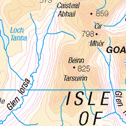
OS Map of Tighvein
Height: 458m / 1503ft • Prominence: 183m / 600ft • Summit : rock 1m NE of trig point • Trip reports (hill-bagging)

Freya
At Urie Loch swimming and having a picnic
25-Jul-21 • cams-not-in-lux • flickr
people campbell isleofarran freya uk family scotland places urieloch 51335833556

Hiking to Urie Loch
25-Jul-21 • cams-not-in-lux • flickr
campbell freya isleofarran people places scotland uk urieloch family 51336050198

Carn Ban chambered cairn, Isle of Arran, Ayrshire photographed c.1993.
This is a huge pile of stones built on the lip of a steep hillside. Secondary cists can be seen, but little of the original chambered cairn.
11-Mar-21 • hercon2000uk. • flickr
51028600266

Carn Ban chambered cairn, Isle of Arran, Ayrshire photographed c.1993.
Here is one of the exposed chambers to the main cairn, little of the original capstones and mound being in place. An interesting site, but not for the novice archaeologist or sightseer.
11-Mar-21 • hercon2000uk. • flickr
51028699322

Carn Ban, Isle of Arran, Ayrshire photographed c.1993.
This is the soutern end of the chambered cairn, a vast pile of loose stones cascading down the hill. The setting is on a steep slope within forestry, a long walk in being neccessary if you wish to view the site.
11-Mar-21 • hercon2000uk. • flickr
51028699622

Carn Ban neolithic chambered tomb, Isle of Arran, Ayrshire, photographed c. 1993.
This pile of stones contains a number of secondary cists, but the main chamered part is now sadly very displaced and hard to make out. Located high up in the hills in the south part of the island, the forestry gives it an added sullen feel. It's an unusual setting, clinging to the steep hillside.
11-Mar-21 • hercon2000uk. • flickr
51027874343
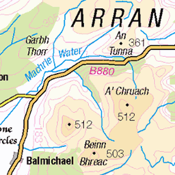
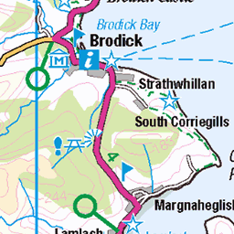
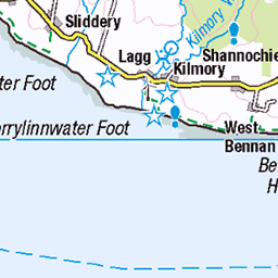
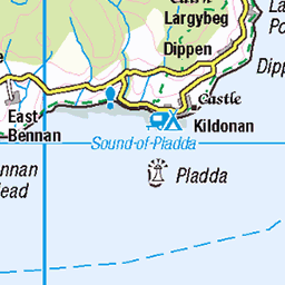
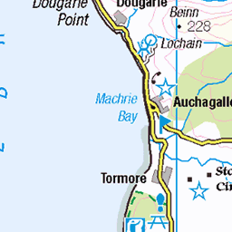
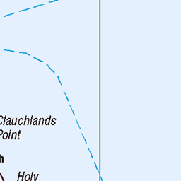
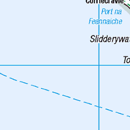
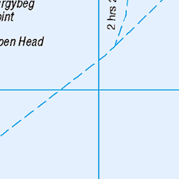
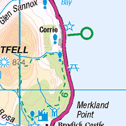
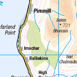
OS Map
This is OS mapping. In some areas, OpenStreetMap shows more footpaths
Spatial NI has online OSNI mapping. Click "Basemap Gallery" (4 squares icon at the top).
Now would be a good time for a cup of tea.


GPX Editor
Record map clicks
Reload map
Photos
Please tag your photos and upload them to the British and Irish Mountains group on Flickr
The other photos have been geo-tagged as on or around the summit. For less busy mountains, it can be a little hit and miss.
Freya
At Urie Loch swimming and having a picnic
25-Jul-21 • cams-not-in-lux • flickr
people campbell isleofarran freya uk family scotland places urieloch 51335833556
Hiking to Urie Loch
25-Jul-21 • cams-not-in-lux • flickr
campbell freya isleofarran people places scotland uk urieloch family 51336050198
Carn Ban chambered cairn, Isle of Arran, Ayrshire photographed c.1993.
This is a huge pile of stones built on the lip of a steep hillside. Secondary cists can be seen, but little of the original chambered cairn.
11-Mar-21 • hercon2000uk. • flickr
51028600266
Carn Ban chambered cairn, Isle of Arran, Ayrshire photographed c.1993.
Here is one of the exposed chambers to the main cairn, little of the original capstones and mound being in place. An interesting site, but not for the novice archaeologist or sightseer.
11-Mar-21 • hercon2000uk. • flickr
51028699322
Carn Ban, Isle of Arran, Ayrshire photographed c.1993.
This is the soutern end of the chambered cairn, a vast pile of loose stones cascading down the hill. The setting is on a steep slope within forestry, a long walk in being neccessary if you wish to view the site.
11-Mar-21 • hercon2000uk. • flickr
51028699622
Carn Ban neolithic chambered tomb, Isle of Arran, Ayrshire, photographed c. 1993.
This pile of stones contains a number of secondary cists, but the main chamered part is now sadly very displaced and hard to make out. Located high up in the hills in the south part of the island, the forestry gives it an added sullen feel. It's an unusual setting, clinging to the steep hillside.
11-Mar-21 • hercon2000uk. • flickr
51027874343

Carn Ban, Isle of Arran, Ayrshire photographed in 1993.
This pre-historic stone cairn contains several burial cists and is located in forestry high up in the hills in the south of Arran. Not the best of tombs to visit for the tourist, the cists being either hidden or missing their capstones, but a site to be studied by the archaeologist.
06-Mar-21 • hercon2000uk. • flickr
51018376133


1483 Tighvein a
18-Apr-16 • Dugswell2 • flickr
marilyn isleofarran hump trigpoint tump p181 tighvein 27134122256

1483 Tighvein c
18-Apr-16 • Dugswell2 • flickr
marilyn isleofarran hump trigpoint tump p181 tighvein 27134069826

1483 Tighvein d
18-Apr-16 • Dugswell2 • flickr
marilyn isleofarran hump trigpoint tump p181 tighvein 27134100736

1483 Tighvein e
18-Apr-16 • Dugswell2 • flickr
marilyn isleofarran hump trigpoint tump p181 tighvein 26892849500
Videos
None found
Notes
- Data: Database of British and Irish Hills v18.2
- Maps: We use OS mapping for England, Scotland, Wales, and the Isle of Man. Sadly, Channel Islands, Northern (OSNI) and Southern Ireland (OSI) mapping isn't available online, so we use Openstreetmap.