Hills of Britain and Ireland
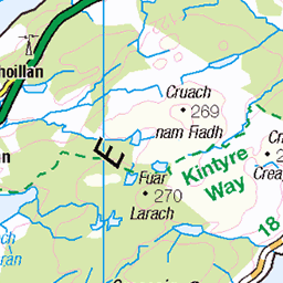
OS Map of Beinn Tarsuinn

A'Chir Ridge, Isle of Arran, Scotland, 2024
23-Jun-24 • Dr John2005 • flickr
scotland unitedkingdom blackandwhite hipstamatic cameraphone iphoneography achirridge arran rock landscape island johnperivolaris lofi iphone13 diary stone 53895339790

A'Chir Ridge, Isle of Arran, Scotland, 2024
23-Jun-24 • Dr John2005 • flickr
blackandwhite achirridge arran europe geology grain hipstamatic horizon iphone13 iphoneography island isola johnperivolaris june lofi outdoor rocks sea shapes sky scotland stone summer surfaces textures unitedkingdom 53897620864

A'Chir Ridge, Isle of Arran, Scotland, 2024
23-Jun-24 • Dr John2005 • flickr
blackandwhite achirridge arran europe geology grain hipstamatic horizon iphone13 iphoneography island isola johnperivolaris june lofi outdoor rocks sea shapes sky scotland stone summer surfaces unitedkingdom silverefexpro2 53900886776

Say hi to the old man
The Arran mountains are home to many amusing stone characters if you look well enough. However the most obvious and by far the most popular is the Old Man of Tarsuinn.
09-Jul-22 • ally bally bee • flickr
argyllandbute arran blue colours climbing face flying green grass hillwalking heather height isleofarran island landscape landmark mountains nature beinntarsuinn corbett drone dji oldmanoftarsuinn rocks ridge scotland tors valley wilderness mavicair2s 52410934197

Height Advantage
Beinn Tarsuinn and Beinn Nuis on the Isle of Arran. Always wondered how the view would look from 30m higher up. Now I know.
09-Jul-22 • ally bally bee • flickr
atmospheric argyllandbute arran beinnnuis beinntarsuinn clouds climbing cliffs flying green hillwalking height isleofarran landscape mountains mountaineering nature outdoors path peaks rocks ridge scotland slope drone dji mavicair2s view valley wilderness corbett 52409437464

Another ropey bit
14-May-22 • cams-not-in-lux • flickr
achirridge uk scotland events places isleofarran arranhills arranmountainfestival achirridgescramble alihume hiking a people unitedkingdom 52077025738
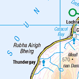
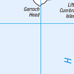
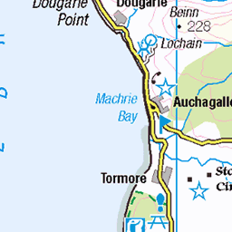
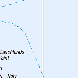
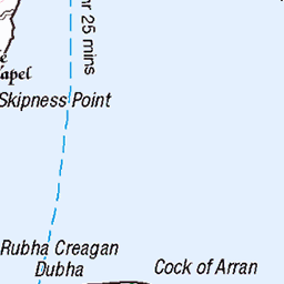
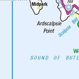
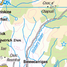
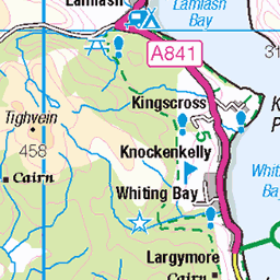
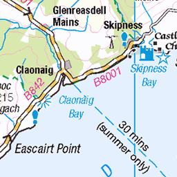
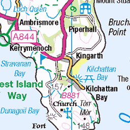
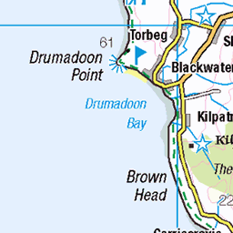
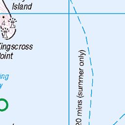
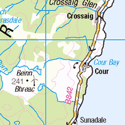
OS Map
This is OS mapping. In some areas, OpenStreetMap shows more footpaths
Spatial NI has online OSNI mapping. Click "Basemap Gallery" (4 squares icon at the top).
Now would be a good time for a cup of tea.
GPX Editor
Record map clicks
Reload map
Photos
Please tag your photos and upload them to the British and Irish Mountains group on Flickr
The other photos have been geo-tagged as on or around the summit. For less busy mountains, it can be a little hit and miss.
A'Chir Ridge, Isle of Arran, Scotland, 2024
23-Jun-24 • Dr John2005 • flickr
scotland unitedkingdom blackandwhite hipstamatic cameraphone iphoneography achirridge arran rock landscape island johnperivolaris lofi iphone13 diary stone 53895339790
A'Chir Ridge, Isle of Arran, Scotland, 2024
23-Jun-24 • Dr John2005 • flickr
blackandwhite achirridge arran europe geology grain hipstamatic horizon iphone13 iphoneography island isola johnperivolaris june lofi outdoor rocks sea shapes sky scotland stone summer surfaces textures unitedkingdom 53897620864
A'Chir Ridge, Isle of Arran, Scotland, 2024
23-Jun-24 • Dr John2005 • flickr
blackandwhite achirridge arran europe geology grain hipstamatic horizon iphone13 iphoneography island isola johnperivolaris june lofi outdoor rocks sea shapes sky scotland stone summer surfaces unitedkingdom silverefexpro2 53900886776
Say hi to the old man
The Arran mountains are home to many amusing stone characters if you look well enough. However the most obvious and by far the most popular is the Old Man of Tarsuinn.
09-Jul-22 • ally bally bee • flickr
argyllandbute arran blue colours climbing face flying green grass hillwalking heather height isleofarran island landscape landmark mountains nature beinntarsuinn corbett drone dji oldmanoftarsuinn rocks ridge scotland tors valley wilderness mavicair2s 52410934197
Height Advantage
Beinn Tarsuinn and Beinn Nuis on the Isle of Arran. Always wondered how the view would look from 30m higher up. Now I know.
09-Jul-22 • ally bally bee • flickr
atmospheric argyllandbute arran beinnnuis beinntarsuinn clouds climbing cliffs flying green hillwalking height isleofarran landscape mountains mountaineering nature outdoors path peaks rocks ridge scotland slope drone dji mavicair2s view valley wilderness corbett 52409437464
Another ropey bit
14-May-22 • cams-not-in-lux • flickr
achirridge uk scotland events places isleofarran arranhills arranmountainfestival achirridgescramble alihume hiking a people unitedkingdom 52077025738

Ropey bit
14-May-22 • cams-not-in-lux • flickr
uk scotland events places isleofarran arranhills achirridge arranmountainfestival achirridgescramble alihume people unitedkingdom hiking a 52075975417

Scrambling
14-May-22 • cams-not-in-lux • flickr
uk scotland events places isleofarran arranhills achirridge arranmountainfestival achirridgescramble hiking unitedkingdom 52077506165

Coming down
14-May-22 • cams-not-in-lux • flickr
uk scotland events places isleofarran arranhills beinnachliabhain arranmountainfestival achirridgescramble unitedkingdom hiking 52077027283

1474 Beinn Tarsuinn
Limited parking near Glen Rosa camp site then adventurous route to Beinn Nuis, Beinn Tarsuinn, detour below A Chir before Cir Mhor then return to col before descending the fine path back into Glen Rosa with Chris Watson. Name:Beinn Tarsuinn Hill number:1474 Height:826m / 2710ft Section:20C: Arran and Holy Island County/UA:North Ayrshire (UA) Maritime Area:Firth of Clyde to Mull of Kintyre Island:Arran Class:Marilyn, Hump, Simm, Corbett, Trail 100 Grid ref:NR 96021 41270 Summit feature:rock Drop:235m Col:591m NR968428 Observations:rock 90m SW at NR 96023 41269 is about as high Survey:Abney level
20-Apr-16 • Dugswell2 • flickr
marilyn isleofarran hump corbett simm tump beinntarsuinn p235 27097723392

1474 Beinn Tarsuinn a
20-Apr-16 • Dugswell2 • flickr
marilyn isleofarran corbett simm tump beinntarsuinn p235 27124403951

1474 Beinn Tarsuinn b
20-Apr-16 • Dugswell2 • flickr
marilyn isleofarran corbett simm tump beinntarsuinn p235 27124411391

1474 Beinn Tarsuinn c
20-Apr-16 • Dugswell2 • flickr
marilyn isleofarran hump corbett simm tump beinntarsuinn p235 26587326854

Old Man of Tarsuinn, Beinn Tarsuinn walk
07-Sep-03 • davidmcnuh • flickr
scotland arran hill mountain hillwalking beinntarsuinn brodick brodickbay rock oldmanoftarsuinn tarsuinn formation outcrop summit 52354959792
Videos
It was a great climbing day. Even though Arran's mountains are not Munros, visiting them feels like visiting the highest mountains ...
In this video, I continue my Scottish hiking adventure on the Isle of Arran with a 15 mile walk to Beinn Nuis and Beinn Tarsuinn.
Join me on this special solo trip to the Isle of Arran where I spend two days hiking and camping on the mountains to the North of ...
Notes
- Data: Database of British and Irish Hills v18.2
- Maps: We use OS mapping for England, Scotland, Wales, and the Isle of Man. Sadly, Channel Islands, Northern (OSNI) and Southern Ireland (OSI) mapping isn't available online, so we use Openstreetmap.