Hills of Britain and Ireland
OS Map of Green Holm


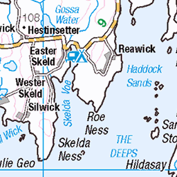
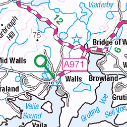
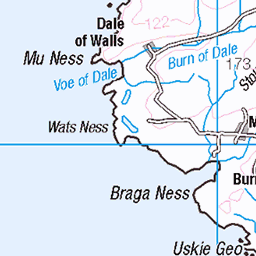
12168 Green Holm
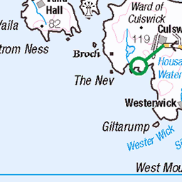
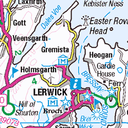
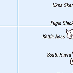
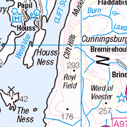
Landed at south west end of island and easy walk up grazed (and very green) slopes to summit. Name:Green Holm Hill number:12168 Height:33m / 108ft Parent (Ma):none RHB Section:22: Shetland Islands County/UA:Shetland Islands (UA) Island:Mono Tump island Maritime area:Shetland - South Class:Tump (0-99m), SIB Grid ref:HU 38162 37897 Summit feature:rock outcrop Drop:33m Col:Sea
15-Jun-19 • Dugswell2 • flickr
greenholm p33 tump sib 48162527902


Lamb & Shetland Pony Pals
fauna horses shetland scalloway scotland unitedkingdom 42716528905
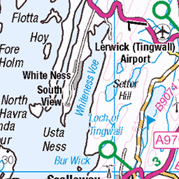
OS Map
This is OS mapping. In some areas, OpenStreetMap shows more footpaths
Spatial NI has online OSNI mapping. Click "Basemap Gallery" (4 squares icon at the top).
Now would be a good time for a cup of tea.


GPX Editor
Record map clicks
Reload map
Photos
Please tag your photos and upload them to the British and Irish Mountains group on Flickr
The other photos have been geo-tagged as on or around the summit. For less busy mountains, it can be a little hit and miss.
12168 Green Holm
Landed at south west end of island and easy walk up grazed (and very green) slopes to summit. Name:Green Holm Hill number:12168 Height:33m / 108ft Parent (Ma):none RHB Section:22: Shetland Islands County/UA:Shetland Islands (UA) Island:Mono Tump island Maritime area:Shetland - South Class:Tump (0-99m), SIB Grid ref:HU 38162 37897 Summit feature:rock outcrop Drop:33m Col:Sea
15-Jun-19 • Dugswell2 • flickr
greenholm p33 tump sib 48162527902
Lamb & Shetland Pony Pals
fauna horses shetland scalloway scotland unitedkingdom 42716528905


Micro météo
Pro-tip: éviter les sommets de Mainland, ils ont tendance à accrocher une nappe de nuage...
19-Jul-14 • Julien Carnot • flickr
16364235682


Videos
None found
Notes
- Data: Database of British and Irish Hills v18.2
- Maps: We use OS mapping for England, Scotland, Wales, and the Isle of Man. Sadly, Channel Islands, Northern (OSNI) and Southern Ireland (OSI) mapping isn't available online, so we use Openstreetmap.