Hills of Britain and Ireland
OS Map of Mid Hill (Beinn Dubh)

Frog or Toad Skin
Quite a few of these along the track (puddles & pools) I wonder what does this.
11-Apr-23 • troutcolor • flickr
fauna 52810100076


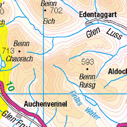
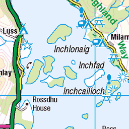
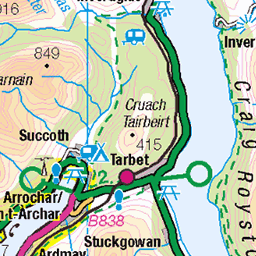
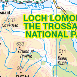
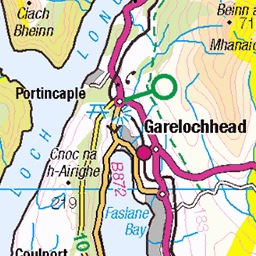
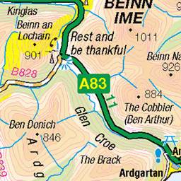
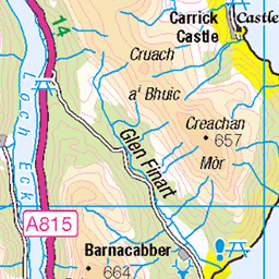
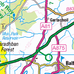
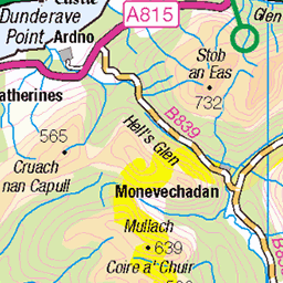
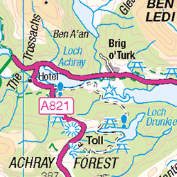
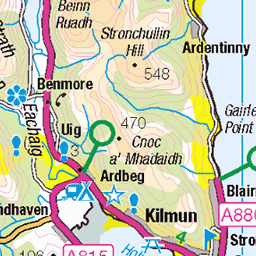
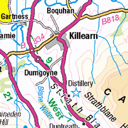
OS Map
This is OS mapping. In some areas, OpenStreetMap shows more footpaths
Spatial NI has online OSNI mapping. Click "Basemap Gallery" (4 squares icon at the top).
Now would be a good time for a cup of tea.
GPX Editor
Record map clicks
Reload map
Photos
Please tag your photos and upload them to the British and Irish Mountains group on Flickr
The other photos have been geo-tagged as on or around the summit. For less busy mountains, it can be a little hit and miss.
Frog or Toad Skin
Quite a few of these along the track (puddles & pools) I wonder what does this.
11-Apr-23 • troutcolor • flickr
fauna 52810100076


Loch Lomond
Of " www.youtube.com/watch?v=feLT7Btuqpc" rel="nofollow Bonnie, Bonnie Banks " fame. (Loch Lomond, 2016) www.facebook.com/MarkLiddellPhoto" rel="nofollow Facebook | www.instagram.com/markliddellphoto" rel="nofollow Instagram | twitter.com/liddellmark" rel="nofollow Twitter | markliddell.tumblr.com" rel="nofollow Tumblr | www.markliddell.co.uk/" rel="nofollow Website
10-Oct-16 • Mark Liddell • flickr
beinn dubh beinndubh lochlomond loch lomond lake scotland highlands freshwater inland stretch water scottish landscape nature mountain climbing hill walking hiking hike trossachs national park lowlands people climbers blue sky fence posts islands archipelago dirt grass road cliff steep luss glen striddle horseshoe ridge glenstriddle 30239463065

Beinn Dubh
A horseshoe ridge encircling Glen Striddle. Its eastern arm rises directly from the village of Luss, and overlooks the beautiful Loch Lomond. (Loch Lomond, 2016) www.facebook.com/MarkLiddellPhoto" rel="nofollow Facebook | www.instagram.com/markliddellphoto" rel="nofollow Instagram | twitter.com/liddellmark" rel="nofollow Twitter | markliddell.tumblr.com" rel="nofollow Tumblr | www.markliddell.co.uk/" rel="nofollow Website
10-Oct-16 • Mark Liddell • flickr
beinn dubh beinndubh lochlomond loch lomond lake scotland highlands freshwater inland stretch water scottish landscape nature mountain climbing hill walking hiking hike trossachs national park lowlands moody stormy sky people hillwalkers climbers john leather jacket man bottle grass blowing wind windy luss glen striddle horseshoe ridge glenstriddle 30204547126
Videos
I wondered, lonely as a cloud. Beinn Dubh. 642 metres above sea level. Pronounce it any way you want. It's near Luss, on the ...
After a decent dusting of snow Alistair set off to break in the winter gear for the first time in the mountains above Luss, Loch ...
Beinn Dubh @ Jan 2022 #Scotland #Hiking #BeinnDubh #DayDayPlay.
A hill/ fell run around the Glen Striddle Horseshoe (Beinn Dubh and Mid-Hill). Instagram: ...
Notes
- Data: Database of British and Irish Hills v18.2
- Maps: We use OS mapping for England, Scotland, Wales, and the Isle of Man. Sadly, Channel Islands, Northern (OSNI) and Southern Ireland (OSI) mapping isn't available online, so we use Openstreetmap.