Hills of Britain and Ireland
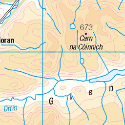
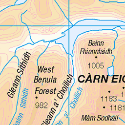
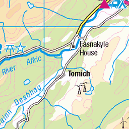
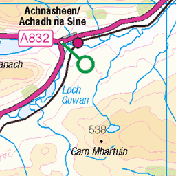
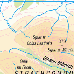
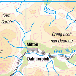
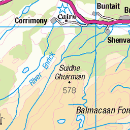
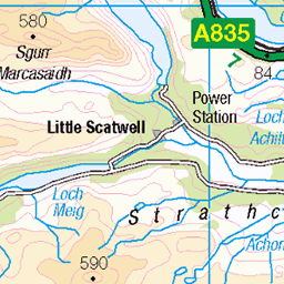
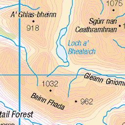
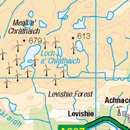
OS Map of Meall Innis an Loichel
Height: 390m / 1280ft • Prominence: 171m / 561ft • Summit : cairn on rock • Trip reports (hill-bagging)


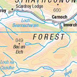
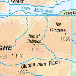
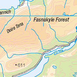
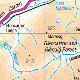
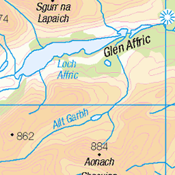
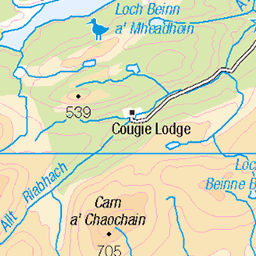
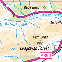
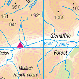
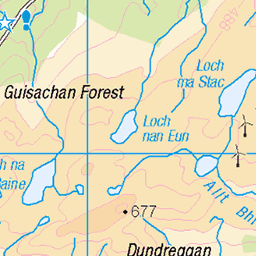
OS Map
This is OS mapping. In some areas, OpenStreetMap shows more footpaths
Spatial NI has online OSNI mapping. Click "Basemap Gallery" (4 squares icon at the top).
Now would be a good time for a cup of tea.
GPX Editor
Record map clicks
Reload map
Photos
Please tag your photos and upload them to the British and Irish Mountains group on Flickr
The other photos have been geo-tagged as on or around the summit. For less busy mountains, it can be a little hit and miss.


As the sun rises south of east its rays catch the wild and remote mountains west of Loch Monar, a dammed reservoir at the far western end of glorious Strathfarrar, Inverness-shire, Scotland.
Commentary. The heart of the North-West Highlands in autumn. Remote mountains glow in orange iridescence where Loch Monar is dammed for hydro-electric power. Here is the end of the road. From this point, only paths wend their way through the wilderness. Remote. Quiet. Distant. Far from the madding crowd. Such wild beauty either inspires or inhibits, beneath the slopes of the Munro, Sgurr na Lapaich (out of image, to the left). Once these slopes were less austere, and were softer, gentler, clothed by a mass of Scots Pine foliage. Seventeenth Century landowners imported sheep to replace crofters. Saplings eaten before maturity led to these bare sunlit slopes. Damming of many North-West Highland valleys, as here, changed winding, gorge-like river valleys into a series of man-made, dammed lochs as part of immense Hydro-Electric Power Schemes. And so, even scenery evolves under the influence of humans, animals and technology. Fortunately, the scale, grandeur and ancient mountainous framework dismisses such changes with disdain. The whole is greater than the sum of the parts and this landscape still glows with glorious splendour.
26-Oct-13 • Scotland by NJC. • flickr
54099593151
Videos
None found
Notes
- Data: Database of British and Irish Hills v18.2
- Maps: We use OS mapping for England, Scotland, Wales, and the Isle of Man. Sadly, Channel Islands, Northern (OSNI) and Southern Ireland (OSI) mapping isn't available online, so we use Openstreetmap.