Hills of Britain and Ireland
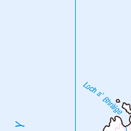
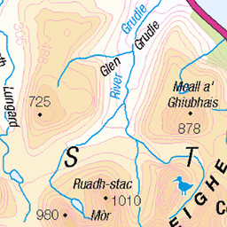
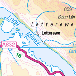
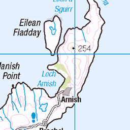
OS Map of Eilean Mor
Height: 31m / 102ft • Prominence: 31m / 102ft • Summit : no feature: bracken • Trip reports (hill-bagging)

Building Cloud Over Torridon
This turned out our final stop last weekend. The cloud was thickening and shortly after, we lost the light as we approached Diabaig and Torridon. I liked here the colourful cliff face of Eilean Mor and some late spring snow on the peaks of Beinns Alligin and Dearg.
28-Apr-24 • Stoates-Findhorn • flickr
2024 beinnalligin beinndearg eileanmor kenmore lochtorridon mountainsmunro olympusem1mkii scotland spring torridon stoates steveoates olympus steveoatesphotographycouk 53698102403


9110 Eilean Mor a
04-Sep-23 • Dugswell2 • flickr
eileanmor p31 tump sib westerross camasaneilean 53186562734


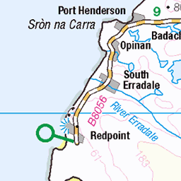
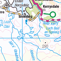
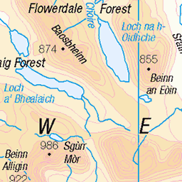
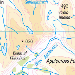
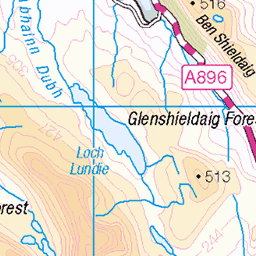
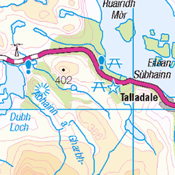
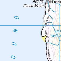
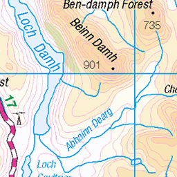
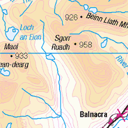
OS Map
This is OS mapping. In some areas, OpenStreetMap shows more footpaths
Spatial NI has online OSNI mapping. Click "Basemap Gallery" (4 squares icon at the top).
Now would be a good time for a cup of tea.


GPX Editor
Record map clicks
Reload map
Photos
Please tag your photos and upload them to the British and Irish Mountains group on Flickr
The other photos have been geo-tagged as on or around the summit. For less busy mountains, it can be a little hit and miss.
Building Cloud Over Torridon
This turned out our final stop last weekend. The cloud was thickening and shortly after, we lost the light as we approached Diabaig and Torridon. I liked here the colourful cliff face of Eilean Mor and some late spring snow on the peaks of Beinns Alligin and Dearg.
28-Apr-24 • Stoates-Findhorn • flickr
2024 beinnalligin beinndearg eileanmor kenmore lochtorridon mountainsmunro olympusem1mkii scotland spring torridon stoates steveoates olympus steveoatesphotographycouk 53698102403
9110 Eilean Mor a
04-Sep-23 • Dugswell2 • flickr
eileanmor p31 tump sib westerross camasaneilean 53186562734


North coast 500
28-May-21 • peterwoods58 • flickr
north coast 500 scotland bay seascapes travel nature coastlines panoramas iphone x 51238958588


Videos
Tour Scotland short travel video clip, with Scottish music, of Beinn Alligin, Scottish Gaelic: Beinn Àilleagan, one of the classic ...
Notes
- Data: Database of British and Irish Hills v18.2
- Maps: We use OS mapping for England, Scotland, Wales, and the Isle of Man. Sadly, Channel Islands, Northern (OSNI) and Southern Ireland (OSI) mapping isn't available online, so we use Openstreetmap.