Hills of Britain and Ireland
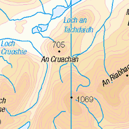
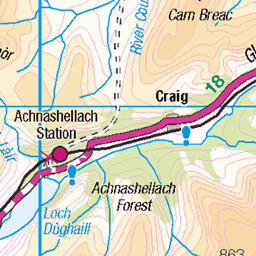
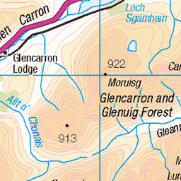
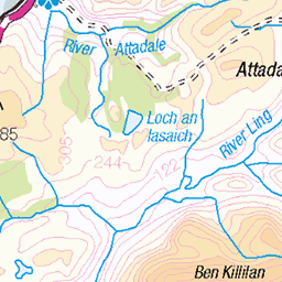
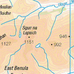
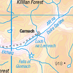
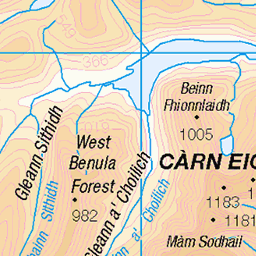
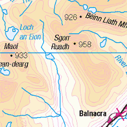
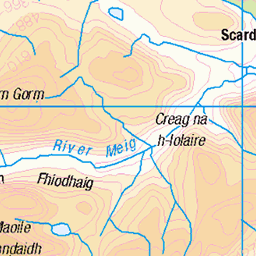
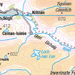
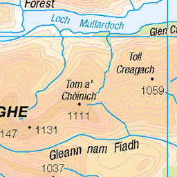
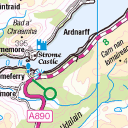
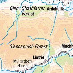
OS Map of Lurg Mhor
Height: 987m / 3238ft • Prominence: 442m / 1450ft • Summit : cairn on rock outcrop • Trip reports (hill-bagging)


photo
Looking east from the slopes of Lurg Mhor at clouds over the Mullardoch mountains (possibly An Riabhachan?)
11-May-23 • OutdoorMonkey • flickr
52917121681

photo
Heading up towards the bealach between Lurg Mhòr and Bidein a' Choire Sheasgaich ("Cheesecake") as the clouds roll in. The loch below is Loch Calavie.
11-May-23 • OutdoorMonkey • flickr
lurgmhòr lurgmhor remote wild wilderness scotland outside outdoor rural nature natural scenic scenery mountain mountainside 52917508230

Approaching Lurg Mhòr summit
A great peak but one characterised mainly by its considerable remoteness! This really did feel a long way from civilisation… which always introduces another mental element to any solo hike.
11-May-23 • OutdoorMonkey • flickr
lurgmhòr lurgmhor remote wild wilderness scotland outside outdoor rural nature natural scenic scenery mountain mountainside 52917579338

Bidein a' Choire Sheasgaich
A flat looking ridge when seen from Lurg Mhor, but completely different viewed from the north-east - flic.kr/p/2oC9PMm" rel="noreferrer nofollow flic.kr/p/2oC9PMm
11-May-23 • OutdoorMonkey • flickr
lurgmhòr lurgmhor remote wild wilderness scotland outside outdoor rural nature natural scenic scenery mountain mountainside 52917509840
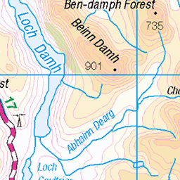
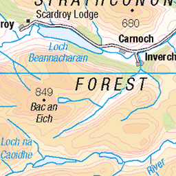
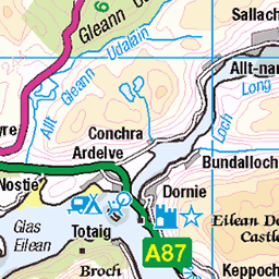
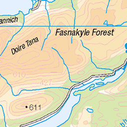
OS Map
This is OS mapping. In some areas, OpenStreetMap shows more footpaths
Spatial NI has online OSNI mapping. Click "Basemap Gallery" (4 squares icon at the top).
Now would be a good time for a cup of tea.

GPX Editor
Record map clicks
Reload map
Photos
Please tag your photos and upload them to the British and Irish Mountains group on Flickr
The other photos have been geo-tagged as on or around the summit. For less busy mountains, it can be a little hit and miss.
photo
Looking east from the slopes of Lurg Mhor at clouds over the Mullardoch mountains (possibly An Riabhachan?)
11-May-23 • OutdoorMonkey • flickr
52917121681
photo
Heading up towards the bealach between Lurg Mhòr and Bidein a' Choire Sheasgaich ("Cheesecake") as the clouds roll in. The loch below is Loch Calavie.
11-May-23 • OutdoorMonkey • flickr
lurgmhòr lurgmhor remote wild wilderness scotland outside outdoor rural nature natural scenic scenery mountain mountainside 52917508230
Approaching Lurg Mhòr summit
A great peak but one characterised mainly by its considerable remoteness! This really did feel a long way from civilisation… which always introduces another mental element to any solo hike.
11-May-23 • OutdoorMonkey • flickr
lurgmhòr lurgmhor remote wild wilderness scotland outside outdoor rural nature natural scenic scenery mountain mountainside 52917579338
Bidein a' Choire Sheasgaich
A flat looking ridge when seen from Lurg Mhor, but completely different viewed from the north-east - flic.kr/p/2oC9PMm" rel="noreferrer nofollow flic.kr/p/2oC9PMm
11-May-23 • OutdoorMonkey • flickr
lurgmhòr lurgmhor remote wild wilderness scotland outside outdoor rural nature natural scenic scenery mountain mountainside 52917509840

West Monar
Lurg Mhòr and the west end of Loch Monar from partway up Bidein a' Choire Sheasgaich ("Cheesecake")
11-May-23 • OutdoorMonkey • flickr
lurgmhòr lurgmhor remote wild wilderness scotland outside outdoor rural nature natural scenic scenery mountain mountainside 52917272609

Decending Bidein A Choire Sheaschaig
Mike and I decending the cheesecake. Clearing after topping out on a cloudy summit.
16-Mar-13 • Mark Hill1 • flickr
8570131046


Videos
After our long, tiring walk into remote Beinn Dronaig bothy (Part 1) and camping the night before, Part 2 of our adventure sees us ...
Bidein a' Choire Sheasgaich and Lurg Mhòr, from Attadale. Bike and hike. Music by Amarel ...
Munros Bidein a' Choire Sheasgaich and Lurg Mhor from Attadale in the North West Highlands of Scotland. A long cycle in to ...
The Big Bike Hike Day 1-Murky Lurgy and 'Cheesecake.' Route description: Bidein a' Choire Sheasgaich and Lurg Mhòr. Date ...
A fantastic weekend Mountain, Wild Camping Adventure with Greg & Robin. Saturday saw us taking in the Corbetts Sgurr na ...
Notes
- Data: Database of British and Irish Hills v18.2
- Maps: We use OS mapping for England, Scotland, Wales, and the Isle of Man. Sadly, Channel Islands, Northern (OSNI) and Southern Ireland (OSI) mapping isn't available online, so we use Openstreetmap.