Hills of Britain and Ireland
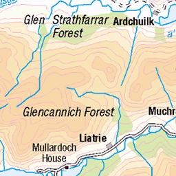
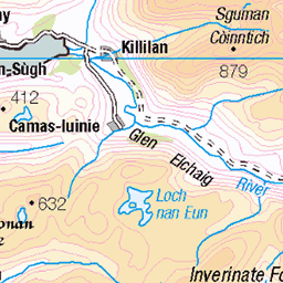
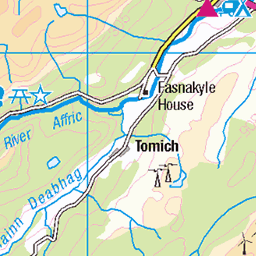
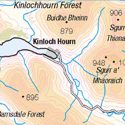
OS Map of Tigh Mor na Seilge

photo
Sgurr nan Conbhairean from the north (the route to/from neighbouring peak Sail Chaorainn). Gleann na Ciche is down to the right.
06-Sep-20 • OutdoorMonkey • flickr
50352642987


Sail Chaorainn Summit Selfie
Me on the summit of Sail Chaorainn (1002m / 3287ft)
13-Feb-16 • MarcProudfoot • flickr
scotland munros kintail 24931755042

Frozen Selfie
Anne and I were freezing as we waited for John to come back from the top.
13-Feb-16 • MarcProudfoot • flickr
scotland munros kintail 24754157510
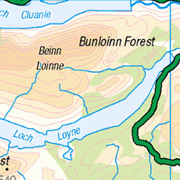
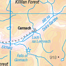
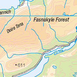
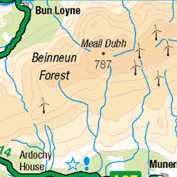
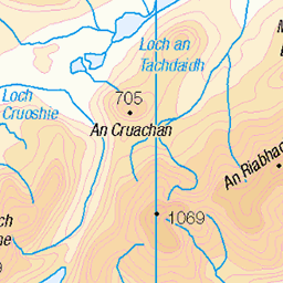
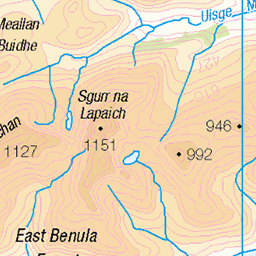
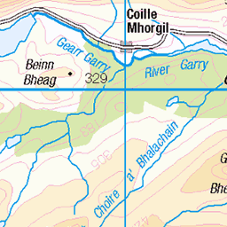
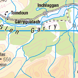
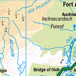
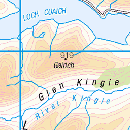
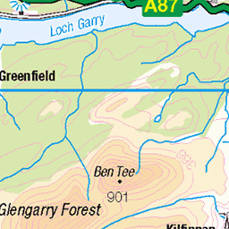
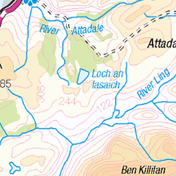
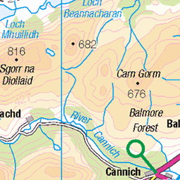
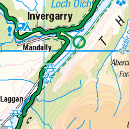
OS Map
This is OS mapping. In some areas, OpenStreetMap shows more footpaths
Spatial NI has online OSNI mapping. Click "Basemap Gallery" (4 squares icon at the top).
Now would be a good time for a cup of tea.


GPX Editor
Record map clicks
Reload map
Photos
Please tag your photos and upload them to the British and Irish Mountains group on Flickr
The other photos have been geo-tagged as on or around the summit. For less busy mountains, it can be a little hit and miss.
photo
Sgurr nan Conbhairean from the north (the route to/from neighbouring peak Sail Chaorainn). Gleann na Ciche is down to the right.
06-Sep-20 • OutdoorMonkey • flickr
50352642987
Sail Chaorainn Summit Selfie
Me on the summit of Sail Chaorainn (1002m / 3287ft)
13-Feb-16 • MarcProudfoot • flickr
scotland munros kintail 24931755042
Frozen Selfie
Anne and I were freezing as we waited for John to come back from the top.
13-Feb-16 • MarcProudfoot • flickr
scotland munros kintail 24754157510
Videos
Back in 2021 I decided to go on my biggest wildcamping adventure, hoping to hike over two Corbetts, two Munro Tops and two ...
Notes
- Data: Database of British and Irish Hills v18.2
- Maps: We use OS mapping for England, Scotland, Wales, and the Isle of Man. Sadly, Channel Islands, Northern (OSNI) and Southern Ireland (OSI) mapping isn't available online, so we use Openstreetmap.