Hills of Britain and Ireland
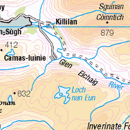
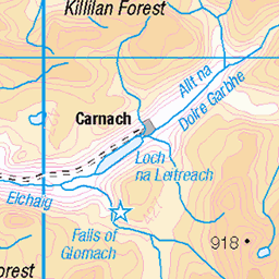
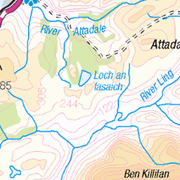
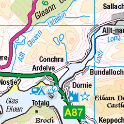
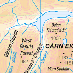
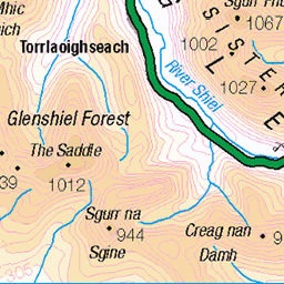
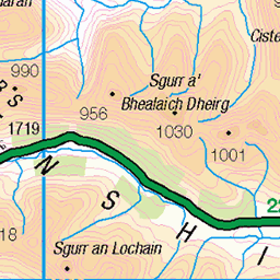
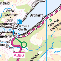
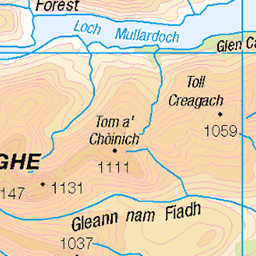
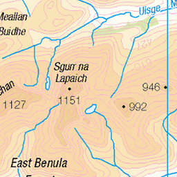
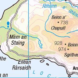
OS Map of A' Ghlas-bheinn

Bealach Na Sgairne
A view along the Bealach Na Sgairne a narrowing pass between the two mountain masses of Beinn Fhada and A' Ghlas-bheinn.
05-May-23 • Russell-Davies • flickr
bealachnasgairne canon canonr6 highlands hiking landscape mountains munro munrobagging scotland uk kintail beinnfhada aghlasbheinn 53125835516


A' Ghlas-bheinn summit
Looking down Strath Croe to Morvich and Loch Duich from the summit of A' Ghlas-bheinn. The peak in the distance is Beinn Sgritheall.
04-Jul-18 • OutdoorMonkey • flickr
beinnsgritheall aghlasbheinn peak summit cairn mountain scotland kintail morvich lochduich landscape countryside rural outside outdoor stones loch coast valley mountainside hillside cloudy mountains munro 43707939221

70.177 Satyr Pug (Eupithecia satyrata), Bealach na Sroine, Highland, Scotland
27-May-18 • Terathopius • flickr
satyrpug bealachnasroine geometridae larentiinae eupitheciasatyrata moth spring springwatch highland scotland unitedkingdom greatbritain macro closeup outside nature naturephotography naturaleza natureza wildlife wildlifephotography canon canon5d lepidoptera arthropod entomology insect invertebrate 44506974141

70.177 Satyr Pug (Eupithecia satyrata), Bealach na Sroine, Highland, Scotland
27-May-18 • Terathopius • flickr
satyrpug bealachnasroine geometridae larentiinae highland eupitheciasatyrata scotland greatbritain unitedkingdom moth lepidoptera arthropod entomology insect invertebrate macro closeup animal fauna wildlife wildlifephotography nature naturephotography naturaleza natureza outside canon canon5d 48028058472
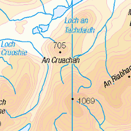
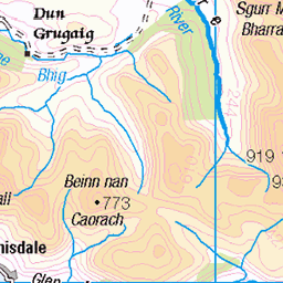
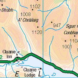
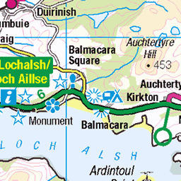
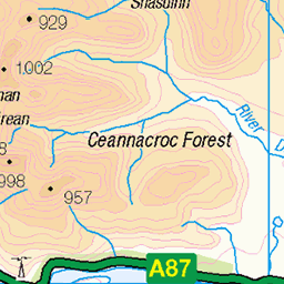
OS Map
This is OS mapping. In some areas, OpenStreetMap shows more footpaths
Spatial NI has online OSNI mapping. Click "Basemap Gallery" (4 squares icon at the top).
Now would be a good time for a cup of tea.

GPX Editor
Record map clicks
Reload map
Photos
Please tag your photos and upload them to the British and Irish Mountains group on Flickr
The other photos have been geo-tagged as on or around the summit. For less busy mountains, it can be a little hit and miss.
Bealach Na Sgairne
A view along the Bealach Na Sgairne a narrowing pass between the two mountain masses of Beinn Fhada and A' Ghlas-bheinn.
05-May-23 • Russell-Davies • flickr
bealachnasgairne canon canonr6 highlands hiking landscape mountains munro munrobagging scotland uk kintail beinnfhada aghlasbheinn 53125835516
A' Ghlas-bheinn summit
Looking down Strath Croe to Morvich and Loch Duich from the summit of A' Ghlas-bheinn. The peak in the distance is Beinn Sgritheall.
04-Jul-18 • OutdoorMonkey • flickr
beinnsgritheall aghlasbheinn peak summit cairn mountain scotland kintail morvich lochduich landscape countryside rural outside outdoor stones loch coast valley mountainside hillside cloudy mountains munro 43707939221
70.177 Satyr Pug (Eupithecia satyrata), Bealach na Sroine, Highland, Scotland
27-May-18 • Terathopius • flickr
satyrpug bealachnasroine geometridae larentiinae eupitheciasatyrata moth spring springwatch highland scotland unitedkingdom greatbritain macro closeup outside nature naturephotography naturaleza natureza wildlife wildlifephotography canon canon5d lepidoptera arthropod entomology insect invertebrate 44506974141
70.177 Satyr Pug (Eupithecia satyrata), Bealach na Sroine, Highland, Scotland
27-May-18 • Terathopius • flickr
satyrpug bealachnasroine geometridae larentiinae highland eupitheciasatyrata scotland greatbritain unitedkingdom moth lepidoptera arthropod entomology insect invertebrate macro closeup animal fauna wildlife wildlifephotography nature naturephotography naturaleza natureza outside canon canon5d 48028058472


Taking a rest
14-Apr-11 • BurnThePlans • flickr
camping dog mountains scotland highlands collie hills backpacking bordercollie loch hillwalking kintail lochgaorsaic 5622705172
Videos
A Ghlas-bheinn near Morvich, with Mina the dog. #hiking #scotland #morvich.
While on our Summer holidays staying in Morvich Caravan and Motorhome club site for 10 nights, Jura and I decided to climb ...
A'Ghlas-bheinn, 28/10/2018, Time taken: 6 hours, Distance: 21.5 km/13.5miles, Ascent: 1196m. Trying to catch up with reports is ...
hillwalking #scotland A hike from Morvich to the munro A Ghlas Bheinn,Kintail. Weather worsened and route off was from the ...
Sting in the Kintail- Day 1, Beinn Fhada, 1032m. 23.4.19 A Very windy day! (35-45mph), Ascent 1295m, 6hrs, 11 miles. Had been ...
Notes
- Data: Database of British and Irish Hills v18.2
- Maps: We use OS mapping for England, Scotland, Wales, and the Isle of Man. Sadly, Channel Islands, Northern (OSNI) and Southern Ireland (OSI) mapping isn't available online, so we use Openstreetmap.