Hills of Britain and Ireland
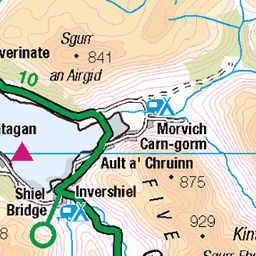
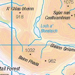
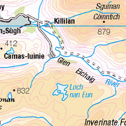
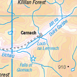
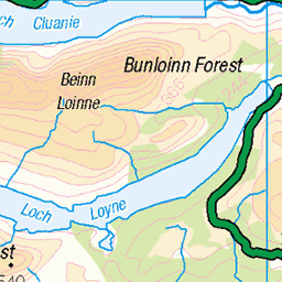
OS Map of Sgurr na Carnach
Height: 1002m / 3287ft • Prominence: 134m / 440ft • Summit : large cairn • Trip reports (hill-bagging)


Panorama Loch Duich, Sgurr nan Saighead, a Beinn Fhada
17-Aug-23 • robatwilliams • flickr
53651791869

Loch Duich
Looking down to Loch Duich nearing the end of a hike over the Five Sisters of Kintail.
27-Jul-22 • Russell-Davies • flickr
munro munrobagging kintail glenshiel fivesistersofkintail ridge lochduich hiking trail summer canon canonr6 r6 highlands uk scotland 52609245569
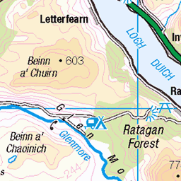
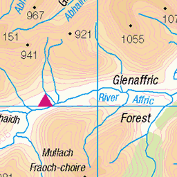
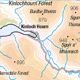
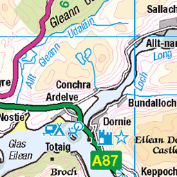
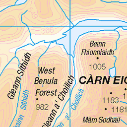
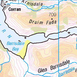
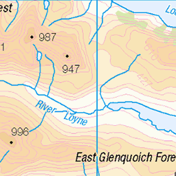
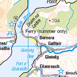
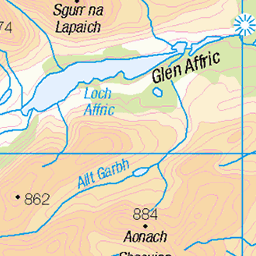
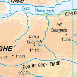
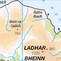
OS Map
This is OS mapping. In some areas, OpenStreetMap shows more footpaths
Spatial NI has online OSNI mapping. Click "Basemap Gallery" (4 squares icon at the top).
Now would be a good time for a cup of tea.

GPX Editor
Record map clicks
Reload map
Photos
Please tag your photos and upload them to the British and Irish Mountains group on Flickr
The other photos have been geo-tagged as on or around the summit. For less busy mountains, it can be a little hit and miss.
Panorama Loch Duich, Sgurr nan Saighead, a Beinn Fhada
17-Aug-23 • robatwilliams • flickr
53651791869
Loch Duich
Looking down to Loch Duich nearing the end of a hike over the Five Sisters of Kintail.
27-Jul-22 • Russell-Davies • flickr
munro munrobagging kintail glenshiel fivesistersofkintail ridge lochduich hiking trail summer canon canonr6 r6 highlands uk scotland 52609245569

Forcan Ridge
The Forcan Ridge and The Saddle from the nearby Sisters Ridge in Kintail, Scotland.
06-Jul-21 • OutdoorMonkey • flickr
forcanridge ridge arete thesaddle peak summit munro scotland sottish mountain mountainside outside outdoor rural countryside nature natural scenic scenery 51314644611

Coire Domhain
The coire enclosed by part of the 'Sisters Ridge' in Kintail, Scotland. i think (but could be wrong) the peak just right-of-centre is Sgurr nan Spainteach.
06-Jul-21 • OutdoorMonkey • flickr
valley coire coiredomhain sistersridge ridge kintail glenshiel scotland scottish sgurrnanspainteach spainteach outside outdoor rural nature natural scenic scenery mountain mountains mountainside summit river 51315347118

Sgurr na Ciste Duibhe
One of the peaks that makes up the 'Five Sisters Of Kintail' ridge on the north side of Glen Shiel in Scotland.
06-Jul-21 • OutdoorMonkey • flickr
fivesisters sistersridge kintail fivesistersofkintail mountain mountainside munro peak summit scotland scottish outside outdoor rural countryside nature natural scenic scenery peakoftheblackchest 51315871504

The Saddle
One of the finest mountain in Scotland, The Saddle in Glen Shiel, as seen from the Five Sisters ridge on the other side of the glen. Wall Art: shop.photo4me.com/1254964/print?o=19&e=0&s=233&u=mm&share=true" rel="noreferrer nofollow Photo4Me Facebook: www.facebook.com/vanishingpointsphoto/" rel="noreferrer nofollow @vanishingpointsphoto Website: www.vanishingpoints.net" rel="noreferrer nofollow Vanishing Points
24-Oct-16 • VanishingPoints • flickr
munros highlands glenshiel kintail scotland thesaddle scottishhighlands mountainscenery fivesistersridge 53413589997
Videos
Clag rolled in for the first 2 Munros, Sgùrr na Ciste Duibhe and Sgùrr na Càrnach. It soon passed, offering fine views from Sgùrr ...
Filmed at the end of May 2024. Probably the wettest and windiest start of any year, it was chucking it down as we drove from Glen ...
Tour Scotland travel video, with Scottish music, of the Five Sisters Of Kintail Mountains , on visit to the Scottish Highlands. The five ...
Kintail #Hiking A weekend trip to Kintail including the hill of the Spaniards, Sgurr na Carnach,Sgurr Fhuaran and Sgurr nan ...
This visit to Glen Shiel had us deciding that we would do the Five Sisters of Kintail climb, one problem, no second car and we ...
Notes
- Data: Database of British and Irish Hills v18.2
- Maps: We use OS mapping for England, Scotland, Wales, and the Isle of Man. Sadly, Channel Islands, Northern (OSNI) and Southern Ireland (OSI) mapping isn't available online, so we use Openstreetmap.