Hills of Britain and Ireland
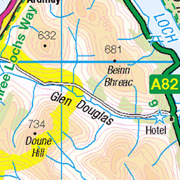
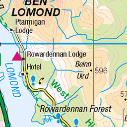
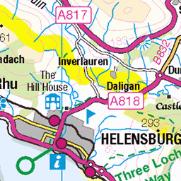
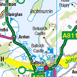
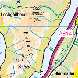
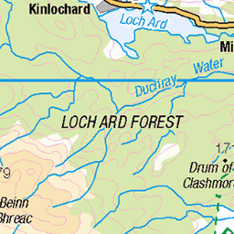
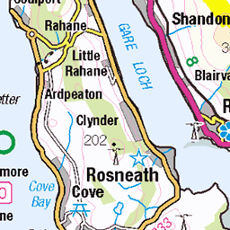
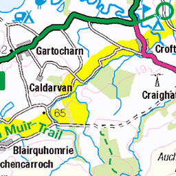
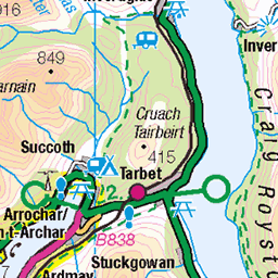
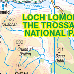
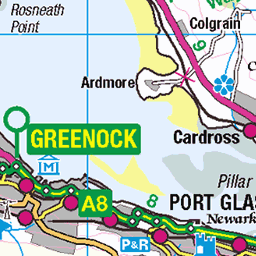
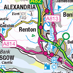
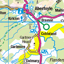
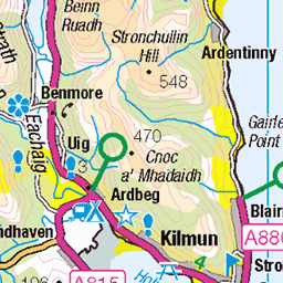
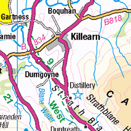
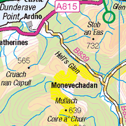
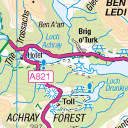
OS Map of Tom nan Clag


A gray day at Luss, Loch Lomond.
03-Feb-25 • billmac_sco • flickr
scotland luss lochlomond landscape scenic pier 54304621366

Fraoch Eilean
Loch Lomond, Scotland
02-Oct-24 • Joe Passe • flickr
lochlomond fraocheilean autumn water island scotland loch 54277978750


Scottish Backhold Wrestling
The 2024 Luss Highland Gathering
06-Jul-24 • FotoFling Scotland • flickr
event gregneilson highlandgames lochlomond scotland scottishwrestlingbond scottishbackholdwrestling wrestling kilt luss lusshighlandgames fotoflingscotland ©richardfindlay allrightsreserved 54341201096
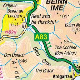
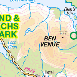
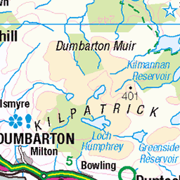
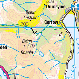
OS Map
This is OS mapping. In some areas, OpenStreetMap shows more footpaths
Spatial NI has online OSNI mapping. Click "Basemap Gallery" (4 squares icon at the top).
Now would be a good time for a cup of tea.

GPX Editor
Record map clicks
Reload map
Photos
Please tag your photos and upload them to the British and Irish Mountains group on Flickr
The other photos have been geo-tagged as on or around the summit. For less busy mountains, it can be a little hit and miss.
A gray day at Luss, Loch Lomond.
03-Feb-25 • billmac_sco • flickr
scotland luss lochlomond landscape scenic pier 54304621366
Fraoch Eilean
Loch Lomond, Scotland
02-Oct-24 • Joe Passe • flickr
lochlomond fraocheilean autumn water island scotland loch 54277978750
Scottish Backhold Wrestling
The 2024 Luss Highland Gathering
06-Jul-24 • FotoFling Scotland • flickr
event gregneilson highlandgames lochlomond scotland scottishwrestlingbond scottishbackholdwrestling wrestling kilt luss lusshighlandgames fotoflingscotland ©richardfindlay allrightsreserved 54341201096

8172 Tom nan Clag
10-Sep-22 • Dugswell2 • flickr
tomnanclag p78 tump sib freshwaterislandinchtavannach lochlomond 52399380558

8172 Tom nan Clag a
Second Tump & first SIB on a seven island cruise from Aldochlay with Jill. Name:Tom nan Clag Hill number:8172 Height:86m / 282ft Parent (Ma):none RHB Section:01E: Loch Long to Loch Lomond County/UA:Argyll and Bute (UA) Island:Inchtavannach Maritime area:Freshwater Catchment:Leven (Dumbarton) Class:Tump (0-99m), SIB Grid ref:NS 36672 91610 Summit feature:outcrop Drop:78m Col:8m Loch
10-Sep-22 • Dugswell2 • flickr
tomnanclag p78 tump sib freshwaterislandinchtavannach lochlomond 52399319635


Loch Long after sunrise, opposite the village of Arrochar, Argyll and Bute, Scotland.
Commentary. Lochs Long, Goil, Holy and Fyne indent so far inland their combined coastline exceeds two hundred miles. Argyll and Bute alone have over one thousand miles of coastline, much of it as seen here. Long fingers of sea reaching twenty, thirty and forty miles inland and a hundred other sounds, firths, rias, bays and sea-lochs in addition. The biggest flow is the tide, being that the hilly and mountainous strips of land, between the finger-like sea-lochs, provide shelter and act like giant breakwaters. The buddleia complements the orange tinge of early morning light, reflected in the water on a calm, clear morning at 05:31a.m. The world is yet to wake and the tranquillity is tangible. Many such days would be needed to explore the myriad of twists and turns that make up this amazing, convoluted coastline. But to me, that fact makes this moment even more precious, with the promise of return visits an exciting prospect.
02-Aug-16 • Scotland by NJC. • flickr
alexandria scotland unitedkingdom 54370362166

Silhouetted Loch Lomond at Aldochlay Bay near Luss, Argyll, Scotland.
Poem. Sensational sunrise. A mellow, peachy sky strengthens to a golden glow on the eastern horizon. The eastern hill-bound shore is hyphenated by the coal-black images of three of Lomond’s thirty islands. Three boats moor near the western shore. A wooden mooring pier and bullet-point floats add perspective and detail to a near-perfect water-canvas.
26-Aug-87 • Scotland by NJC. • flickr
54278704671
Videos
None found
Notes
- Data: Database of British and Irish Hills v18.2
- Maps: We use OS mapping for England, Scotland, Wales, and the Isle of Man. Sadly, Channel Islands, Northern (OSNI) and Southern Ireland (OSI) mapping isn't available online, so we use Openstreetmap.