Hills of Britain and Ireland
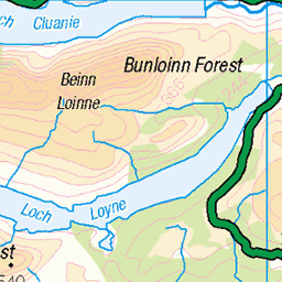
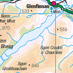
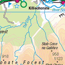
OS Map of Meall Blair
Height: 657m / 2154ft • Prominence: 213m / 699ft • Summit : trig point • Trip reports (hill-bagging)

S9704 - Meall Blair
NN077950, LR33. HISTORY Pillar completed 21st May 1958 costing £109.3s.5d. Computed as secondary triangulation station NG80/18 within the Fort William block, and levelled to second class precision during 1959. This pillar station was last maintained by the Ordnance Survey in June 1980. SITE VISIT Approached from the southwest. Makeshift parking space to the south side of the unclassified C1153 at NN055923, Arcabhi. Climbing the slope opposite leads to an unmapped track which continues to Loch Blair. At the highpoint on the track, deviate northeast for the summit. The pillar is in good condition. The spider retains its original OS centre cap with raised large narrow weathered letters. The flush bracket faces southeast, compass measurement 129°. Vented through the back (NW) sight hole. Full 360° panoramic view. Photographed: 19th June 2013, GRP. ═════════════════════════ Interactive index: www.google.com/maps/d/viewer?mid=1arx2Qmo5mVeVUJA2lzVG_uzbYPW59ffh&ll=57.0063819,-5.167586&z=11" rel="noreferrer nofollow Google My Maps ═════════════════════════ Neighbouring Triangulation Pillars www.flickr.com/photos/13460108@N06/10914845753/in/album-72157631831281682 S9709 - Achnasaul Geal Charn : 4.92 miles to the east. S9754 - Sgurr An Fhuarain : 5.88 miles to the west. www.flickr.com/photos/13460108@N06/8114096774/in/album-72157631831281682/ S9797 - Druim Na H-achlaise : 6.29 miles to the northeast. www.flickr.com/photos/13460108@N06/10846171253/in/album-72157631831281682/ S9706 - Beinn Bhan : 7.00 miles to the southeast. www.flickr.com/photos/13460108@N06/14676661021/in/album-72157631831281682 S9794 - Culvain : 7.32 miles to the southwest. ═════════════════════════
19-Jun-13 • Graeme5015 • flickr
s9704 meallblair arkaig locharkaig invermallie 10935059644
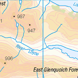
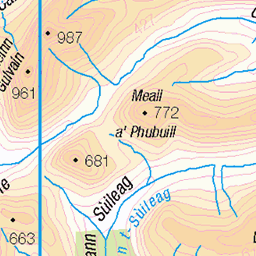
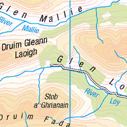
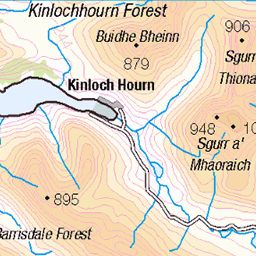
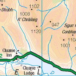
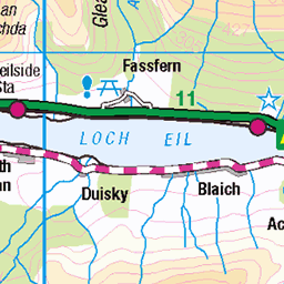
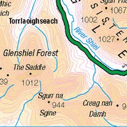
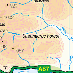
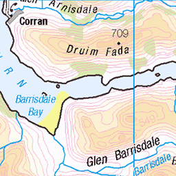
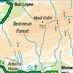
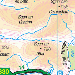
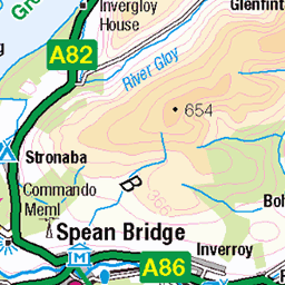
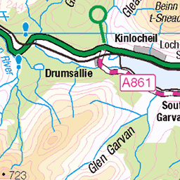
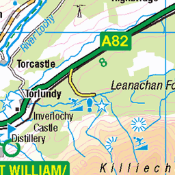
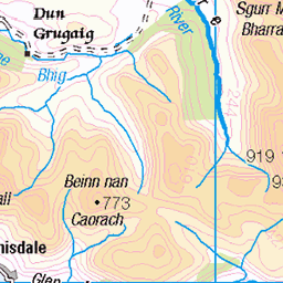
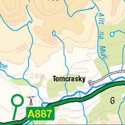
OS Map
This is OS mapping. In some areas, OpenStreetMap shows more footpaths
Spatial NI has online OSNI mapping. Click "Basemap Gallery" (4 squares icon at the top).
Now would be a good time for a cup of tea.


GPX Editor
Record map clicks
Reload map
Photos
Please tag your photos and upload them to the British and Irish Mountains group on Flickr
The other photos have been geo-tagged as on or around the summit. For less busy mountains, it can be a little hit and miss.
S9704 - Meall Blair
NN077950, LR33. HISTORY Pillar completed 21st May 1958 costing £109.3s.5d. Computed as secondary triangulation station NG80/18 within the Fort William block, and levelled to second class precision during 1959. This pillar station was last maintained by the Ordnance Survey in June 1980. SITE VISIT Approached from the southwest. Makeshift parking space to the south side of the unclassified C1153 at NN055923, Arcabhi. Climbing the slope opposite leads to an unmapped track which continues to Loch Blair. At the highpoint on the track, deviate northeast for the summit. The pillar is in good condition. The spider retains its original OS centre cap with raised large narrow weathered letters. The flush bracket faces southeast, compass measurement 129°. Vented through the back (NW) sight hole. Full 360° panoramic view. Photographed: 19th June 2013, GRP. ═════════════════════════ Interactive index: www.google.com/maps/d/viewer?mid=1arx2Qmo5mVeVUJA2lzVG_uzbYPW59ffh&ll=57.0063819,-5.167586&z=11" rel="noreferrer nofollow Google My Maps ═════════════════════════ Neighbouring Triangulation Pillars www.flickr.com/photos/13460108@N06/10914845753/in/album-72157631831281682 S9709 - Achnasaul Geal Charn : 4.92 miles to the east. S9754 - Sgurr An Fhuarain : 5.88 miles to the west. www.flickr.com/photos/13460108@N06/8114096774/in/album-72157631831281682/ S9797 - Druim Na H-achlaise : 6.29 miles to the northeast. www.flickr.com/photos/13460108@N06/10846171253/in/album-72157631831281682/ S9706 - Beinn Bhan : 7.00 miles to the southeast. www.flickr.com/photos/13460108@N06/14676661021/in/album-72157631831281682 S9794 - Culvain : 7.32 miles to the southwest. ═════════════════════════
19-Jun-13 • Graeme5015 • flickr
s9704 meallblair arkaig locharkaig invermallie 10935059644
Videos
None found
Notes
- Data: Database of British and Irish Hills v18.2
- Maps: We use OS mapping for England, Scotland, Wales, and the Isle of Man. Sadly, Channel Islands, Northern (OSNI) and Southern Ireland (OSI) mapping isn't available online, so we use Openstreetmap.