Hills of Britain and Ireland
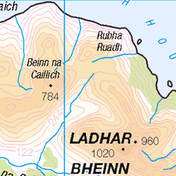
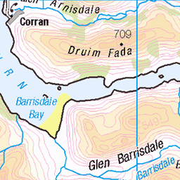
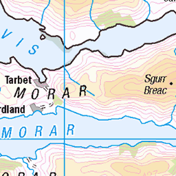
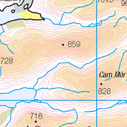
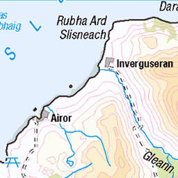
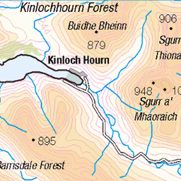
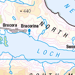
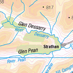
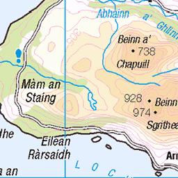
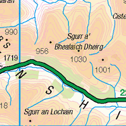
OS Map of Meall Buidhe SE Top

Meall Buidhe
The summit of one of Knoydart's remote munro peaks, looking towards Loch Nevis and the coast at Inverie.
28-Jul-24 • OutdoorMonkey • flickr
knoydart scotland wild wilderness remote outside outdoor rural nature natural scenic scenery countryside highlands 53914030564

Knoydart wilderness
On the ridge between Meall Buidhe and Luinne Bheinn in Knoydart, looking north-west over the complex terrain towards Ladhar Bheinn (middle distance) and Beinn Sgritheall (in the distance on the right).
28-Jul-24 • OutdoorMonkey • flickr
knoydart scotland wild wilderness remote outside outdoor rural nature natural scenic scenery countryside highlands ladharbheinn mountain peak munro coire 53913677721

Sgùrr na Cìche
The distinctive peak of Sgùrr na Cìche rises out of a temperature Inversion from Meall Bhuidhe.
18-May-24 • Russell-Davies • flickr
sgurrnaciche knoydart roughboundsofknoydart meallbhuidhe munro munrobagging temperatureinversion cloudinversion clouds landscape canon canonr6 highlands hiking mountains scotland summer summit uk 54112178740

Leaving Meall Bhuidhe
Looking out west to a sea of low clouds and a distant Isle of Rum from Meall Bhuidhe.
18-May-24 • Russell-Davies • flickr
meallbhuidhe knoydart roughboundsofknoydart munro munrobagging cloudinversion temperatureinversion isleofrum rum inversion westernisles canon canonr6 clouds highlands hiking landscape mountains scotland summer summit uk 54112213714

The Rough Bounds
Plotting a route from Meall Bhuidhe back to Barrisdale across the Rough Bounds of Knoydart.
18-May-24 • Russell-Davies • flickr
knoydart roughboundsofknoydart meallbhuidhe luinnebheinn munro munrobagging munros canon canonr6 highlands hiking landscape mountains scotland summer uk 54112402603

Roughest Bounds
Rough ground between Luinne Bheinn and Meall Bhuidhe in Knoydart.
18-May-24 • Russell-Davies • flickr
meallbhuidhe luinnebheinn knoydart roughboundsofknoydart landscape summer munro munrobagging canon canonr6 highlands hiking scotland uk 54112483254
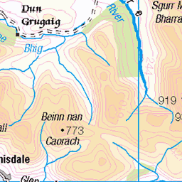
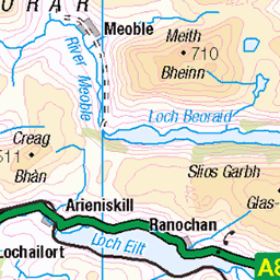
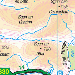
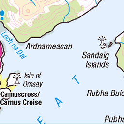
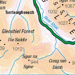
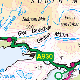
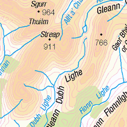
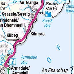
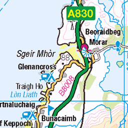
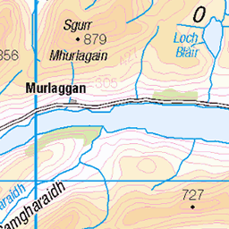
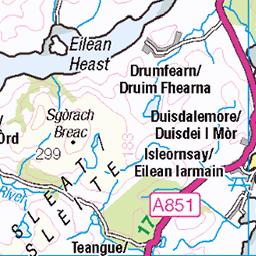
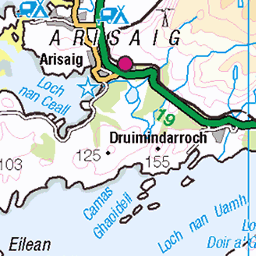
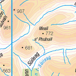
OS Map
This is OS mapping. In some areas, OpenStreetMap shows more footpaths
Spatial NI has online OSNI mapping. Click "Basemap Gallery" (4 squares icon at the top).
Now would be a good time for a cup of tea.

GPX Editor
Record map clicks
Reload map
Photos
Please tag your photos and upload them to the British and Irish Mountains group on Flickr
The other photos have been geo-tagged as on or around the summit. For less busy mountains, it can be a little hit and miss.
Meall Buidhe
The summit of one of Knoydart's remote munro peaks, looking towards Loch Nevis and the coast at Inverie.
28-Jul-24 • OutdoorMonkey • flickr
knoydart scotland wild wilderness remote outside outdoor rural nature natural scenic scenery countryside highlands 53914030564
Knoydart wilderness
On the ridge between Meall Buidhe and Luinne Bheinn in Knoydart, looking north-west over the complex terrain towards Ladhar Bheinn (middle distance) and Beinn Sgritheall (in the distance on the right).
28-Jul-24 • OutdoorMonkey • flickr
knoydart scotland wild wilderness remote outside outdoor rural nature natural scenic scenery countryside highlands ladharbheinn mountain peak munro coire 53913677721
Sgùrr na Cìche
The distinctive peak of Sgùrr na Cìche rises out of a temperature Inversion from Meall Bhuidhe.
18-May-24 • Russell-Davies • flickr
sgurrnaciche knoydart roughboundsofknoydart meallbhuidhe munro munrobagging temperatureinversion cloudinversion clouds landscape canon canonr6 highlands hiking mountains scotland summer summit uk 54112178740
Leaving Meall Bhuidhe
Looking out west to a sea of low clouds and a distant Isle of Rum from Meall Bhuidhe.
18-May-24 • Russell-Davies • flickr
meallbhuidhe knoydart roughboundsofknoydart munro munrobagging cloudinversion temperatureinversion isleofrum rum inversion westernisles canon canonr6 clouds highlands hiking landscape mountains scotland summer summit uk 54112213714
The Rough Bounds
Plotting a route from Meall Bhuidhe back to Barrisdale across the Rough Bounds of Knoydart.
18-May-24 • Russell-Davies • flickr
knoydart roughboundsofknoydart meallbhuidhe luinnebheinn munro munrobagging munros canon canonr6 highlands hiking landscape mountains scotland summer uk 54112402603
Roughest Bounds
Rough ground between Luinne Bheinn and Meall Bhuidhe in Knoydart.
18-May-24 • Russell-Davies • flickr
meallbhuidhe luinnebheinn knoydart roughboundsofknoydart landscape summer munro munrobagging canon canonr6 highlands hiking scotland uk 54112483254


Videos
In today's video I will be Munro Bagging the Three Munros on the East side of Kintail! This route is around 11 Miles long and will ...
In today's video I will be walking the South Glen Shiel Ridge in Kintail, this a long 18 mile hike that includes 7 Munros, A real treat ...
I hiked alone over three munros to the summit of Sgurr na Ciche, one of the most iconic mountains in Scotland on the edge of ...
Meine 11 tägige Tour durch Schottland, von Glenfinnan nach Shiel Bridge. Regen an jedem Tag! :(
After a nights camp on the north shore of Loch Morar, we headed to Mallaig Harbour. We cought the boat across to Inverie ...
Notes
- Data: Database of British and Irish Hills v18.2
- Maps: We use OS mapping for England, Scotland, Wales, and the Isle of Man. Sadly, Channel Islands, Northern (OSNI) and Southern Ireland (OSI) mapping isn't available online, so we use Openstreetmap.