Hills of Britain and Ireland
OS Map of Sgurr Mor
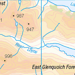
Height: 1003m / 3291ft • Prominence: 341m / 1119ft • Summit : large cairn • Trip reports (hill-bagging)


Glen Kingie
The remote and wild (often called lonely and desolate) Glen Kingie, sandwiched between Loch Arkaig and Loch Cuaich in the Scottish Highlands. Munro peak Sgurr Mor is up to the left, and the usual route to that peak is through the low point between the hills on the right and across the valley floor.
31-Jul-24 • OutdoorMonkey • flickr
glenkingie glen valley moor moorland grass grassland mountain mountains mountainside hill hillside remote wild wilderness countryside rural outside outdoor nature natural scotland highlands knoydart 53916044016


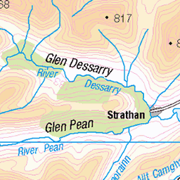
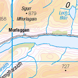
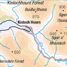
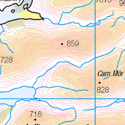
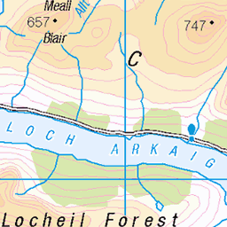
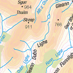
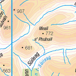
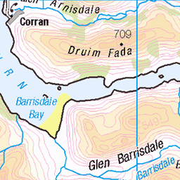
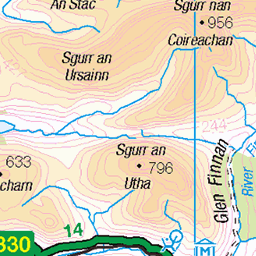
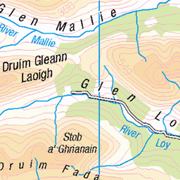
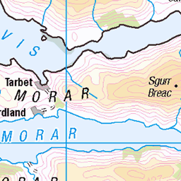
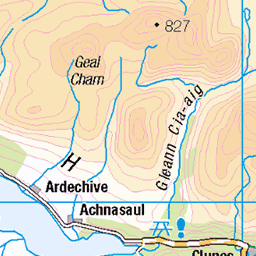
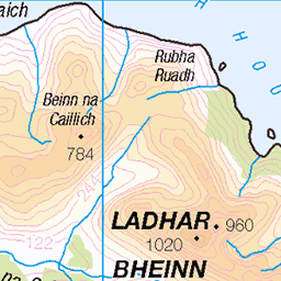
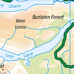
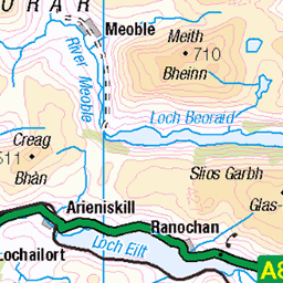
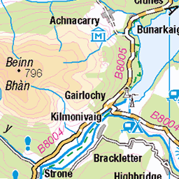
OS Map
This is OS mapping. In some areas, OpenStreetMap shows more footpaths
Spatial NI has online OSNI mapping. Click "Basemap Gallery" (4 squares icon at the top).
Now would be a good time for a cup of tea.

GPX Editor
Record map clicks
Reload map
Photos
Please tag your photos and upload them to the British and Irish Mountains group on Flickr
The other photos have been geo-tagged as on or around the summit. For less busy mountains, it can be a little hit and miss.
Glen Kingie
The remote and wild (often called lonely and desolate) Glen Kingie, sandwiched between Loch Arkaig and Loch Cuaich in the Scottish Highlands. Munro peak Sgurr Mor is up to the left, and the usual route to that peak is through the low point between the hills on the right and across the valley floor.
31-Jul-24 • OutdoorMonkey • flickr
glenkingie glen valley moor moorland grass grassland mountain mountains mountainside hill hillside remote wild wilderness countryside rural outside outdoor nature natural scotland highlands knoydart 53916044016


Videos
ROUTE GUIDE below... • Buy my GUIDEBOOKS here: Scottish Highlands - Hillwalking Guide ...
After leaving the self catering cottage in Glen Dessary we drove to the end of Loch Arkaig and also the end of the road and ...
A kayak across Loch Quoich to bag the Munro Sgurr Mor and it's neighbouring Corbett Sgurr an Fhuarain. A beautiful hot sunny ...
Sgùrr Mòr, from the Loch Quoich dam. Solo Hike #hiking #scotland #munro.
Friday night and i headed to loch Quoich for a overnight stay in the camper van. the night sky was fantastic and the next morning i ...
Notes
- Data: Database of British and Irish Hills v18.2
- Maps: We use OS mapping for England, Scotland, Wales, and the Isle of Man. Sadly, Channel Islands, Northern (OSNI) and Southern Ireland (OSI) mapping isn't available online, so we use Openstreetmap.