Hills of Britain and Ireland
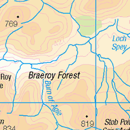
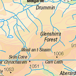
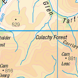
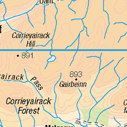
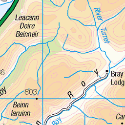
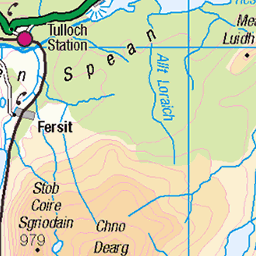
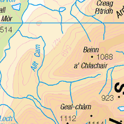
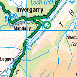
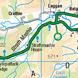
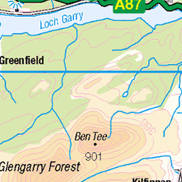
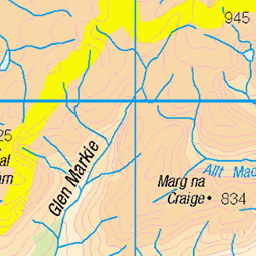
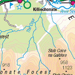
OS Map of Creag Meagaidh
Height: 1128m / 3701ft • Prominence: 868m / 2848ft • Summit : large cairn • Trip reports (hill-bagging)

mad meg's cairn and carn liath
from creag meagaidh
09-Sep-24 • galoot fc • flickr
scotland landscape munro hills 53983568176


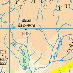
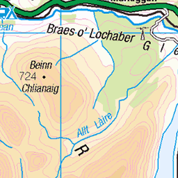
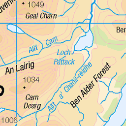
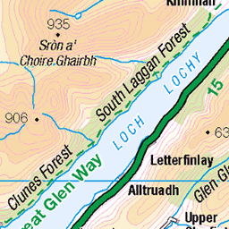
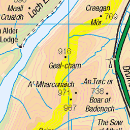
OS Map
This is OS mapping. In some areas, OpenStreetMap shows more footpaths
Spatial NI has online OSNI mapping. Click "Basemap Gallery" (4 squares icon at the top).
Now would be a good time for a cup of tea.

GPX Editor
Record map clicks
Reload map
Photos
Please tag your photos and upload them to the British and Irish Mountains group on Flickr
The other photos have been geo-tagged as on or around the summit. For less busy mountains, it can be a little hit and miss.
mad meg's cairn and carn liath
from creag meagaidh
09-Sep-24 • galoot fc • flickr
scotland landscape munro hills 53983568176


Videos
Creag Meagaidh is an amazing place, an expansive plateau gaurded by some of the most amazing cliffs in Scotland. This walk ...
Creag Meagaidh is an 1130-metre-high Munro towering over Loch Laggan. It is also the name of a range formed by this mountain ...
Nae luck with the weather on Creag Meagaidh. I took a walk along the top of the crags before heading west to the summit.
Tour Scotland short travel video clip, with Scottish music, of Creag Meagaidh, Scottish Gaelic: Creag Mèagaidh, a mountain on the ...
YouTube Channel Contact: Email: ketracell78@gmail.com Chris Stapleton Youtube Channel: ...
Notes
- Data: Database of British and Irish Hills v18.2
- Maps: We use OS mapping for England, Scotland, Wales, and the Isle of Man. Sadly, Channel Islands, Northern (OSNI) and Southern Ireland (OSI) mapping isn't available online, so we use Openstreetmap.