Hills of Britain and Ireland
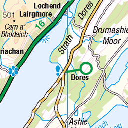
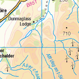
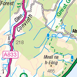
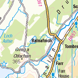
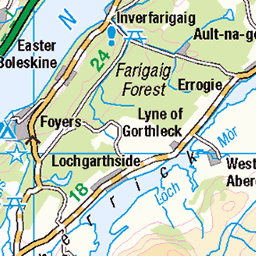
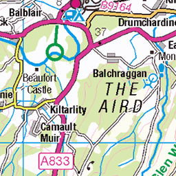
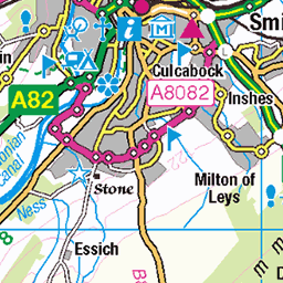
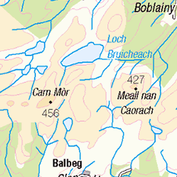
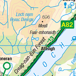
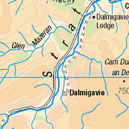
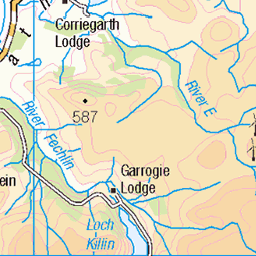
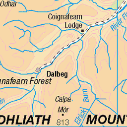
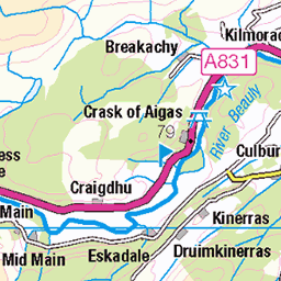
OS Map of Creag nan Clag
Height: 407m / 1335ft • Prominence: 168m / 551ft • Summit : no feature: heather • Trip reports (hill-bagging)

30th October 2024
Loch Ceo Glaiss on a suprisingly rare excusion south of Loch Ness!
30-Oct-24 • Rob Sutherland • flickr
304 54107147253


14th August 2021
Lachlan at Loch Cio Glais just outside Inverness after we took a scenic detour on the way back from the supermarket.
14-Aug-21 • Rob Sutherland • flickr
226 loch cioglais inverness 51377012447

Loch Duntelchaig, Torness, Highlands, Sep 2020
It was a nice day and I was enjoying being out in the countryside. The clouds were moving fast and the water on the loch was a nice shade of blue.
23-Sep-20 • allanmaciver • flickr
loch duntelchaig torness highlands moor clouds countryside rural peace quiet allanmaciver 50695211941

Rural Countryside, Torness, Highlands, Sep 2020
I was on the minor road towards Loch Ruthven from Dores. You might just be able to see the hairpin bends on the the hillside. The sheep lie beside the road and sometimes they get up and walk right in front of the car!! It was a lovely day and I was enjoying the wide open countryside.
23-Sep-20 • allanmaciver • flickr
rural countryside torness dores loch ruthven moor farm sheep trees clouds hazy allanmaciver 50695299972
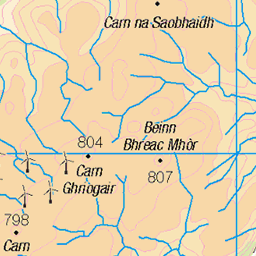
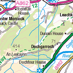
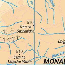
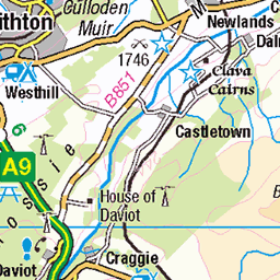
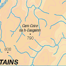
OS Map
This is OS mapping. In some areas, OpenStreetMap shows more footpaths
Spatial NI has online OSNI mapping. Click "Basemap Gallery" (4 squares icon at the top).
Now would be a good time for a cup of tea.


GPX Editor
Record map clicks
Reload map
Photos
Please tag your photos and upload them to the British and Irish Mountains group on Flickr
The other photos have been geo-tagged as on or around the summit. For less busy mountains, it can be a little hit and miss.
30th October 2024
Loch Ceo Glaiss on a suprisingly rare excusion south of Loch Ness!
30-Oct-24 • Rob Sutherland • flickr
304 54107147253
14th August 2021
Lachlan at Loch Cio Glais just outside Inverness after we took a scenic detour on the way back from the supermarket.
14-Aug-21 • Rob Sutherland • flickr
226 loch cioglais inverness 51377012447
Loch Duntelchaig, Torness, Highlands, Sep 2020
It was a nice day and I was enjoying being out in the countryside. The clouds were moving fast and the water on the loch was a nice shade of blue.
23-Sep-20 • allanmaciver • flickr
loch duntelchaig torness highlands moor clouds countryside rural peace quiet allanmaciver 50695211941
Rural Countryside, Torness, Highlands, Sep 2020
I was on the minor road towards Loch Ruthven from Dores. You might just be able to see the hairpin bends on the the hillside. The sheep lie beside the road and sometimes they get up and walk right in front of the car!! It was a lovely day and I was enjoying the wide open countryside.
23-Sep-20 • allanmaciver • flickr
rural countryside torness dores loch ruthven moor farm sheep trees clouds hazy allanmaciver 50695299972


The Abersky Boats ..
.. At Loch Ruthven, Scottish Highlands.
02-Jul-19 • Gordie Broon. • flickr
lochruthven abersky torness scottishhighlands scotland fishingboats browntrout flyfishing invernessshire dalcrombie schottland lago lac le escocia reflections landscape paysage paisaje scenery ecosse scenic sunset tranquil july hills lecoucherdusoleil gordiebroonphotography atardecer rowingboats scozia caledonia alba clouds sky grahamsgunsandfishingtackle inverness geotagged tramonto collines 48297471687

Oostzijde Loch Ness, op weg van Inverness naar Fort Augustus
02-Jan-19 • ruudfwitte • flickr
31658453567

From Dalcrombie.
Looking South East at sunset over Loch Ruthven earlier in the year.
10-Jan-18 • Gordie Broon. • flickr
dalcrombie lochruthven sunset monadhliath hills scotland scottishhighlands schottland view ecosse scenery paysage reflections collines escocia abersky torness field szkocja paisaje colinas hugeln scenic caledonia lago lac trees silhouettes scozia scenario tullich croachy gordiebroonphotography alba atardecer zonsondergang lecoucherdusoleil sonnenuntergang see invernessshire inverness northernscotland winter 2018 heuvels trout fishing sheep ruthven ice geotagged achnabat sonyilce7rm2 sonyfe1635f4zaosslens 40803005564
Videos
None found
Notes
- Data: Database of British and Irish Hills v18.2
- Maps: We use OS mapping for England, Scotland, Wales, and the Isle of Man. Sadly, Channel Islands, Northern (OSNI) and Southern Ireland (OSI) mapping isn't available online, so we use Openstreetmap.