Hills of Britain and Ireland
OS Map of Stac na Cathaig
Height: 446m / 1463ft • Prominence: 213m / 699ft • Summit : rock 3m NE of cairn • Trip reports (hill-bagging)
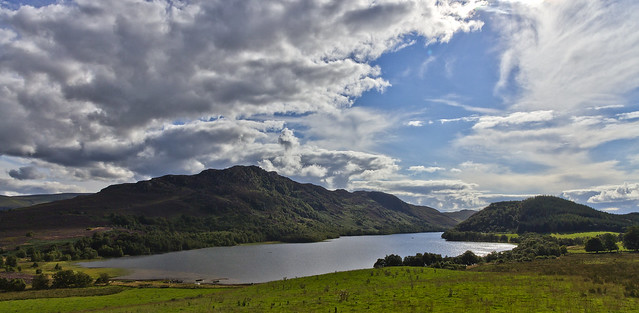
Loch Ruthven
One of Scotland's lesser known but still excellent wild brown trout lochs. A very pretty place to spend a day afloat. Its trout are solid and strong, as I saw when two fishers coming off the water showed me. Must go back with a rod one day soon!
26-Aug-12 • Kilrymont Ian • flickr
landscape scotland fishing scenery highland brownie flyfishing loch trout ruthven lochs daytrip zulu lochside wetfly scottishlochs highlandloch scotlandslochs greatbritishlandscape highlandwildlife lochstyle claretbumble 7873010072

Lichen
Taken on a walk above Loch Ruthven
29-Jan-12 • Adam Fowler • flickr
scotland bokeh lichen loch ruthven inverness 6785199403
OS Map
This is OS mapping. In some areas, OpenStreetMap shows more footpaths
Spatial NI has online OSNI mapping. Click "Basemap Gallery" (4 squares icon at the top).
Now would be a good time for a cup of tea.
GPX Editor
Record map clicks
Reload map
Photos
Please tag your photos and upload them to the British and Irish Mountains group on Flickr
The other photos have been geo-tagged as on or around the summit. For less busy mountains, it can be a little hit and miss.
Loch Ruthven
One of Scotland's lesser known but still excellent wild brown trout lochs. A very pretty place to spend a day afloat. Its trout are solid and strong, as I saw when two fishers coming off the water showed me. Must go back with a rod one day soon!
26-Aug-12 • Kilrymont Ian • flickr
landscape scotland fishing scenery highland brownie flyfishing loch trout ruthven lochs daytrip zulu lochside wetfly scottishlochs highlandloch scotlandslochs greatbritishlandscape highlandwildlife lochstyle claretbumble 7873010072
Lichen
Taken on a walk above Loch Ruthven
29-Jan-12 • Adam Fowler • flickr
scotland bokeh lichen loch ruthven inverness 6785199403
Videos
None found
Notes
- Data: Database of British and Irish Hills v18.2
- Maps: We use OS mapping for England, Scotland, Wales, and the Isle of Man. Sadly, Channel Islands, Northern (OSNI) and Southern Ireland (OSI) mapping isn't available online, so we use Openstreetmap.