Hills of Britain and Ireland
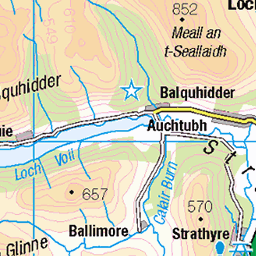
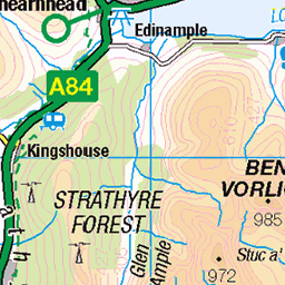
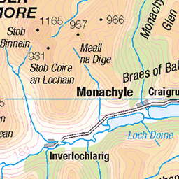
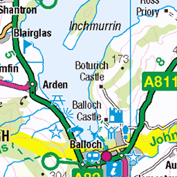
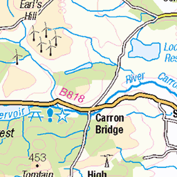
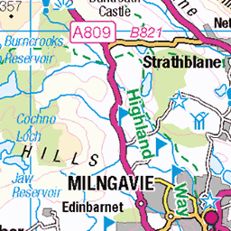
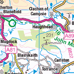
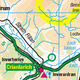
OS Map of Beinn Dearg
Height: 427m / 1401ft • Prominence: 212m / 696ft • Summit : ground 1m S of fence junction • Trip reports (hill-bagging)


Dream Come True, Menteith Hills
Processed with VSCO with e3 preset
15-Jul-22 • Ross Finnie [20Hz] • flickr
52621287433


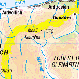
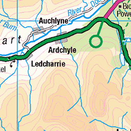
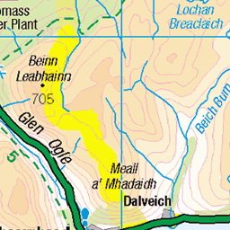
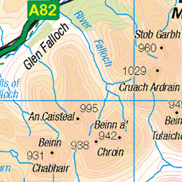
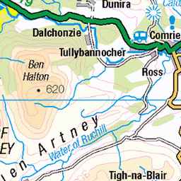
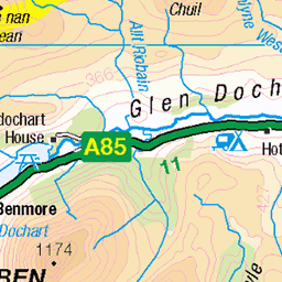
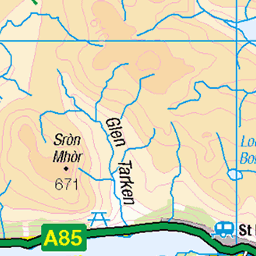
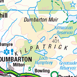
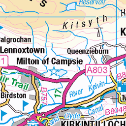
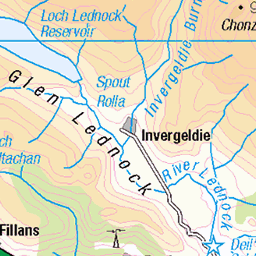
OS Map
This is OS mapping. In some areas, OpenStreetMap shows more footpaths
Spatial NI has online OSNI mapping. Click "Basemap Gallery" (4 squares icon at the top).
Now would be a good time for a cup of tea.
GPX Editor
Record map clicks
Reload map
Photos
Please tag your photos and upload them to the British and Irish Mountains group on Flickr
The other photos have been geo-tagged as on or around the summit. For less busy mountains, it can be a little hit and miss.
Dream Come True, Menteith Hills
Processed with VSCO with e3 preset
15-Jul-22 • Ross Finnie [20Hz] • flickr
52621287433


Videos
Walking in the Trossachs just south of Callander we walk up Ben Gullipen and then across marshland to Beinn Dearg, taking a ...
In his final trip of 2021 Douglas visited Loch Katrine to hike the Primrose Hill trail. This superb way-marked trail runs high through ...
After a significant time away from the mountains and recovering from an injury Alistair hiked Ben A'an to see how he would fair on ...
Well, winter took its sweet time getting here but after a snowy trudge up Ben Venue I finally feel as though my winter walking ...
Float planes, glass like conditions, fishing... what a fantastic day out on Loch Lubnaig.
Notes
- Data: Database of British and Irish Hills v18.2
- Maps: We use OS mapping for England, Scotland, Wales, and the Isle of Man. Sadly, Channel Islands, Northern (OSNI) and Southern Ireland (OSI) mapping isn't available online, so we use Openstreetmap.