Hills of Britain and Ireland
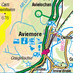
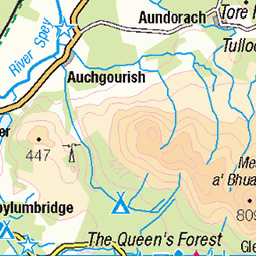
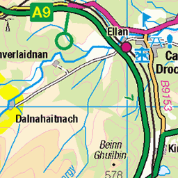
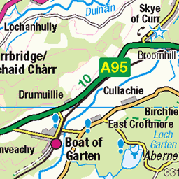
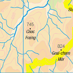
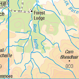
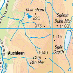
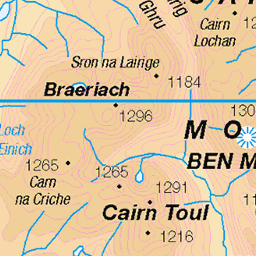
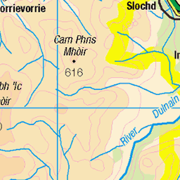
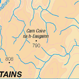
OS Map of Ord Ban
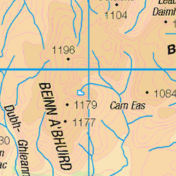
Height: 429m / 1407ft • Prominence: 167m / 548ft • Summit : rock 1m W of trig point • Trip reports (hill-bagging)


Loch Gamnha, Rothiemurchus, Scotland
© All rights reserved
12-Dec-24 • David May • flickr
scotland rothiemurchus cairngorms national park winter remote ice cold スコットランド écosse soe skottland skotlanti skotland scozia schottland schotland loch landscape highlands explore escocia elite alba ngc 54200459989


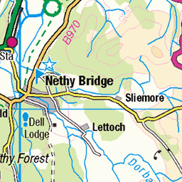
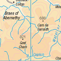
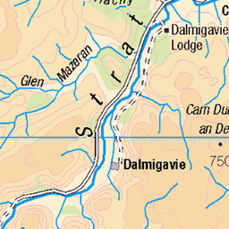
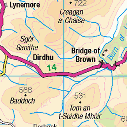
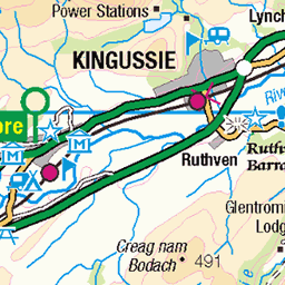
OS Map
This is OS mapping. In some areas, OpenStreetMap shows more footpaths
Spatial NI has online OSNI mapping. Click "Basemap Gallery" (4 squares icon at the top).
Now would be a good time for a cup of tea.
GPX Editor
Record map clicks
Reload map
Photos
Please tag your photos and upload them to the British and Irish Mountains group on Flickr
The other photos have been geo-tagged as on or around the summit. For less busy mountains, it can be a little hit and miss.
Loch Gamnha, Rothiemurchus, Scotland
© All rights reserved
12-Dec-24 • David May • flickr
scotland rothiemurchus cairngorms national park winter remote ice cold スコットランド écosse soe skottland skotlanti skotland scozia schottland schotland loch landscape highlands explore escocia elite alba ngc 54200459989


“Nuts”, Cairngorms, Scotland
A very, very unkind soul once said that grey squirrels are like rats with a good PR man. Absolutely does not refer to the beautiful red squirrels that populate much of the Cairngorm woodlands. © All nuts reserved
26-Dec-21 • David May • flickr
scotland cairngorms loch an eilean red squirrel nuts iconic wildlife スコットランド écosse soe skottland skotlanti skotland scozia schottland schotland ngc highlands explore escocia elite alba rothiemurchus national park 54193696056

609 Ord Ban a
07-Jun-18 • Dugswell2 • flickr
trigpoint vanessatrig 10767 oldbantrigpoint oldban p166 tump marilyn hump 43568758751

609 Ord Ban
Name:Ord Ban Hill number:609 Height:428m / 1404ft RHB Section:08A: Cairngorms County/UA:Highland (UA) Catchment:Spey Class:Marilyn, Hump, Tump (400-499m) Grid ref:NH 89171 08520 Summit feature:rock 1m W of trig point Drop:166m Col:262m NH885075
07-Jun-18 • Dugswell2 • flickr
trigpoint vanessatrig 10767 oldbantrigpoint oldban p166 tump marilyn hump 29697745448

609 Ord Ban c
07-Jun-18 • Dugswell2 • flickr
trigpoint vanessatrig 10767 oldbantrigpoint oldban p166 tump marilyn hump 43522367962

609 Ord Ban d
Grid reference : NH 89169 08530 Type : Pillar Condition : Good Flush Bracket : 10767 OSGB36 Station : NH90/DM/3 Current use : none Historic use : Secondary T:UK waypoint : TP5236 County : Highland Region Nearest town : KINGUSSIE
07-Jun-18 • Dugswell2 • flickr
trigpoint vanessatrig 10767 oldbantrigpoint oldban p166 tump marilyn hump 43522382102
Videos
A short hike from the Forest Cottage, Ord Ban affords spectacular views of Loch en Eilein, the Cairngorm Mountain Range, and ...
Exploring Aviemore & Rothiemurchus in Scotland. Aviemore is conveniently located, just off the A9, around 30 miles south east of ...
trailrunning #runningvlog #goprohero8 Weekly Trail Runs #9 - A 2nd upload per week every Friday, logging some of my weekly ...
Notes
- Data: Database of British and Irish Hills v18.2
- Maps: We use OS mapping for England, Scotland, Wales, and the Isle of Man. Sadly, Channel Islands, Northern (OSNI) and Southern Ireland (OSI) mapping isn't available online, so we use Openstreetmap.