Hills of Britain and Ireland
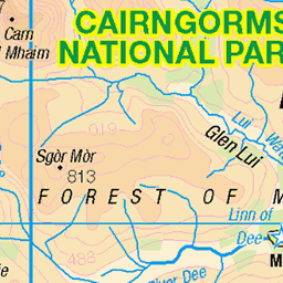
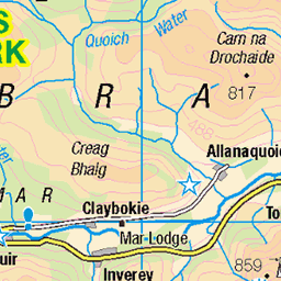
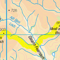
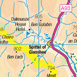
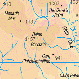
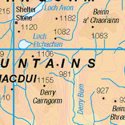
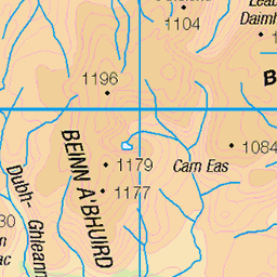
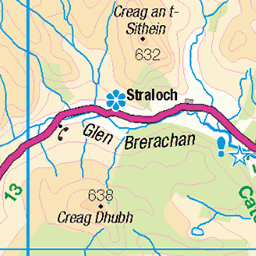
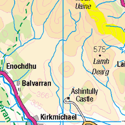
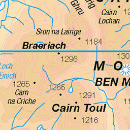
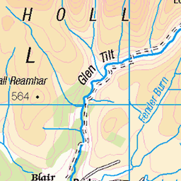
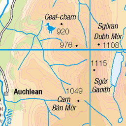
OS Map of Carn Bhac South Top
Height: 818m / 2682ft • Prominence: 31m / 102ft • Summit : no feature: heather • Trip reports (hill-bagging)


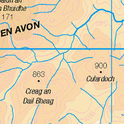
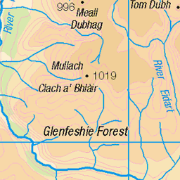
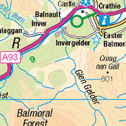
OS Map
This is OS mapping. In some areas, OpenStreetMap shows more footpaths
Spatial NI has online OSNI mapping. Click "Basemap Gallery" (4 squares icon at the top).
Now would be a good time for a cup of tea.
GPX Editor
Record map clicks
Reload map
Photos
Please tag your photos and upload them to the British and Irish Mountains group on Flickr
The other photos have been geo-tagged as on or around the summit. For less busy mountains, it can be a little hit and miss.

P19 Ford on Allt Beinn Iutharn
This burn has to forded in remote country to gain the lower glen towards Glen Ey.
30-Apr-10 • Grahamtravels • flickr
6285919111

P20 View W into Beinn Iutharns
A view opens up towards the Beinn Iutharns, a group of Munros at the head of Glen Ey.
30-Apr-10 • Grahamtravels • flickr
6285920473

The Allt a' Ghlinne Bhig
11-Apr-10 • Nick Bramhall • flickr
mountains landscape scotland raw cairngorms 4516292502

Below Beinn Iutharn Mhor
11-Apr-10 • Nick Bramhall • flickr
mountains landscape scotland raw cairngorms 4516297842
Videos
Ascent of the Munro Carn Bhac from Inverey, wild camping the night before near the ruined Altanour Lodge. The prolonged ...
Starting from Dalmunzie Castle Hotel where you can park for £2, we walked up to Loch Nan Eun and setup camp. We then ticked ...
Notes
- Data: Database of British and Irish Hills v18.2
- Maps: We use OS mapping for England, Scotland, Wales, and the Isle of Man. Sadly, Channel Islands, Northern (OSNI) and Southern Ireland (OSI) mapping isn't available online, so we use Openstreetmap.