Hills of Britain and Ireland
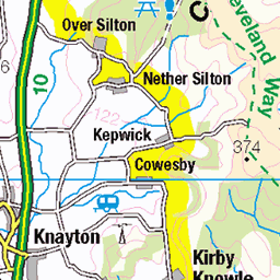
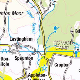
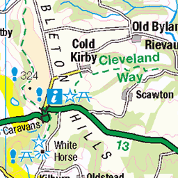
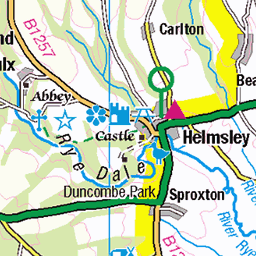
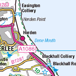
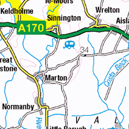
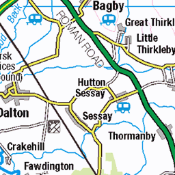
OS Map of Quarry Hill
Height: 100m / 328ft • Prominence: 13m / 43ft • Summit : ground at S fence of copse • Trip reports (hill-bagging)


Mute Swan 7
31-Dec-23 • wickensmurray • flickr
british bird nature wildlife canon sigma muteswan 54037306149

Mute Swan 8
31-Dec-23 • wickensmurray • flickr
british bird nature wildlife canon sigma muteswan 54033641402

Mute Swan 9
31-Dec-23 • wickensmurray • flickr
british bird nature wildlife canon sigma muteswan 54037239203
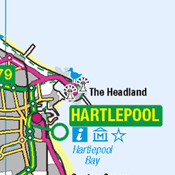
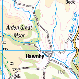
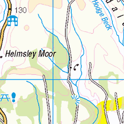
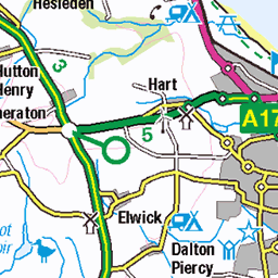
OS Map
This is OS mapping. In some areas, OpenStreetMap shows more footpaths
Spatial NI has online OSNI mapping. Click "Basemap Gallery" (4 squares icon at the top).
Now would be a good time for a cup of tea.


GPX Editor
Record map clicks
Reload map
Photos
Please tag your photos and upload them to the British and Irish Mountains group on Flickr
The other photos have been geo-tagged as on or around the summit. For less busy mountains, it can be a little hit and miss.
Mute Swan 7
31-Dec-23 • wickensmurray • flickr
british bird nature wildlife canon sigma muteswan 54037306149
Mute Swan 8
31-Dec-23 • wickensmurray • flickr
british bird nature wildlife canon sigma muteswan 54033641402
Mute Swan 9
31-Dec-23 • wickensmurray • flickr
british bird nature wildlife canon sigma muteswan 54037239203

Snow Goose 1
31-Dec-23 • wickensmurray • flickr
british bird nature wildlife canon sigma goose 54038536182

Chinese Goose 2
31-Dec-23 • wickensmurray • flickr
british bird nature wildlife canon sigma chinesegoose 54041548136

Chinese Goose 3
31-Dec-23 • wickensmurray • flickr
british bird nature wildlife canon sigma chinesegoose 54041994055

Snow Goose 2
31-Dec-23 • wickensmurray • flickr
british bird nature wildlife canon sigma goose 54039656708
Videos
This is just a little video of us Exploring some Caves we came across when we had a walk around Roseberry Topping. The first ...
A walk upto Highcliffe Nab in Guisborough. Then Along to Roseberry Topping.
https://www.youtube.com/watch?v=x9legL2H4Ng Click above to watch previous video. Click SUBSCRIBE to see more of my ...
Teeside was well know for its mining in the hills of Eston. Some of the old mining days history are still left on the hills in Teeside ...
An unexpected trip to walk a section of the Cleveland Way, from Captain Cooks Monument to Roseberry Topping. Superb scenery ...
Notes
- Data: Database of British and Irish Hills v18.2
- Maps: We use OS mapping for England, Scotland, Wales, and the Isle of Man. Sadly, Channel Islands, Northern (OSNI) and Southern Ireland (OSI) mapping isn't available online, so we use Openstreetmap.