Hills of Britain and Ireland
OS Map of Higher Newford
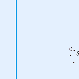
Height: 51m / 167ft • Prominence: 51m / 167ft • Summit : no feature: 3m from wall on W side of road • Trip reports (hill-bagging)

Common Snipe (Gallinago Gallinago)
Common Snipe on Lower Moors nature reserve on ST Mary's Isles Of Scilly ,Cornwall, the snipe had come in front of the to feed after a short heavy rainstorm, as i was in the hide while the rain storm passed over,
16-Oct-24 • S H JOHNSON 1980 • flickr
nikond500 sigma150600mm islesofscilly 16102024 bird nature cornwall stmarys wildlife gallinagogallinago ybs24nature 54183671403


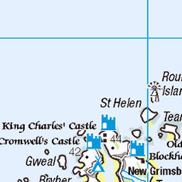
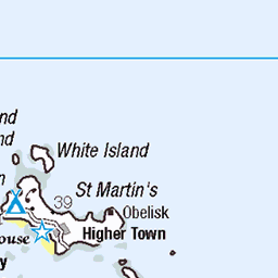
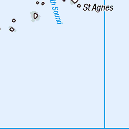
OS Map
This is OS mapping. In some areas, OpenStreetMap shows more footpaths
Spatial NI has online OSNI mapping. Click "Basemap Gallery" (4 squares icon at the top).
Now would be a good time for a cup of tea.


GPX Editor
Record map clicks
Reload map
Photos
Please tag your photos and upload them to the British and Irish Mountains group on Flickr
The other photos have been geo-tagged as on or around the summit. For less busy mountains, it can be a little hit and miss.
Common Snipe (Gallinago Gallinago)
Common Snipe on Lower Moors nature reserve on ST Mary's Isles Of Scilly ,Cornwall, the snipe had come in front of the to feed after a short heavy rainstorm, as i was in the hide while the rain storm passed over,
16-Oct-24 • S H JOHNSON 1980 • flickr
nikond500 sigma150600mm islesofscilly 16102024 bird nature cornwall stmarys wildlife gallinagogallinago ybs24nature 54183671403


Common Snipe
16-Oct-21 • Ted Smith 574 • flickr
islesofscilly england unitedkingdom common snipe wildlife bird nature reflection 54344969234

5507 Higher Newford
Bagged with Jon Metcalf, Rob Woodall and Adrian Rayner's jacket on a multi-TUMP and bench mark tour of the island. Name:Higher Newford Hill number:5507 Height:51m / 167ft Parent (Ma):none Section:40: Cornwall & Devon County/UA:Isles of Scilly (UA) Maritime Area:Isles of Scilly Island:St Mary's Class:Tump (0-99m), Current County/UA Top, SIB Grid ref:SV 91228 12060 Summit feature:no feature: 3m from wall on W side of road Drop:51m Col:Sea
01-Jul-16 • Dugswell2 • flickr
highernewford tump sib p51 islesofscilly stmarys 28569124532
Videos
None found
Notes
- Data: Database of British and Irish Hills v18.2
- Maps: We use OS mapping for England, Scotland, Wales, and the Isle of Man. Sadly, Channel Islands, Northern (OSNI) and Southern Ireland (OSI) mapping isn't available online, so we use Openstreetmap.