Hills of Britain and Ireland
OS Map of Kerloch
Height: 534m / 1752ft • Prominence: 181m / 594ft • Summit : trig point • Trip reports (hill-bagging)


View from Kerloch
The glow is the city of Aberdeen. The red lights are Durris Mast on the next hill along. At 322m it's the tallest structure in Scotland.
11-Feb-23 • We travel the Spaceways • flickr
52684054759
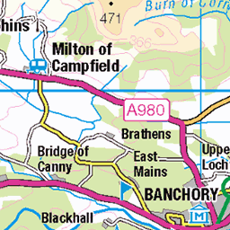
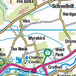
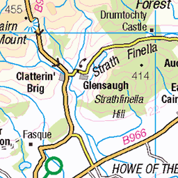
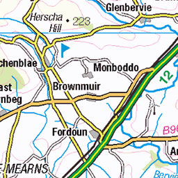
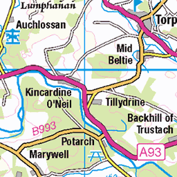
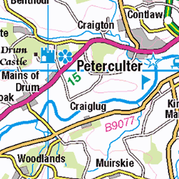
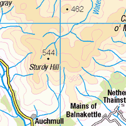
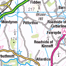
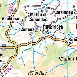
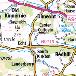
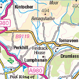
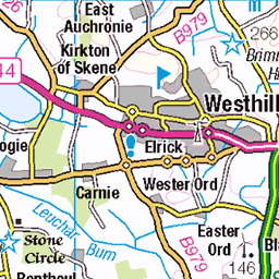
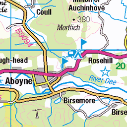
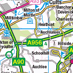
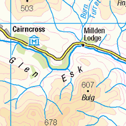
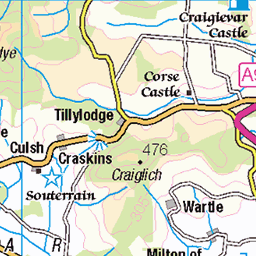
OS Map
This is OS mapping. In some areas, OpenStreetMap shows more footpaths
Spatial NI has online OSNI mapping. Click "Basemap Gallery" (4 squares icon at the top).
Now would be a good time for a cup of tea.

GPX Editor
Record map clicks
Reload map
Photos
Please tag your photos and upload them to the British and Irish Mountains group on Flickr
The other photos have been geo-tagged as on or around the summit. For less busy mountains, it can be a little hit and miss.
View from Kerloch
The glow is the city of Aberdeen. The red lights are Durris Mast on the next hill along. At 322m it's the tallest structure in Scotland.
11-Feb-23 • We travel the Spaceways • flickr
52684054759

Kerloch
First time up after sunset. It was dark!
11-Feb-23 • We travel the Spaceways • flickr
52684198575


Evening on Kerloch
Today's the last day of our sunny spell, the rain's coming tomorrow.
25-Apr-21 • We travel the Spaceways • flickr
51138431801

Videos
View of Kerloch looking from Banchory.
Walk up Kerloch Hill 534M from Bridge of Bogendreip. Lots of Forestry. About 10 miles in all ..Found it tough on my feet, but no ...
Banchory.. Kerloch Fliers Club in field..
super afternoon at knockburn watching and flying RC planes.
2 DJI mavic minis, one small Hubsan and small piper rc plane +Stone Circle and views of distant Ben Avon and Clachnaben.
Notes
- Data: Database of British and Irish Hills v18.2
- Maps: We use OS mapping for England, Scotland, Wales, and the Isle of Man. Sadly, Channel Islands, Northern (OSNI) and Southern Ireland (OSI) mapping isn't available online, so we use Openstreetmap.