Hills of Britain and Ireland
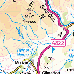
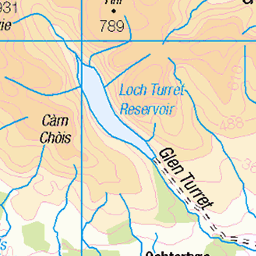
OS Map of Commonedge Hill
Height: 468m / 1535ft • Prominence: 135m / 443ft • Summit : cairn partly buried in grass • Trip reports (hill-bagging)

CastlehillReservoir-21111606
Castlehill Reservoir
16-Nov-21 • Lee Live: Photographer (Personal) • flickr
businessphotographerinedinburgh castlehillreservoir dollar geordieswood glendevonwoodlands glenqueyreservoir leelivephotographer woodlandtrustscotland scotland unitedkingdom 51683302607

CastlehillReservoir-21111607
Castlehill Reservoir
16-Nov-21 • Lee Live: Photographer (Personal) • flickr
businessphotographerinedinburgh castlehillreservoir dollar geordieswood glendevonwoodlands glenqueyreservoir leelivephotographer woodlandtrustscotland scotland unitedkingdom 51684088351

CastlehillReservoir-21111609
Castlehill Reservoir
16-Nov-21 • Lee Live: Photographer (Personal) • flickr
aerialphotography birdseyeview businessphotographerinedinburgh castlehillreservoir commercialdronepilot djimini2 dollar drone dronevideography edinburgh geordieswood glendevonwoodlands glenqueyreservoir highangle leelivephotographer leelivephotography licenceddroneoperator midlothian ourdreamphotography overhead scotland videographer woodlandtrustscotland unitedkingdom 51684989910

CastlehillReservoir-21111610
Castlehill Reservoir
16-Nov-21 • Lee Live: Photographer (Personal) • flickr
aerialphotography birdseyeview businessphotographerinedinburgh castlehillreservoir commercialdronepilot djimini2 dollar drone dronevideography edinburgh geordieswood glendevonwoodlands glenqueyreservoir highangle leelivephotographer leelivephotography licenceddroneoperator midlothian ourdreamphotography overhead scotland videographer woodlandtrustscotland unitedkingdom 51684087876

CastlehillReservoir-21111611
Castlehill Reservoir
16-Nov-21 • Lee Live: Photographer (Personal) • flickr
aerialphotography birdseyeview businessphotographerinedinburgh castlehillreservoir commercialdronepilot djimini2 dollar drone dronevideography edinburgh geordieswood glendevonwoodlands glenqueyreservoir highangle leelivephotographer leelivephotography licenceddroneoperator midlothian ourdreamphotography overhead scotland videographer woodlandtrustscotland unitedkingdom 51684360973

CastlehillReservoir-21111612
Castlehill Reservoir
16-Nov-21 • Lee Live: Photographer (Personal) • flickr
aerialphotography birdseyeview businessphotographerinedinburgh castlehillreservoir commercialdronepilot djimini2 dollar drone dronevideography edinburgh geordieswood glendevonwoodlands glenqueyreservoir highangle leelivephotographer leelivephotography licenceddroneoperator midlothian ourdreamphotography overhead scotland videographer woodlandtrustscotland unitedkingdom 51683301802
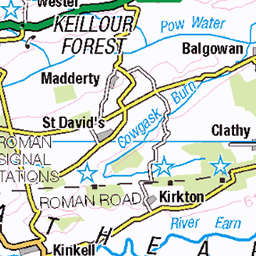
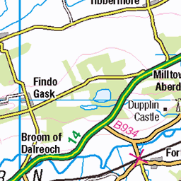
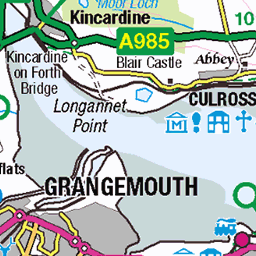
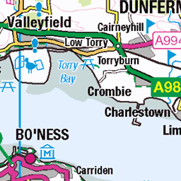
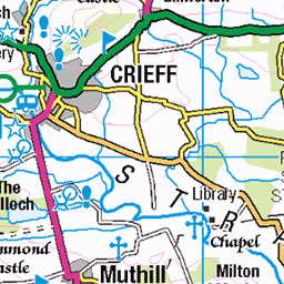
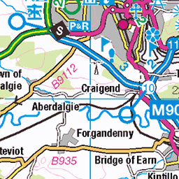
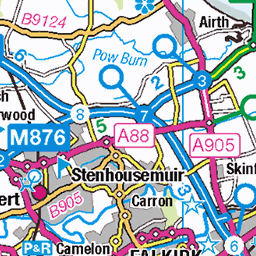
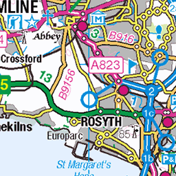
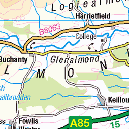
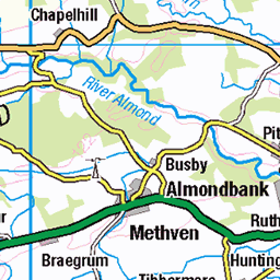
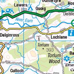
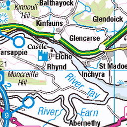
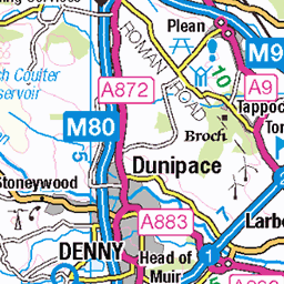
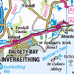
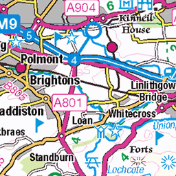
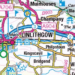
OS Map
This is OS mapping. In some areas, OpenStreetMap shows more footpaths
Spatial NI has online OSNI mapping. Click "Basemap Gallery" (4 squares icon at the top).
Now would be a good time for a cup of tea.
GPX Editor
Record map clicks
Reload map
Photos
Please tag your photos and upload them to the British and Irish Mountains group on Flickr
The other photos have been geo-tagged as on or around the summit. For less busy mountains, it can be a little hit and miss.
CastlehillReservoir-21111606
Castlehill Reservoir
16-Nov-21 • Lee Live: Photographer (Personal) • flickr
businessphotographerinedinburgh castlehillreservoir dollar geordieswood glendevonwoodlands glenqueyreservoir leelivephotographer woodlandtrustscotland scotland unitedkingdom 51683302607
CastlehillReservoir-21111607
Castlehill Reservoir
16-Nov-21 • Lee Live: Photographer (Personal) • flickr
businessphotographerinedinburgh castlehillreservoir dollar geordieswood glendevonwoodlands glenqueyreservoir leelivephotographer woodlandtrustscotland scotland unitedkingdom 51684088351
CastlehillReservoir-21111609
Castlehill Reservoir
16-Nov-21 • Lee Live: Photographer (Personal) • flickr
aerialphotography birdseyeview businessphotographerinedinburgh castlehillreservoir commercialdronepilot djimini2 dollar drone dronevideography edinburgh geordieswood glendevonwoodlands glenqueyreservoir highangle leelivephotographer leelivephotography licenceddroneoperator midlothian ourdreamphotography overhead scotland videographer woodlandtrustscotland unitedkingdom 51684989910
CastlehillReservoir-21111610
Castlehill Reservoir
16-Nov-21 • Lee Live: Photographer (Personal) • flickr
aerialphotography birdseyeview businessphotographerinedinburgh castlehillreservoir commercialdronepilot djimini2 dollar drone dronevideography edinburgh geordieswood glendevonwoodlands glenqueyreservoir highangle leelivephotographer leelivephotography licenceddroneoperator midlothian ourdreamphotography overhead scotland videographer woodlandtrustscotland unitedkingdom 51684087876
CastlehillReservoir-21111611
Castlehill Reservoir
16-Nov-21 • Lee Live: Photographer (Personal) • flickr
aerialphotography birdseyeview businessphotographerinedinburgh castlehillreservoir commercialdronepilot djimini2 dollar drone dronevideography edinburgh geordieswood glendevonwoodlands glenqueyreservoir highangle leelivephotographer leelivephotography licenceddroneoperator midlothian ourdreamphotography overhead scotland videographer woodlandtrustscotland unitedkingdom 51684360973
CastlehillReservoir-21111612
Castlehill Reservoir
16-Nov-21 • Lee Live: Photographer (Personal) • flickr
aerialphotography birdseyeview businessphotographerinedinburgh castlehillreservoir commercialdronepilot djimini2 dollar drone dronevideography edinburgh geordieswood glendevonwoodlands glenqueyreservoir highangle leelivephotographer leelivephotography licenceddroneoperator midlothian ourdreamphotography overhead scotland videographer woodlandtrustscotland unitedkingdom 51683301802

CastlehillReservoir-21111613
Castlehill Reservoir
16-Nov-21 • Lee Live: Photographer (Personal) • flickr
aerialphotography birdseyeview businessphotographerinedinburgh castlehillreservoir commercialdronepilot djimini2 dollar drone dronevideography edinburgh geordieswood glendevonwoodlands glenqueyreservoir highangle leelivephotographer leelivephotography licenceddroneoperator midlothian ourdreamphotography overhead scotland videographer woodlandtrustscotland unitedkingdom 51684989525

CastlehillReservoir-21111614
Castlehill Reservoir
16-Nov-21 • Lee Live: Photographer (Personal) • flickr
aerialphotography birdseyeview businessphotographerinedinburgh castlehillreservoir commercialdronepilot djimini2 dollar drone dronevideography edinburgh geordieswood glendevonwoodlands glenqueyreservoir highangle leelivephotographer leelivephotography licenceddroneoperator midlothian ourdreamphotography overhead scotland videographer woodlandtrustscotland unitedkingdom 51684087526

CastlehillReservoir-21111615
Castlehill Reservoir
16-Nov-21 • Lee Live: Photographer (Personal) • flickr
aerialphotography birdseyeview businessphotographerinedinburgh castlehillreservoir commercialdronepilot djimini2 dollar drone dronevideography edinburgh geordieswood glendevonwoodlands glenqueyreservoir highangle leelivephotographer leelivephotography licenceddroneoperator midlothian ourdreamphotography overhead scotland videographer woodlandtrustscotland unitedkingdom 51683301512

CastlehillReservoir-21111616
Castlehill Reservoir
16-Nov-21 • Lee Live: Photographer (Personal) • flickr
aerialphotography birdseyeview businessphotographerinedinburgh castlehillreservoir commercialdronepilot djimini2 dollar drone dronevideography edinburgh geordieswood glendevonwoodlands glenqueyreservoir highangle leelivephotographer leelivephotography licenceddroneoperator midlothian ourdreamphotography overhead scotland videographer woodlandtrustscotland unitedkingdom 51683301432
Videos
Glen Quey - Seamab Hill Loop. Ochil Hills mountain biking. Glendevon MTB. Dollar MTB trails. Drone MTB video. Perth & Kinross.
Glen Quey - Seamab Hill Loop. Drone MTB Follow. Ochil Hills mountain biking. Glendevon MTB. Drone Tracking MTB.
Good news about the lost dog. Luna was reunited with her owner the day after my walk. A circular route of 11 miles starting and ...
I Must Share This Wonderful MTB trail in Scotland. Glen Quey - Seamab Hill. 3D Route Map. STRAVA GPX INCLUDED.
Notes
- Data: Database of British and Irish Hills v18.2
- Maps: We use OS mapping for England, Scotland, Wales, and the Isle of Man. Sadly, Channel Islands, Northern (OSNI) and Southern Ireland (OSI) mapping isn't available online, so we use Openstreetmap.