Hills of Britain and Ireland
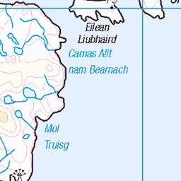
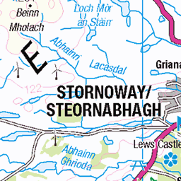
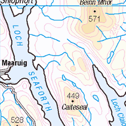
OS Map of Caitiosbhal
Height: 146m / 480ft • Prominence: 120m / 394ft • Summit : pile of stones • Trip reports (hill-bagging)


Tabhaigh Mhòr
In Loch Erisort. Photo taken from Marvig.
27-Feb-25 • Bays of Harris • flickr
54354636886


Marvig
With sunlight highlighting Tabhaigh Mhòr in Loch Erisort
27-Feb-25 • Bays of Harris • flickr
54354636221
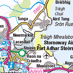
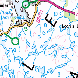
OS Map
This is OS mapping. In some areas, OpenStreetMap shows more footpaths
Spatial NI has online OSNI mapping. Click "Basemap Gallery" (4 squares icon at the top).
Now would be a good time for a cup of tea.


GPX Editor
Record map clicks
Reload map
Photos
Please tag your photos and upload them to the British and Irish Mountains group on Flickr
The other photos have been geo-tagged as on or around the summit. For less busy mountains, it can be a little hit and miss.
Tabhaigh Mhòr
In Loch Erisort. Photo taken from Marvig.
27-Feb-25 • Bays of Harris • flickr
54354636886
Marvig
With sunlight highlighting Tabhaigh Mhòr in Loch Erisort
27-Feb-25 • Bays of Harris • flickr
54354636221


4951 Caitiosbhal
Parked to the north of this scenic coastal HuMP to leave less than 0.75 Km to the summit. Name:Caitiosbhal Hill number:4951 Height:146m / 479ft Parent (Ma/M):1584 Beinn Bhreac Section:24A: Lewis and Nearby Islands County/UA:Na h-Eileanan Siar [Western Isles] (UA) Island:Lewis and Harris Class:HuMP, Tump (100-199m) Grid ref:NB 40686 17787 Summit feature:pile of stones Drop:121m Col:25m NB359158
16-Sep-14 • Dugswell2 • flickr
hump isleoflewis p121 caitiosbhal 15329788388

4951 Caitiosbhal a
Name:Caitiosbhal Hill number:4951 Height:146m / 479ft Parent (Ma/M):1584 Beinn Bhreac Section:24A: Lewis and Nearby Islands County/UA:Na h-Eileanan Siar [Western Isles] (UA) Island:Lewis and Harris Class:HuMP, Tump (100-199m) Grid ref:NB 40686 17787 Summit feature:pile of stones Drop:121m Col:25m NB359158
16-Sep-14 • Dugswell2 • flickr
hump isleoflewis p121 caitiosbhal 15516049482
Videos
None found
Notes
- Data: Database of British and Irish Hills v18.2
- Maps: We use OS mapping for England, Scotland, Wales, and the Isle of Man. Sadly, Channel Islands, Northern (OSNI) and Southern Ireland (OSI) mapping isn't available online, so we use Openstreetmap.