Hills of Britain and Ireland
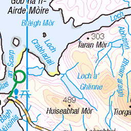
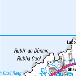
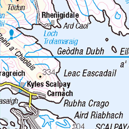
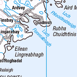
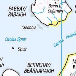
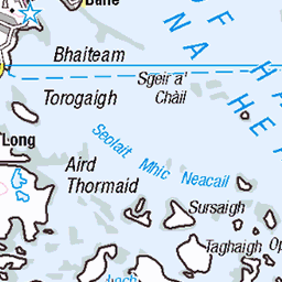
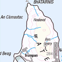
OS Map of Sron ri Gaoith

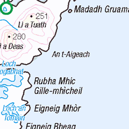
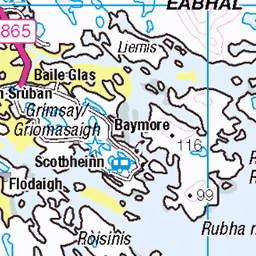
4939 Sron ri Gaoith
Walked in from road to east on track initially then off piste to Oirchleit,then on to Sron ri Gaoith then contoured back to Direadh Beinn via the beach then across to Oileasail to complete my Isle of Lewis HuMPs. Back done the ridge of Oileasail to track nd then car. Name: Sron ri Gaoith Hill number:4939 Height:253m / 830ft Parent (Ma):1567 Suaineabhal [Suainaval] Section:24A: Lewis and Nearby Islands County/UA:Na h-Eileanan Siar [Western Isles] (UA) Island:Lewis and Harris Class:Hump, Tump (200-299m) Grid ref:NB 07512 29118 Summit feature:outcrop Drop:124m Col:129m NB080290
12-Jun-16 • Dugswell2 • flickr
isleoflewis hump tump p124 sronrigaoith 28770643911

4939 Sron ri Gaoith a
12-Jun-16 • Dugswell2 • flickr
isleoflewis hump tump p124 sronrigaoith 28846619915

4939 Sron ri Gaoith c
12-Jun-16 • Dugswell2 • flickr
isleoflewis hump tump p124 sronrigaoith 28231731183

4939 Sron ri Gaoith
A view down Loch Suaineabhal towards Sron ri Gaoith. Name:Sron ri Gaoith Hill number:4939 Height:253m / 830ft Parent (Ma/M):1567 Suaineabhal [Suainaval] Section:24A: Lewis and Nearby Islands County/UA:Na h-Eileanan Siar [Western Isles] (UA) Island:Lewis and Harris Class:HuMP, Tump (200-299m) Grid ref:NB 07512 29118 Summit feature:outcrop Drop:124m Col:129m NB080290
20-Sep-14 • Dugswell2 • flickr
hump isleoflewis p124 sronrigaoith lochsuaineabhal 15517309872

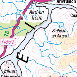
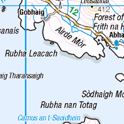
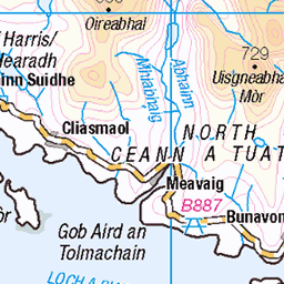
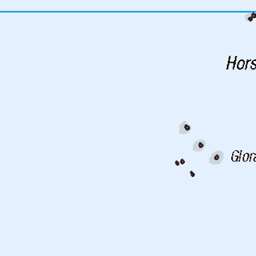
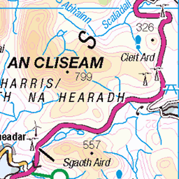
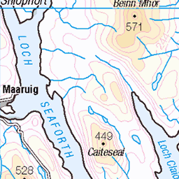
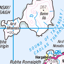
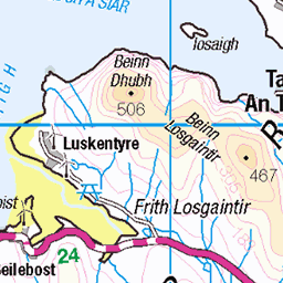
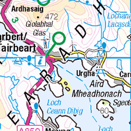
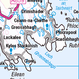
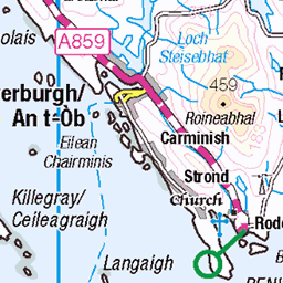
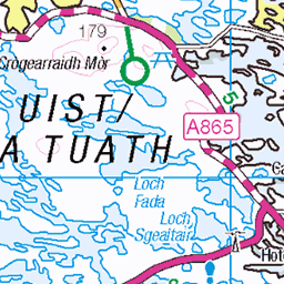
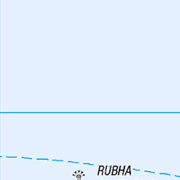
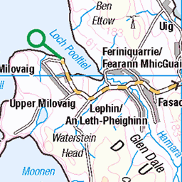
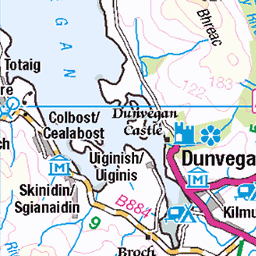
OS Map
This is OS mapping. In some areas, OpenStreetMap shows more footpaths
Spatial NI has online OSNI mapping. Click "Basemap Gallery" (4 squares icon at the top).
Now would be a good time for a cup of tea.


GPX Editor
Record map clicks
Reload map
Photos
Please tag your photos and upload them to the British and Irish Mountains group on Flickr
The other photos have been geo-tagged as on or around the summit. For less busy mountains, it can be a little hit and miss.
4939 Sron ri Gaoith
Walked in from road to east on track initially then off piste to Oirchleit,then on to Sron ri Gaoith then contoured back to Direadh Beinn via the beach then across to Oileasail to complete my Isle of Lewis HuMPs. Back done the ridge of Oileasail to track nd then car. Name: Sron ri Gaoith Hill number:4939 Height:253m / 830ft Parent (Ma):1567 Suaineabhal [Suainaval] Section:24A: Lewis and Nearby Islands County/UA:Na h-Eileanan Siar [Western Isles] (UA) Island:Lewis and Harris Class:Hump, Tump (200-299m) Grid ref:NB 07512 29118 Summit feature:outcrop Drop:124m Col:129m NB080290
12-Jun-16 • Dugswell2 • flickr
isleoflewis hump tump p124 sronrigaoith 28770643911
4939 Sron ri Gaoith a
12-Jun-16 • Dugswell2 • flickr
isleoflewis hump tump p124 sronrigaoith 28846619915
4939 Sron ri Gaoith c
12-Jun-16 • Dugswell2 • flickr
isleoflewis hump tump p124 sronrigaoith 28231731183
4939 Sron ri Gaoith
A view down Loch Suaineabhal towards Sron ri Gaoith. Name:Sron ri Gaoith Hill number:4939 Height:253m / 830ft Parent (Ma/M):1567 Suaineabhal [Suainaval] Section:24A: Lewis and Nearby Islands County/UA:Na h-Eileanan Siar [Western Isles] (UA) Island:Lewis and Harris Class:HuMP, Tump (200-299m) Grid ref:NB 07512 29118 Summit feature:outcrop Drop:124m Col:129m NB080290
20-Sep-14 • Dugswell2 • flickr
hump isleoflewis p124 sronrigaoith lochsuaineabhal 15517309872
Videos
None found
Notes
- Data: Database of British and Irish Hills v18.2
- Maps: We use OS mapping for England, Scotland, Wales, and the Isle of Man. Sadly, Channel Islands, Northern (OSNI) and Southern Ireland (OSI) mapping isn't available online, so we use Openstreetmap.