Hills of Britain and Ireland
OS Map of Island Davaar
Height: 115m / 377ft • Prominence: 114m / 374ft • Summit : rock 35m ENE of trig point • Trip reports (hill-bagging)


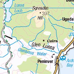
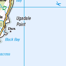
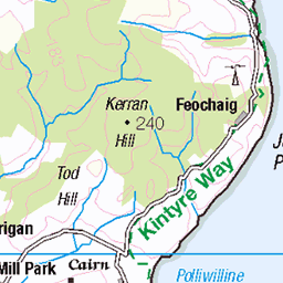
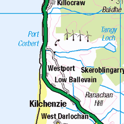
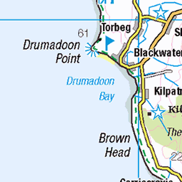
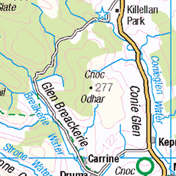
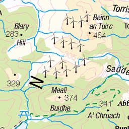
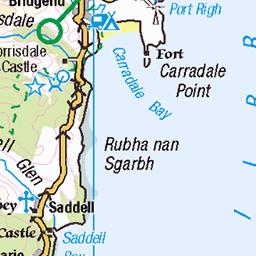
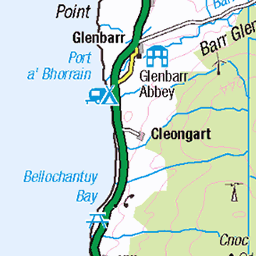
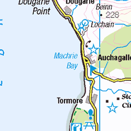
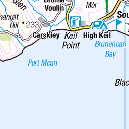
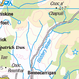
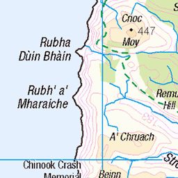
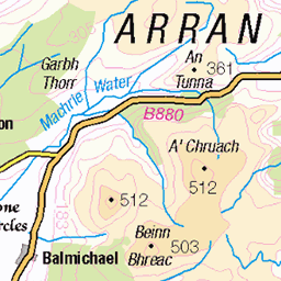
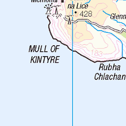
OS Map
This is OS mapping. In some areas, OpenStreetMap shows more footpaths
Spatial NI has online OSNI mapping. Click "Basemap Gallery" (4 squares icon at the top).
Now would be a good time for a cup of tea.


GPX Editor
Record map clicks
Reload map
Photos
Please tag your photos and upload them to the British and Irish Mountains group on Flickr
The other photos have been geo-tagged as on or around the summit. For less busy mountains, it can be a little hit and miss.

Davaar Island Lighthouse with Ailsa Craig in the distance.
21-Jul-24 • billmac_sco • flickr
scotland firth clyde lighthouse davaar island sea scenic 53877018717


4856 Island Davaar
Third hill today with Alison Fox, Bob Taylor and Richard Spiers with GR8 views to Arran and Ailsa Craig. Island also has feral goats. Name:Island Davaar Hill number:4856 Height:115m / 377ft Parent (Ma):1416 Beinn Ghuilean RHB Section:19B: Knapdale and Kintyre County/UA:Argyll and Bute (UA) Island:Mono Tump island (t) Maritime area:Firth of Clyde to Mull of Kintyre Class:Hump, Tump (100-199m), SIB Grid ref:NR 75818 20004 Summit feature:rock 35m ENE of trig point Drop:114m Col:1m NR747201 Observations:rock is same height as flush bracket on trig point at NR 75786 19995 Survey:Abney level
27-Aug-11 • Dugswell2 • flickr
islanddavaar p114 hump sib tump tidalisland 46261281834
Videos
Hidden Secrets of Davaar Island, Kintyre One of my favourite locations to date! And an island that throws up some truly unique ...
Davaar was known as the island of Sanct Barre between the years 1449 to 1508. The modern form Davaar is from the older Do ...
Tour Scotland travel video clip, with Scottish music, of the lighthouse on visit to Davaar Island, Scottish Gaelic: Eilean Dà Bhàrr, ...
ADVENTURE NATURE film maker // Support on Patreon https://www.patreon.com/kelpandfern or buy us a coffee ...
The 3rd of December 2021 may not seem like the best day to go day-tripping, but I jump on a Loganair Twin Otter for a flight of 50 ...
Notes
- Data: Database of British and Irish Hills v18.2
- Maps: We use OS mapping for England, Scotland, Wales, and the Isle of Man. Sadly, Channel Islands, Northern (OSNI) and Southern Ireland (OSI) mapping isn't available online, so we use Openstreetmap.