Hills of Britain and Ireland
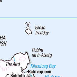
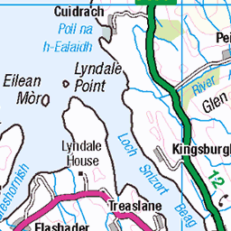
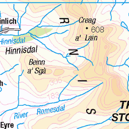
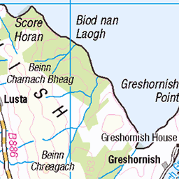
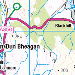
OS Map of Cleat
Height: 336m / 1102ft • Prominence: 120m / 394ft • Summit : no feature • Trip reports (hill-bagging)

The Quiraing
Even in the drizzle and mid day grey light the Quiraing in Skye can look out of this world.
18-Feb-25 • PentlandPirate: Slapdash Photography • flickr
54336189891

The tour bus
A tour bus climbs the road to the Quiraing, Isle of Skye. You can clearly see the main trail running across the front of the escarpment. It's a bit of an adventure, up and down, in and out, and a bit challenging in places, especially for all those tourists in white trainers. The upper trail runs parallel but up in the mists and clouds, along the edge, but not having been there, I'm not convinced the views will be any better than half way up
18-Feb-25 • PentlandPirate: Slapdash Photography • flickr
54341572386

Quiraing
The Trotternish ridge, taken from the Quiraing, Isle of Skye. August 2024.
30-Aug-24 • amberkenny10 • flickr
scotland skye isle quiraing trotternish 54299394073

Quiraing walk
22-Aug-24 • Bernhard Schlor • flickr
schottland aussicht grosbritannien landschaft europa sonne himmel berg natur wetter grün isleofskye farbe trotternish sonnenstrahl wolken innerehebriden jahreszeiten sommer hebriden quiraing 54288212031

isle of Skye bei Schlechtwetter
21-Aug-24 • Bernhard Schlor • flickr
schottland grosbritannien innerehebriden wasserfall wasser trotternish europa hebriden isleofskye natur quiraing anteileansgitheanach country cuithraing eileana’cheò europe gb gewässer greatbritain hebrides inseldesnebels skye cascade ilpaese lacqua leau lacampagne leseaux nahinnsegall‚suðreyjar water waterfall waters portree vereinigteskönigreich 54288215616

isle of Skye bei Schlechtwetter
21-Aug-24 • Bernhard Schlor • flickr
schottland grosbritannien innerehebriden europa trotternish himmel quiraing hebriden isleofskye nebel regen natur wetter anteileansgitheanach country cuithraing eileana’cheò europe gb greatbritain hebrides inseldesnebels skye fog ilpaese lacampagne letemps mist nahinnsegall‚suðreyjar rain sky weather portree vereinigteskönigreich 54288215721
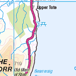
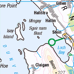
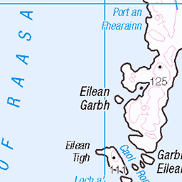
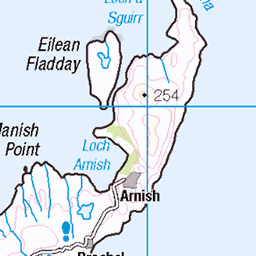
OS Map
This is OS mapping. In some areas, OpenStreetMap shows more footpaths
Spatial NI has online OSNI mapping. Click "Basemap Gallery" (4 squares icon at the top).
Now would be a good time for a cup of tea.


GPX Editor
Record map clicks
Reload map
Photos
Please tag your photos and upload them to the British and Irish Mountains group on Flickr
The other photos have been geo-tagged as on or around the summit. For less busy mountains, it can be a little hit and miss.
The Quiraing
Even in the drizzle and mid day grey light the Quiraing in Skye can look out of this world.
18-Feb-25 • PentlandPirate: Slapdash Photography • flickr
54336189891
The tour bus
A tour bus climbs the road to the Quiraing, Isle of Skye. You can clearly see the main trail running across the front of the escarpment. It's a bit of an adventure, up and down, in and out, and a bit challenging in places, especially for all those tourists in white trainers. The upper trail runs parallel but up in the mists and clouds, along the edge, but not having been there, I'm not convinced the views will be any better than half way up
18-Feb-25 • PentlandPirate: Slapdash Photography • flickr
54341572386
Quiraing
The Trotternish ridge, taken from the Quiraing, Isle of Skye. August 2024.
30-Aug-24 • amberkenny10 • flickr
scotland skye isle quiraing trotternish 54299394073
Quiraing walk
22-Aug-24 • Bernhard Schlor • flickr
schottland aussicht grosbritannien landschaft europa sonne himmel berg natur wetter grün isleofskye farbe trotternish sonnenstrahl wolken innerehebriden jahreszeiten sommer hebriden quiraing 54288212031
isle of Skye bei Schlechtwetter
21-Aug-24 • Bernhard Schlor • flickr
schottland grosbritannien innerehebriden wasserfall wasser trotternish europa hebriden isleofskye natur quiraing anteileansgitheanach country cuithraing eileana’cheò europe gb gewässer greatbritain hebrides inseldesnebels skye cascade ilpaese lacqua leau lacampagne leseaux nahinnsegall‚suðreyjar water waterfall waters portree vereinigteskönigreich 54288215616
isle of Skye bei Schlechtwetter
21-Aug-24 • Bernhard Schlor • flickr
schottland grosbritannien innerehebriden europa trotternish himmel quiraing hebriden isleofskye nebel regen natur wetter anteileansgitheanach country cuithraing eileana’cheò europe gb greatbritain hebrides inseldesnebels skye fog ilpaese lacampagne letemps mist nahinnsegall‚suðreyjar rain sky weather portree vereinigteskönigreich 54288215721

And there was light
And there was light - Dawn breaks across the Isle of Skye with an opportune gap in the clouds allowing the most intense golden hour light to bathe the whole Trotternish ridge with an incredible glowing warmth. The view as seen from the Quiraing, picks out the golden autumn slopes of Cleat and Bioda Buidhe with Beinn Edra lurking beneath the clouds in the distance. Only moments before, the scene was grey and flat, suddenly and spectacularly transformed by the unexpected light rush across the landscape. The resulting unfolding scene just exemplifies what a truly inspirational location and world-class landscape the Trotternish is; spectacular in the dramatic and intense light with the typically unpredictable, ever changing, moody Skye weather adding to the unexpected drama and sense of awe. Isle of Skye, Scottish Inner Hebrides Explore #1 www.flickr.com/explore/2025/01/26/ 26/01/2025 www.twiston.com/" rel="noreferrer nofollow website | www.instagram.com/images.twiston/" rel="noreferrer nofollow instagram | 500px.com/p/twiston?view=photos" rel="noreferrer nofollow 500px
08-Oct-22 • images@twiston • flickr
dawn sunrise golden hour light sunlight clouds quiraing skye cuithraing isleofskye innerhebrides scotland cleat beinnedra biodabuidhe ridge staffin uig landslip shiftinglight thelandthattimeforgot highlands scottish mountain unitedkingdom greatbritain landscape imagestwiston countryside nisi nisifilters gnd neutraldensity grad 54285932747

Quiraing
isle of Skye landscapes, amazing nature...
03-May-19 • Rafa Lorenzo • flickr
skye trotternishridge 54291900030


What a morning this was . . . Explore 21-03-2025 #19
A deep dive into the archives for this one . . . This is a view from the Quiraing of the Trotternish Ridge, visible is Cnòc a Mhèrlich, Cleat and Bioda Buidhe barely visible in the cloud cover. Behind Cleat and hidden in the clouds is Beinn Edra In this image, the shifting light is lighting up a path through the low clouds before highlighting the upper portion of Cleat and the base of Druim an Ruma and Dun Dubh. The light is also beginning to highlight portions of Cnòc a Mhèrlich. Another special feature of this sunrise at the Quiraing was that I was the ONLY person there to enjoy and photograph it. Best viewed Large(L)
20-Sep-13 • Brad Eide • flickr
skye isleofskye scotland innerhebrides quiraing trotternishridge cnòcamhèrlich cleat biodabuidhe druimanruma dundubh sunrise dapplinglight shiftinglight waitingforthelight landscape panorama bradeide nikon d7100 gitzo tripod 54400948354

4784 Cleat
From the cemetery car park on a very wet and windy morning...I was on my hands and knees on the summit. Name:Cleat Hill number:4784 Height:336m / 1102ft Parent (Ma):1225 Bioda Buidhe RHB Section:17A: North Skye and Raasay County/UA:Highland (UA) Island:Skye Maritime area:Skye & surrounding islands Class:Hump, Tump (300-399m), Yeaman (Hu,Tu,3,Y) Grid ref:NG 44636 66880 Summit feature:no feature Drop:120m Col:216m NG443668
02-Jun-11 • Dugswell2 • flickr
cleat p120 tump hump yeaman 50319195051
Videos
Ever wondered what to photograph in Scotland? Do you want to photograph Breath taking Mountains, or capture EPIC dramatic ...
Notes
- Data: Database of British and Irish Hills v18.2
- Maps: We use OS mapping for England, Scotland, Wales, and the Isle of Man. Sadly, Channel Islands, Northern (OSNI) and Southern Ireland (OSI) mapping isn't available online, so we use Openstreetmap.