Hills of Britain and Ireland
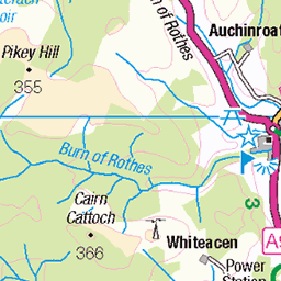
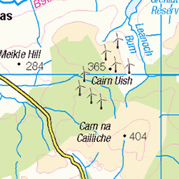
OS Map of Round Hill
Height: 668m / 2192ft • Prominence: 37m / 121ft • Summit : no feature: tussock • Trip reports (hill-bagging)

Lochs of Allt na Craoibhe-caorainn
Second visit to these middle of nowhere little lochs in two months. Last time from Glenlivet, today from the Cabrach side.
24-Jul-21 • We travel the Spaceways • flickr
51333631496


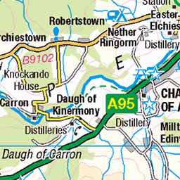
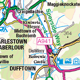
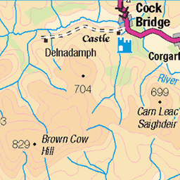
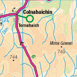
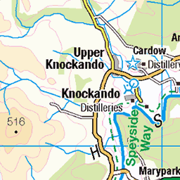
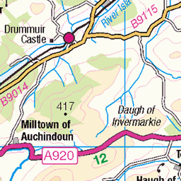
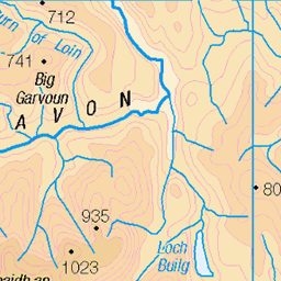
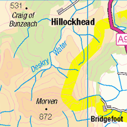
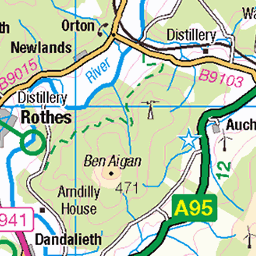
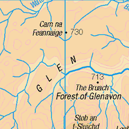
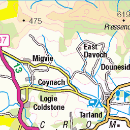
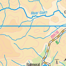
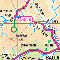
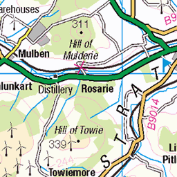
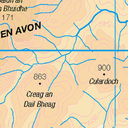
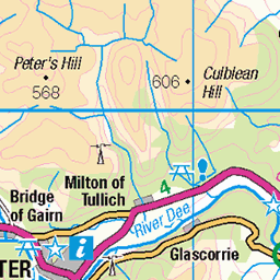
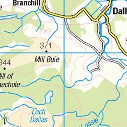
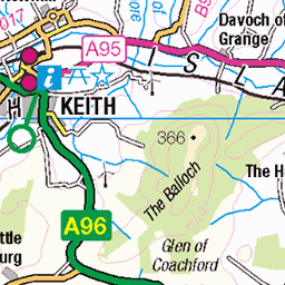
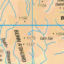
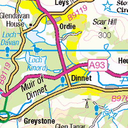
OS Map
This is OS mapping. In some areas, OpenStreetMap shows more footpaths
Spatial NI has online OSNI mapping. Click "Basemap Gallery" (4 squares icon at the top).
Now would be a good time for a cup of tea.
GPX Editor
Record map clicks
Reload map
Photos
Please tag your photos and upload them to the British and Irish Mountains group on Flickr
The other photos have been geo-tagged as on or around the summit. For less busy mountains, it can be a little hit and miss.
Lochs of Allt na Craoibhe-caorainn
Second visit to these middle of nowhere little lochs in two months. Last time from Glenlivet, today from the Cabrach side.
24-Jul-21 • We travel the Spaceways • flickr
51333631496


Highlands
www.davidredondo.es" rel="nofollow www.davidredondo.es
28-May-11 • David Gimeno Redondo • flickr
blue sky cloud mountain lake tree water grass azul arbol lago agua cielo nube ciervo hierba montaña 7169391738
Videos
TrailForks Link - https://www.trailforks.com/ridelog/view/27200809/ Strava Link - https://www.strava.com/activities/5567516262 ...
Glenlivet Hill Trek provide a unique and personal service to their clients in the form of a thoroughly enjoyable Highland Hilltop ...
Downhill mountain biking. ABSOLUTELY WONDERFUL MTB TRAIL RIDING. Glenlivet mountain bike trails. Cairngorms National ...
This is just a quick glance at the 2 run, 1 lift 2090 Lecht bike park in Scotland. #mtb #mountainbiking #bikescotland.
Had a good day up at glenlivet stoked to send the gap on the mini DH don't forget to subscribe and comment what we ...
Notes
- Data: Database of British and Irish Hills v18.2
- Maps: We use OS mapping for England, Scotland, Wales, and the Isle of Man. Sadly, Channel Islands, Northern (OSNI) and Southern Ireland (OSI) mapping isn't available online, so we use Openstreetmap.